TopoQuest Logo
Do you find TopoQuest useful?
Help keep TopoQuest running and adding new maps/features by donating!
Bitcoin:  19c7KJd3qBynnjoSw5npx9KScwjBe4ifkT
Litecoin:  LXs6TkuXGGXo1vDsWCkWVdjQX94eUKd6ui
Home View Maps Find Maps Find Places Resources & Links


Jamison Ridge, California Topographic Map

USGS Map Title: Jamison Ridge, CA
USGS Map MRC: 39123F2
DRG (GeoTIFF) Download: o39123f2.tif


Neighboring USGS Topographic Map Quads:


  Covelo West, CA  
39123G3
 

  Covelo East, CA  
39123G2
 

  Newhouse Ridge, CA  
39123G1
 

  Dos Rios, CA  
39123F3
 

  Jamison Ridge, CA  
39123F2
 

  Thatcher Ridge, CA  
39123F1
 

  Willis Ridge, CA  
39123E3
 

  Brushy Mountain, CA  
39123E2
 

  Sanhedrin Mountain, CA  
39123E1


Map MRC Location:

N40°
W124°
N40°
W123°
H8 H7 H6 H5 H4 H3 H2 H1
G8 G7 G6 G5 G4 G3 G2 G1
F8 F7 F6 F5 F4 F3 F2 F1
E8 E7 E6 E5 E4 E3 E2 E1
D8 D7 D6 D5 D4 D3 D2 D1
C8 C7 C6 C5 C4 C3 C2 C1
B8 B7 B6 B5 B4 B3 B2 B1
A8 A7 A6 A5 A4 A3 A2 A1
N39°
W124°
N39°
W123°

Jamison Ridge, CA USGS 1:24K Topographic Map Preview:
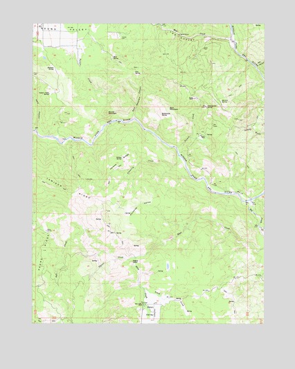
Jamison Ridge, CA USGS Topographic Map
Click on map above to begin viewing in our Map Viewer.

This topographic map contains these locations and features:
Feature Name Type Latitude Longitude GNIS ID View Map
Bald MountainSummitN39.7143°W123.1772°1657981View Map
Bald Mountain CanyonValleyN39.7104°W123.1958°218599View Map
Conner Cabin SpringSpringN39.7207°W123.2420°221462View Map
Doe CanyonValleyN39.7321°W123.1308°266649View Map
Eden CreekStreamN39.6568°W123.1250°222969View Map
Eden ValleyValleyN39.6382°W123.1886°266684View Map
Eden Valley RanchLocaleN39.6329°W123.1914°222973View Map
Elk CreekStreamN39.6763°W123.1339°259846View Map
Foster / Old Pioneer CemeteryCemeteryN39.7435°W123.2028°230755View Map
Iron SpringSpringN39.7296°W123.1958°225991View Map
Jamison RidgeRidgeN39.6810°W123.2314°226141View Map
Jarbow RidgeRidgeN39.6918°W123.2045°226147View Map
Jarbow SpringSpringN39.6938°W123.2025°226148View Map
Kelly CanyonValleyN39.7057°W123.2492°226468View Map
Marks PlacePopulated PlaceN39.7032°W123.1578°1659066View Map
Martini SpringSpringN39.7177°W123.1495°228186View Map
Mill CreekStreamN39.7396°W123.1425°228693View Map
Mud SpringSpringN39.7354°W123.2081°229257View Map
Negro HeadSummitN39.6507°W123.1983°256027View Map
Paradise ValleyValleyN39.6749°W123.1836°230329View Map
Pedro CorralsLocaleN39.6632°W123.2433°234444View Map
Pedro RidgeRidgeN39.6552°W123.2456°230464View Map
Pigtail CreekStreamN39.6524°W123.1950°230650View Map
Rattlesnake SpringSpringN39.7121°W123.1814°231276View Map
Redwine SpringSpringN39.7310°W123.2395°231408View Map
Round MountainSummitN39.7127°W123.2111°231963View Map
Salmon CreekStreamN39.6982°W123.1728°232279View Map
Salt Creek DivideGapN39.6632°W123.2095°1732493View Map
Simmerly CreekStreamN39.6943°W123.1717°233156View Map
The OutletChannelN39.7446°W123.1700°236207View Map
Thrash RanchLocaleN39.7188°W123.1642°236302View Map
Thrash Ranch (historical)LocaleN39.7163°W123.1570°1724139View Map
Toney CreekStreamN39.6396°W123.1906°268352View Map
Yellowjacket SpringSpringN39.7152°W123.1572°238251View Map

Note: Coordinates in the location and feature list above are referenced to NAD83 datum.


Copyright (C) 2008-2024 Ryan Niemi / Sunset Dynamics ... All Rights Reserved