TopoQuest Logo
Do you find TopoQuest useful?
Help keep TopoQuest running and adding new maps/features by donating!
Bitcoin:  19c7KJd3qBynnjoSw5npx9KScwjBe4ifkT
Litecoin:  LXs6TkuXGGXo1vDsWCkWVdjQX94eUKd6ui
Home View Maps Find Maps Find Places Resources & Links


Willis Ridge, California Topographic Map

USGS Map Title: Willis Ridge, CA
USGS Map MRC: 39123E3
DRG (GeoTIFF) Download: o39123e3.tif


Neighboring USGS Topographic Map Quads:


  Laytonville, CA  
39123F4
 

  Dos Rios, CA  
39123F3
 

  Jamison Ridge, CA  
39123F2
 

  Longvale, CA  
39123E4
 

  Willis Ridge, CA  
39123E3
 

  Brushy Mountain, CA  
39123E2
 

  Burbeck, CA  
39123D4
 

  Willits, CA  
39123D3
 

  Foster Mountain, CA  
39123D2


Map MRC Location:

N40°
W124°
N40°
W123°
H8 H7 H6 H5 H4 H3 H2 H1
G8 G7 G6 G5 G4 G3 G2 G1
F8 F7 F6 F5 F4 F3 F2 F1
E8 E7 E6 E5 E4 E3 E2 E1
D8 D7 D6 D5 D4 D3 D2 D1
C8 C7 C6 C5 C4 C3 C2 C1
B8 B7 B6 B5 B4 B3 B2 B1
A8 A7 A6 A5 A4 A3 A2 A1
N39°
W124°
N39°
W123°

Willis Ridge, CA USGS 1:24K Topographic Map Preview:
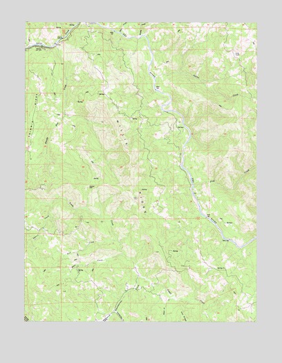
Willis Ridge, CA USGS Topographic Map
Click on map above to begin viewing in our Map Viewer.

This topographic map contains these locations and features:
Feature Name Type Latitude Longitude GNIS ID View Map
Alder CreekStreamN39.6204°W123.3242°218100View Map
Baker Forty CreekStreamN39.5093°W123.2953°218536View Map
Bald MountainSummitN39.5724°W123.3556°1657980View Map
Bean CreekStreamN39.5279°W123.3231°218781View Map
Bloody Run CreekStreamN39.6168°W123.3578°219465View Map
Brushy CreekStreamN39.6185°W123.3136°219948View Map
Bud CreekStreamN39.5340°W123.3261°220073View Map
FarleyPopulated PlaceN39.6146°W123.3672°1658525View Map
Fish CreekStreamN39.5563°W123.2850°223531View Map
Fox PeakSummitN39.5049°W123.2614°1666813View Map
Indian CreekStreamN39.6015°W123.3053°225869View Map
Laurel CreekStreamN39.5488°W123.3617°226939View Map
Lily LakeLakeN39.6117°W123.2629°227096View Map
Pepper GapGapN39.5565°W123.3420°230510View Map
Preston Ranch (historical)LocaleN39.5765°W123.3139°1724122View Map
Saint Louis RanchLocaleN39.5221°W123.3158°1724129View Map
Shelving Rock CreekStreamN39.5046°W123.3275°232950View Map
Shimmin RidgeRidgeN39.5877°W123.3706°233003View Map
Wheelbarrow CreekStreamN39.5188°W123.3133°237597View Map
Wheelbarrow ValleyValleyN39.5038°W123.3289°237598View Map
Willis RidgeRidgeN39.5646°W123.3183°237865View Map

Note: Coordinates in the location and feature list above are referenced to NAD83 datum.


Copyright (C) 2008-2025 Ryan Niemi / Sunset Dynamics ... All Rights Reserved