TopoQuest Logo
Do you find TopoQuest useful?
Help keep TopoQuest running and adding new maps/features by donating!
Bitcoin:  19c7KJd3qBynnjoSw5npx9KScwjBe4ifkT
Litecoin:  LXs6TkuXGGXo1vDsWCkWVdjQX94eUKd6ui
Home View Maps Find Maps Find Places Resources & Links


Covelo East, California Topographic Map

USGS Map Title: Covelo East, CA
USGS Map MRC: 39123G2
DRG (GeoTIFF) Download: o39123g2.tif


Neighboring USGS Topographic Map Quads:


  Mina, CA  
39123H3
 

  Bluenose Ridge, CA  
39123H2
 

  Leech Lake Mountain, CA  
39123H1
 

  Covelo West, CA  
39123G3
 

  Covelo East, CA  
39123G2
 

  Newhouse Ridge, CA  
39123G1
 

  Dos Rios, CA  
39123F3
 

  Jamison Ridge, CA  
39123F2
 

  Thatcher Ridge, CA  
39123F1


Map MRC Location:

N40°
W124°
N40°
W123°
H8 H7 H6 H5 H4 H3 H2 H1
G8 G7 G6 G5 G4 G3 G2 G1
F8 F7 F6 F5 F4 F3 F2 F1
E8 E7 E6 E5 E4 E3 E2 E1
D8 D7 D6 D5 D4 D3 D2 D1
C8 C7 C6 C5 C4 C3 C2 C1
B8 B7 B6 B5 B4 B3 B2 B1
A8 A7 A6 A5 A4 A3 A2 A1
N39°
W124°
N39°
W123°

Covelo East, CA USGS 1:24K Topographic Map Preview:
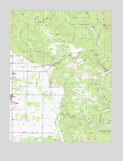
Covelo East, CA USGS Topographic Map
Click on map above to begin viewing in our Map Viewer.

This topographic map contains these locations and features:
Feature Name Type Latitude Longitude GNIS ID View Map
Atkinson FlatFlatN39.7896°W123.1639°218449View Map
Blueschist NarrowsBasinN39.8604°W123.1325°254634View Map
California Department of Forestry and Fire Protection CoveloBuildingN39.8068°W123.2475°2622301View Map
Codding Ranch (historical)LocaleN39.8524°W123.1992°1724076View Map
CoveloPopulated PlaceN39.7929°W123.2481°277603View Map
Covelo Census Designated PlaceCensusN39.8025°W123.2499°2407675View Map
Covelo DivisionCivilN39.7585°W123.1500°1935065View Map
Covelo Fire Protection DistrictBuildingN39.7870°W123.2486°2621802View Map
Covelo Post OfficePost OfficeN39.7941°W123.2493°2760025View Map
Covelo Ranger Station (historical)LocaleN39.8099°W123.1356°1666469View Map
Coyote RockSummitN39.8677°W123.2061°1655934View Map
Cubbler PlacePopulated PlaceN39.7527°W123.1497°1655943View Map
Dingman RidgeRidgeN39.7707°W123.1767°222400View Map
Eel River Charter SchoolSchoolN39.7938°W123.2492°2516070View Map
Etsel CrossingCrossingN39.7854°W123.1592°1666472View Map
Etsel FlatFlatN39.7832°W123.1578°223264View Map
George Lambert CanyonValleyN39.7615°W123.1433°260524View Map
Green Lambert CanyonValleyN39.7602°W123.1431°260855View Map
Grist CreekStreamN39.7846°W123.2083°224623View Map
Little Salt CreekStreamN39.8643°W123.2236°227357View Map
Mendocino County Sheriff's OfficeBuildingN39.7929°W123.2492°2751036View Map
Modesto CampLocaleN39.7821°W123.1620°228890View Map
Murphy CreekStreamN39.8538°W123.1431°263974View Map
Nome Lackee CemeteryCemeteryN39.8232°W123.2061°229573View Map
Panther RockSummitN39.8515°W123.1939°1656206View Map
Poor Mans CreekStreamN39.8274°W123.1420°230933View Map
Poor Mans ValleyBasinN39.8271°W123.1633°230934View Map
Reservation School (historical)SchoolN39.8135°W123.2489°1666477View Map
Round ValleyBasinN39.7796°W123.2278°234591View Map
Short CreekStreamN39.7885°W123.2100°266134View Map
Silver CreekStreamN39.8082°W123.1400°233126View Map
Simmerley FlatFlatN39.7977°W123.1639°233155View Map
Spencer RanchLocaleN39.7979°W123.1386°1666481View Map
Tank CreekStreamN39.8521°W123.2008°268088View Map
Town CreekStreamN39.7838°W123.2447°236481View Map
Turner CreekStreamN39.7538°W123.1908°236652View Map
Williams CreekStreamN39.8146°W123.1331°269120View Map
Williams ValleyBasinN39.8435°W123.1878°237861View Map
Williams Valley 1381 DamDamN39.8382°W123.1845°1664303View Map
Yuki CemeteryCemeteryN39.8065°W123.2011°238300View Map

Note: Coordinates in the location and feature list above are referenced to NAD83 datum.


Copyright (C) 2008-2025 Ryan Niemi / Sunset Dynamics ... All Rights Reserved