TopoQuest Logo
Do you find TopoQuest useful?
Help keep TopoQuest running and adding new maps/features by donating!
Bitcoin:  19c7KJd3qBynnjoSw5npx9KScwjBe4ifkT
Litecoin:  LXs6TkuXGGXo1vDsWCkWVdjQX94eUKd6ui
Home View Maps Find Maps Find Places Resources & Links


Jefferson City, Montana Topographic Map

USGS Map Title: Jefferson City, MT
USGS Map MRC: 46112D1
DRG (GeoTIFF) Download: o46112d1.tif


Neighboring USGS Topographic Map Quads:


  Black Mountain, MT  
46112E2
 

  Helena, MT  
46112E1
 

  East Helena, MT  
46111E8
 

  Chessman Reservoir, MT  
46112D2
 

  Jefferson City, MT  
46112D1
 

  Clancy, MT  
46111D8
 

  Mount Thompson, MT  
46112C2
 

  Wickes, MT  
46112C1
 

  Elkhorn, MT  
46111C8


Map MRC Location:

N47°
W113°
N47°
W112°
H8 H7 H6 H5 H4 H3 H2 H1
G8 G7 G6 G5 G4 G3 G2 G1
F8 F7 F6 F5 F4 F3 F2 F1
E8 E7 E6 E5 E4 E3 E2 E1
D8 D7 D6 D5 D4 D3 D2 D1
C8 C7 C6 C5 C4 C3 C2 C1
B8 B7 B6 B5 B4 B3 B2 B1
A8 A7 A6 A5 A4 A3 A2 A1
N46°
W113°
N46°
W112°

Jefferson City, MT USGS 1:24K Topographic Map Preview:
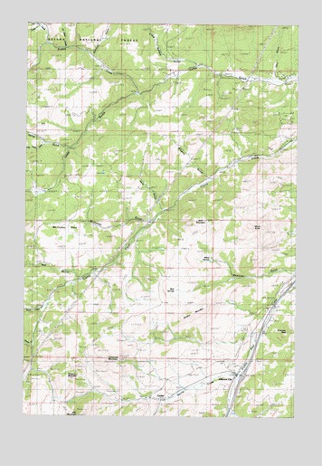
Jefferson City, MT USGS Topographic Map
Click on map above to begin viewing in our Map Viewer.

This topographic map contains these locations and features:
Feature Name Type Latitude Longitude GNIS ID View Map
10N04W11DCAB01 WellWellN46.4660°W112.0719°816390View Map
Alta Post Office (historical)Post OfficeN46.3799°W112.0731°1762497View Map
Beavertown CreekStreamN46.3772°W112.0308°779642View Map
Bertha MineMineN46.3819°W112.0869°803217View Map
Black Jack MineMineN46.3916°W112.0758°803580View Map
Blueball MountainSummitN46.4074°W112.0503°794660View Map
Browns GulchValleyN46.4499°W112.0411°794722View Map
Buffalo CreekStreamN46.4777°W112.0764°780540View Map
Clancy Census Designated PlaceCensusN46.4493°W112.0029°2407627View Map
Concentrator (historical)LocaleN46.3805°W112.0619°1762692View Map
CorbinPopulated PlaceN46.3805°W112.0619°781665View Map
Corbin (historical)LocaleN46.3805°W112.0619°1762691View Map
Corbin Post Office (historical)Post OfficeN46.3805°W112.0619°1762578View Map
Corral GulchValleyN46.4605°W112.1083°781701View Map
Emerson PeakSummitN46.4030°W112.0036°783182View Map
Free Coinage MineMineN46.4852°W112.0333°783711View Map
Freighters Historical MarkerParkN46.4055°W112.0119°1762628View Map
Go Devil CreekStreamN46.4919°W112.1086°784001View Map
Gregory (historical)LocaleN46.3899°W112.1164°1762684View Map
Gregory MineMineN46.3891°W112.1164°784323View Map
Gregory MineMineN46.3899°W112.1142°803220View Map
Gregory MountainSummitN46.3877°W112.1069°784324View Map
Gregory Post Office (historical)Post OfficeN46.3899°W112.1164°1762571View Map
Hartwell (historical)LocaleN46.4230°W112.0003°1762681View Map
Interchange 176CrossingN46.3883°W112.0250°1762611View Map
Jefferson (historical)LocaleN46.3883°W112.0275°1762675View Map
Jefferson CityPopulated PlaceN46.3883°W112.0275°785437View Map
Jefferson City Census Designated PlaceCensusN46.3780°W112.0305°2408441View Map
Jefferson City Fire CompanyBuildingN46.3896°W112.0306°2546584View Map
Jefferson City Post OfficePost OfficeN46.3894°W112.0272°1762568View Map
Jefferson City Rest AreaLocaleN46.4055°W112.0119°1762629View Map
Kelly GulchValleyN46.4405°W112.0614°794723View Map
Little Buffalo GulchValleyN46.4877°W112.0503°786257View Map
Little Corral GulchValleyN46.4605°W112.1200°786272View Map
Little Nellie MineMineN46.4794°W112.0275°786334View Map
Longeway (historical)LocaleN46.4227°W112.0003°1762667View Map
McCauley FlatsFlatN46.4422°W112.1017°794662View Map
McCauley GulchValleyN46.4377°W112.0658°794719View Map
Minnesota MineMineN46.3874°W112.1231°803467View Map
Morgan GulchValleyN46.3974°W112.1233°787682View Map
Mudd SpringsSpringN46.4152°W112.0556°794659View Map
North Fork Travis CreekStreamN46.4988°W112.1208°788269View Map
O K MineMineN46.4838°W112.0481°803440View Map
Ohio GulchValleyN46.4824°W112.0128°794715View Map
Quartz CreekStreamN46.4094°W112.1175°789266View Map
Rarus MineMineN46.3935°W112.0842°803466View Map
Roe GulchValleyN46.4183°W112.0994°789820View Map
Roosevelt MineMineN46.4880°W112.0214°803499View Map
SE SE Section 6 MineMineN46.4685°W112.0197°803465View Map
Spring CreekStreamN46.3885°W112.0261°793874View Map
Superior/Jubilee MineMineN46.4766°W112.0481°803439View Map
SW SE Section 32 MineMineN46.4869°W112.0092°803544View Map
Travis CreekStreamN46.4930°W112.1167°792359View Map
Valparaiso MountainSummitN46.3935°W112.0883°794661View Map
Westover GulchValleyN46.4216°W112.0022°793141View Map
Wheel SpringsSpringN46.4249°W112.0403°794721View Map
Whiteman GulchValleyN46.4897°W112.0967°793230View Map
Windy ButteSummitN46.4355°W112.0217°794720View Map
Wolf MountainSummitN46.4360°W112.0478°794724View Map

Note: Coordinates in the location and feature list above are referenced to NAD83 datum.


Copyright (C) 2008-2024 Ryan Niemi / Sunset Dynamics ... All Rights Reserved