TopoQuest Logo
Do you find TopoQuest useful?
Help keep TopoQuest running and adding new maps/features by donating!
Bitcoin:  19c7KJd3qBynnjoSw5npx9KScwjBe4ifkT
Litecoin:  LXs6TkuXGGXo1vDsWCkWVdjQX94eUKd6ui
Home View Maps Find Maps Find Places Resources & Links


Jennings, Oklahoma Topographic Map

USGS Map Title: Jennings, OK
USGS Map MRC: 36096B5
DRG (GeoTIFF) Download: o36096b5.tif


Neighboring USGS Topographic Map Quads:


  Casey, OK  
36096C6
 

  Blackburn, OK  
36096C5
 

  Cleveland, OK  
36096C4
 

  Maramec, OK  
36096B6
 

  Jennings, OK  
36096B5
 

  Terlton, OK  
36096B4
 

  Yale, OK  
36096A6
 

  Oilton, OK  
36096A5
 

  Olive, OK  
36096A4


Map MRC Location:

N37°
W97°
N37°
W96°
H8 H7 H6 H5 H4 H3 H2 H1
G8 G7 G6 G5 G4 G3 G2 G1
F8 F7 F6 F5 F4 F3 F2 F1
E8 E7 E6 E5 E4 E3 E2 E1
D8 D7 D6 D5 D4 D3 D2 D1
C8 C7 C6 C5 C4 C3 C2 C1
B8 B7 B6 B5 B4 B3 B2 B1
A8 A7 A6 A5 A4 A3 A2 A1
N36°
W97°
N36°
W96°

Jennings, OK USGS 1:24K Topographic Map Preview:
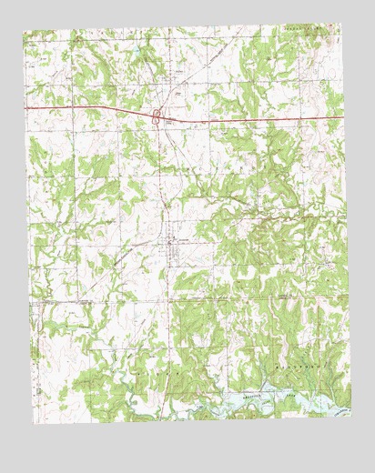
Jennings, OK USGS Topographic Map
Click on map above to begin viewing in our Map Viewer.

This topographic map contains these locations and features:
Feature Name Type Latitude Longitude GNIS ID View Map
Bethany CemeteryCemeteryN36.2317°W96.5525°1090026View Map
Cimarron StripAirportN36.1853°W96.5476°1102517View Map
HallettPopulated PlaceN36.2340°W96.5675°1093491View Map
Hallett InterchangeCrossingN36.2217°W96.5739°1102018View Map
Hallett SidingLocaleN36.2198°W96.5703°1093492View Map
JenningsPopulated PlaceN36.1812°W96.5697°1094211View Map
Jennings CemeteryCemeteryN36.1878°W96.5909°1094212View Map
Jennings Elementary SchoolSchoolN36.1828°W96.5679°1793736View Map
Jennings Fire DepartmentBuildingN36.1816°W96.5681°2657116View Map
Jennings Police DepartmentBuildingN36.1805°W96.5695°2757881View Map
Kenny CreekStreamN36.1598°W96.6206°1094328View Map
Lagoon CreekStreamN36.1270°W96.5067°1094458View Map
Oknoname 037001 DamDamN36.1584°W96.5836°1753185View Map
Oknoname 037001 ReservoirReservoirN36.1584°W96.5836°1753186View Map
Oknoname 117005 DamDamN36.2434°W96.5803°1753437View Map
Oknoname 117005 ReservoirReservoirN36.2427°W96.5808°1753438View Map
Town of HallettCivilN36.2316°W96.5678°2412720View Map
Town of JenningsCivilN36.1823°W96.5690°2412803View Map
Township of McElroyCivilN36.2028°W96.5586°1824846View Map
Victory Christian AcademySchoolN36.1836°W96.5702°2712891View Map

Note: Coordinates in the location and feature list above are referenced to NAD83 datum.


Copyright (C) 2008-2025 Ryan Niemi / Sunset Dynamics ... All Rights Reserved