TopoQuest Logo
Do you find TopoQuest useful?
Help keep TopoQuest running and adding new maps/features by donating!
Bitcoin:  19c7KJd3qBynnjoSw5npx9KScwjBe4ifkT
Litecoin:  LXs6TkuXGGXo1vDsWCkWVdjQX94eUKd6ui
Home View Maps Find Maps Find Places Resources & Links


Oilton, Oklahoma Topographic Map

USGS Map Title: Oilton, OK
USGS Map MRC: 36096A5
DRG (GeoTIFF) Download: o36096a5.tif


Neighboring USGS Topographic Map Quads:


  Maramec, OK  
36096B6
 

  Jennings, OK  
36096B5
 

  Terlton, OK  
36096B4
 

  Yale, OK  
36096A6
 

  Oilton, OK  
36096A5
 

  Olive, OK  
36096A4
 

  North Village, OK  
35096H6
 

  Drumright, OK  
35096H5
 

  Bellvue, OK  
35096H4


Map MRC Location:

N37°
W97°
N37°
W96°
H8 H7 H6 H5 H4 H3 H2 H1
G8 G7 G6 G5 G4 G3 G2 G1
F8 F7 F6 F5 F4 F3 F2 F1
E8 E7 E6 E5 E4 E3 E2 E1
D8 D7 D6 D5 D4 D3 D2 D1
C8 C7 C6 C5 C4 C3 C2 C1
B8 B7 B6 B5 B4 B3 B2 B1
A8 A7 A6 A5 A4 A3 A2 A1
N36°
W97°
N36°
W96°

Oilton, OK USGS 1:24K Topographic Map Preview:
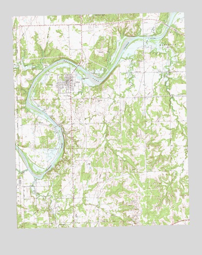
Oilton, OK USGS Topographic Map
Click on map above to begin viewing in our Map Viewer.

This topographic map contains these locations and features:
Feature Name Type Latitude Longitude GNIS ID View Map
Brooks CemeteryCemeteryN36.0973°W96.5303°1090522View Map
Buckeye CreekStreamN36.0462°W96.5006°1090621View Map
Cimarron Valley ChurchChurchN36.0778°W96.5842°1091371View Map
City of OiltonCivilN36.0821°W96.5819°2411307View Map
Deer CreekStreamN36.0934°W96.6009°1092012View Map
Drumright North CemeteryCemeteryN36.0023°W96.6097°1096038View Map
Dry CreekStreamN36.0995°W96.5467°1092221View Map
Euchee CreekStreamN36.0348°W96.6164°1092648View Map
FreyPopulated PlaceN36.0198°W96.6103°1100432View Map
Hilltop AirportAirportN36.1137°W96.5381°2676474View Map
J F Kennedy Elementary SchoolSchoolN36.0824°W96.5797°2712856View Map
MarkhamPopulated PlaceN36.0612°W96.6075°1100605View Map
Monitor HillSummitN36.0745°W96.5661°1095475View Map
North Highland CemeteryCemeteryN36.0845°W96.5956°1095967View Map
Oak Hill CemeteryCemeteryN36.0022°W96.6086°2711463View Map
OiltonPopulated PlaceN36.0845°W96.5836°1096192View Map
Oilton High SchoolSchoolN36.0833°W96.5809°1794273View Map
Oilton Police DepartmentBuildingN36.0866°W96.5862°2757575View Map
Oilton Volunteer Fire DepartmentBuildingN36.0852°W96.5855°2657049View Map
PemetaPopulated PlaceN36.0245°W96.6156°1100729View Map
PlayerPopulated PlaceN36.0962°W96.6031°1100750View Map
Tiger CreekStreamN36.0306°W96.6120°1098895View Map
Township of TigerCivilN36.0640°W96.5753°1824867View Map

Note: Coordinates in the location and feature list above are referenced to NAD83 datum.


Copyright (C) 2008-2025 Ryan Niemi / Sunset Dynamics ... All Rights Reserved