TopoQuest Logo
Do you find TopoQuest useful?
Help keep TopoQuest running and adding new maps/features by donating!
Bitcoin:  19c7KJd3qBynnjoSw5npx9KScwjBe4ifkT
Litecoin:  LXs6TkuXGGXo1vDsWCkWVdjQX94eUKd6ui
Home View Maps Find Maps Find Places Resources & Links


Jeromesville, Ohio Topographic Map

USGS Map Title: Jeromesville, OH
USGS Map MRC: 40082G2
DRG (GeoTIFF) Download: o40082g2.tif


Neighboring USGS Topographic Map Quads:


  Ashland North, OH  
40082H3
 

  Polk, OH  
40082H2
 

  West Salem, OH  
40082H1
 

  Ashland South, OH  
40082G3
 

  Jeromesville, OH  
40082G2
 

  New Pittsburg, OH  
40082G1
 

  Perrysville, OH  
40082F3
 

  Loudonville, OH  
40082F2
 

  Shreve, OH  
40082F1


Map MRC Location:

N41°
W83°
N41°
W82°
H8 H7 H6 H5 H4 H3 H2 H1
G8 G7 G6 G5 G4 G3 G2 G1
F8 F7 F6 F5 F4 F3 F2 F1
E8 E7 E6 E5 E4 E3 E2 E1
D8 D7 D6 D5 D4 D3 D2 D1
C8 C7 C6 C5 C4 C3 C2 C1
B8 B7 B6 B5 B4 B3 B2 B1
A8 A7 A6 A5 A4 A3 A2 A1
N40°
W83°
N40°
W82°

Jeromesville, OH USGS 1:24K Topographic Map Preview:
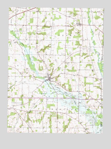
Jeromesville, OH USGS Topographic Map
Click on map above to begin viewing in our Map Viewer.

This topographic map contains these locations and features:
Feature Name Type Latitude Longitude GNIS ID View Map
Ackley CemeteryCemeteryN40.8012°W82.2402°1037308View Map
Apple Barn FarmLocaleN40.7642°W82.1878°2544517View Map
Bethel CemeteryCemeteryN40.8134°W82.1382°1806334View Map
Bethel ChurchChurchN40.8134°W82.1377°1037942View Map
Brandt CemeteryCemeteryN40.8422°W82.1757°1806335View Map
Bushnell CemeteryCemeteryN40.7773°W82.2413°1038557View Map
Cliff CemeteryCemeteryN40.7845°W82.1843°1806338View Map
EnglandPopulated PlaceN40.8403°W82.2393°1064623View Map
Glenn RunStreamN40.7756°W82.1535°1040914View Map
Hillsdale High SchoolSchoolN40.7803°W82.2193°1051126View Map
Jerome ForkStreamN40.7503°W82.1329°1066051View Map
JeromesvillePopulated PlaceN40.8042°W82.1957°1085470View Map
Jeromesville CemeteryCemeteryN40.8006°W82.1935°1806347View Map
Jeromesville Elementary SchoolSchoolN40.8073°W82.1971°1051128View Map
Jeromesville Post OfficePost OfficeN40.8031°W82.1949°1958901View Map
Jeromesville Volunteer Fire DepartmentBuildingN40.8051°W82.1973°2550255View Map
Katotawa CreekStreamN40.8512°W82.2468°1066055View Map
Lake Fork ChurchChurchN40.7542°W82.1463°1042375View Map
Lakefork CemeteryCemeteryN40.7539°W82.1460°1806349View Map
Lakefork School (historical)SchoolN40.7548°W82.1465°1069079View Map
Meng CemeteryCemeteryN40.8203°W82.1721°1043223View Map
Methodist CemeteryCemeteryN40.8054°W82.1943°1806354View Map
Mohican Hills Golf CourseLocaleN40.7748°W82.1332°1051135View Map
Muddy ForkStreamN40.7503°W82.1329°1057859View Map
Newell RunStreamN40.8451°W82.2393°1058180View Map
Oak Grove ChurchChurchN40.7851°W82.1371°1044035View Map
Old Rowsburg CemeteryCemeteryN40.8503°W82.1552°1044127View Map
Oldtown RunStreamN40.7914°W82.1807°1066123View Map
Quaker Springs RunStreamN40.7895°W82.2004°1066158View Map
RowsburgPopulated PlaceN40.8587°W82.1557°1065250View Map
Rowsburg CemeteryCemeteryN40.8592°W82.1546°1806367View Map
Scott RunStreamN40.8351°W82.2282°1046068View Map
SprengPopulated PlaceN40.7809°W82.1563°1065368View Map
Township of MohicanCivilN40.7698°W82.1745°1085710View Map
Township of PerryCivilN40.8573°W82.1739°1085713View Map
TreatonPopulated PlaceN40.8278°W82.2304°1062564View Map
Trinity CemeteryCemeteryN40.8709°W82.2110°1806373View Map
Trinity ChurchChurchN40.8712°W82.2118°1047156View Map
Village of JeromesvilleCivilN40.8037°W82.1964°2398299View Map

Note: Coordinates in the location and feature list above are referenced to NAD83 datum.


Copyright (C) 2008-2025 Ryan Niemi / Sunset Dynamics ... All Rights Reserved