TopoQuest Logo
Do you find TopoQuest useful?
Help keep TopoQuest running and adding new maps/features by donating!
Bitcoin:  19c7KJd3qBynnjoSw5npx9KScwjBe4ifkT
Litecoin:  LXs6TkuXGGXo1vDsWCkWVdjQX94eUKd6ui
Home View Maps Find Maps Find Places Resources & Links


Ashland North, Ohio Topographic Map

USGS Map Title: Ashland North, OH
USGS Map MRC: 40082H3
DRG (GeoTIFF) Download: o40082h3.tif


Neighboring USGS Topographic Map Quads:


  New London, OH  
41082A4
 

  Nova, OH  
41082A3
 

  Sullivan, OH  
41082A2
 

  Olivesburg, OH  
40082H4
 

  Ashland North, OH  
40082H3
 

  Polk, OH  
40082H2
 

  Pavonia, OH  
40082G4
 

  Ashland South, OH  
40082G3
 

  Jeromesville, OH  
40082G2


Map MRC Location:

N41°
W83°
N41°
W82°
H8 H7 H6 H5 H4 H3 H2 H1
G8 G7 G6 G5 G4 G3 G2 G1
F8 F7 F6 F5 F4 F3 F2 F1
E8 E7 E6 E5 E4 E3 E2 E1
D8 D7 D6 D5 D4 D3 D2 D1
C8 C7 C6 C5 C4 C3 C2 C1
B8 B7 B6 B5 B4 B3 B2 B1
A8 A7 A6 A5 A4 A3 A2 A1
N40°
W83°
N40°
W82°

Ashland North, OH USGS 1:24K Topographic Map Preview:
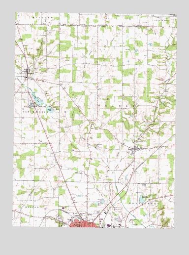
Ashland North, OH USGS Topographic Map
Click on map above to begin viewing in our Map Viewer.

This topographic map contains these locations and features:
Feature Name Type Latitude Longitude GNIS ID View Map
Ashland County AirportAirportN40.9024°W82.2567°1082465View Map
Ashland Memorial ParkCemeteryN40.9070°W82.3399°1806332View Map
Ashland ReservoirSwampN40.8919°W82.2752°1037519View Map
Ashland Water Treatment PlantLocaleN40.8792°W82.2914°2678267View Map
Bailey LakePopulated PlaceN40.9459°W82.3596°1060840View Map
Bailey LakeLakeN40.9461°W82.3605°1037576View Map
Beeghley CemeteryCemeteryN40.9225°W82.3102°1806333View Map
Brookside West ParkParkN40.8784°W82.3482°1051114View Map
Crouse CemeteryCemeteryN40.9012°W82.2740°1039498View Map
Edison Elementary SchoolSchoolN40.8795°W82.3296°1081256View Map
Emmons FieldParkN40.8812°W82.3188°1051119View Map
Emmons LakeLakeN40.8906°W82.3053°1040197View Map
Fackler Arabian FarmLocaleN40.8936°W82.2636°2706065View Map
Fast CemeteryCemeteryN40.9423°W82.3361°1040395View Map
Ford CemeteryCemeteryN40.9273°W82.3163°1040549View Map
Gregg CemeteryCemeteryN40.9784°W82.3588°1041176View Map
Heiffner CemeteryCemeteryN40.9317°W82.2754°1041466View Map
Krebs CemeteryCemeteryN40.9809°W82.3063°1806348View Map
Lake Silverstone Mobile Home ParkPopulated PlaceN40.8887°W82.3068°1084900View Map
Lance LakeReservoirN40.9401°W82.2832°1079340View Map
Lance Lake DamDamN40.9401°W82.2832°1079339View Map
Lang CreekStreamN40.8776°W82.2746°1042415View Map
Leidigh Mill CreekStreamN40.9070°W82.2966°1042486View Map
Lincoln Elementary SchoolSchoolN40.8773°W82.3166°1081557View Map
Maple Grove ChurchChurchN40.9228°W82.3113°1042957View Map
Mapleton High SchoolSchoolN40.9681°W82.2810°1051131View Map
Meadowbrook Mobile Home ParkPopulated PlaceN40.8839°W82.3099°1084901View Map
Mud LakeLakeN40.9489°W82.3568°1043694View Map
NankinPopulated PlaceN40.9214°W82.2818°1065092View Map
Nankin CemeteryCemeteryN40.9217°W82.2760°1806357View Map
Nankin Elementary SchoolSchoolN40.9212°W82.2777°1051137View Map
Nankin Post OfficePost OfficeN40.9223°W82.2818°1958905View Map
Normlein FarmsLocaleN40.9003°W82.2619°2706064View Map
North Orange Cemetery (historical)CemeteryN40.9926°W82.3107°1806358View Map
ODOT District 3 HeliportAirportN40.8767°W82.2954°1082467View Map
Old Hopewell CemeteryCemeteryN40.8795°W82.3390°1806360View Map
Orange CreekStreamN40.9073°W82.2966°1044190View Map
Orange Township Volunteer Fire Department NankinBuildingN40.9218°W82.2812°2550229View Map
Ramsay Dairy FarmLocaleN40.9750°W82.3292°2634672View Map
Rickert CemeteryCemeteryN40.9584°W82.3397°1044991View Map
Saint Lukes CemeteryCemeteryN40.9449°W82.2918°1045614View Map
SavannahPopulated PlaceN40.9653°W82.3652°1065289View Map
Savannah CemeteryCemeteryN40.9656°W82.3699°1806370View Map
Savannah LakesLakeN40.9489°W82.3568°1045979View Map
Savannah Post OfficePost OfficeN40.9653°W82.3652°1958898View Map
Savannah Volunteer Fire CompanyBuildingN40.9611°W82.3659°2549507View Map
Savannah-Clear Creek SchoolSchoolN40.9620°W82.3660°1045980View Map
Slyman LakeReservoirN40.9617°W82.2612°1079338View Map
Slyman Lake DamDamN40.9617°W82.2599°1079337View Map
Spring LakeLakeN40.9433°W82.3473°1046566View Map
Springdale FarmLocaleN40.9367°W82.3422°2706061View Map
Sprinkle LakeLakeN40.8892°W82.3099°1046601View Map
Sprotts HillSummitN40.9137°W82.3616°1062581View Map
Town RunStreamN40.8762°W82.2815°1047101View Map
Township of OrangeCivilN40.9472°W82.2822°1085712View Map
Twin Mobile Home ParkPopulated PlaceN40.8814°W82.3157°1084908View Map
Village of Bailey LakesCivilN40.9490°W82.3570°2398016View Map
Village of SavannahCivilN40.9668°W82.3662°2399764View Map
Vogel Airpark (historical)AirportN40.9612°W82.3707°1083002View Map

Note: Coordinates in the location and feature list above are referenced to NAD83 datum.


Copyright (C) 2008-2024 Ryan Niemi / Sunset Dynamics ... All Rights Reserved