TopoQuest Logo
Do you find TopoQuest useful?
Help keep TopoQuest running and adding new maps/features by donating!
Bitcoin:  19c7KJd3qBynnjoSw5npx9KScwjBe4ifkT
Litecoin:  LXs6TkuXGGXo1vDsWCkWVdjQX94eUKd6ui
Home View Maps Find Maps Find Places Resources & Links


Social Circle, Georgia Topographic Map

USGS Map Title: Social Circle, GA
USGS Map MRC: 33083F6
DRG (GeoTIFF) Download: o33083f6.tif


Neighboring USGS Topographic Map Quads:


  Between, GA  
33083G7
 

  Monroe, GA  
33083G6
 

  High Shoals, GA  
33083G5
 

  Jersey, GA  
33083F7
 

  Social Circle, GA  
33083F6
 

  Rutledge North, GA  
33083F5
 

  Covington, GA  
33083E7
 

  Mansfield, GA  
33083E6
 

  Rutledge South, GA  
33083E5


Map MRC Location:

N34°
W84°
N34°
W83°
H8 H7 H6 H5 H4 H3 H2 H1
G8 G7 G6 G5 G4 G3 G2 G1
F8 F7 F6 F5 F4 F3 F2 F1
E8 E7 E6 E5 E4 E3 E2 E1
D8 D7 D6 D5 D4 D3 D2 D1
C8 C7 C6 C5 C4 C3 C2 C1
B8 B7 B6 B5 B4 B3 B2 B1
A8 A7 A6 A5 A4 A3 A2 A1
N33°
W84°
N33°
W83°

Social Circle, GA USGS 1:24K Topographic Map Preview:
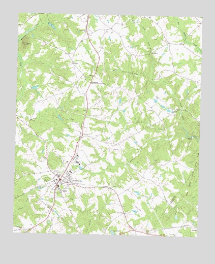
Social Circle, GA USGS Topographic Map
Click on map above to begin viewing in our Map Viewer.

This topographic map contains these locations and features:
Feature Name Type Latitude Longitude GNIS ID View Map
Alcovy MountainSummitN33.7326°W83.7446°310429View Map
Annie Mary ChurchChurchN33.7148°W83.6977°354318View Map
Arnold DamDamN33.7068°W83.7399°337497View Map
Arnold LakeReservoirN33.7078°W83.7376°337498View Map
Baccus LakeReservoirN33.6491°W83.6659°338842View Map
Baccus Lake DamDamN33.6485°W83.6649°338841View Map
Bradley DamDamN33.6485°W83.6649°337505View Map
Bradley LakeReservoirN33.6485°W83.6649°337506View Map
Brown Hill ChurchChurchN33.7290°W83.6588°354872View Map
Browning ShoalsBarN33.6818°W83.6310°311888View Map
Cedar LakeReservoirN33.6968°W83.6467°338838View Map
Cedar Lake DamDamN33.6968°W83.6449°338837View Map
Circle View CemeteryCemeteryN33.6548°W83.7228°312673View Map
City of Social CircleCivilN33.6513°W83.7117°2405481View Map
Conner CemeteryCemeteryN33.6887°W83.6268°342660View Map
Fellowship ChurchChurchN33.7137°W83.7041°355787View Map
Griffin DamDamN33.6368°W83.6399°338609View Map
Griffin LakeReservoirN33.6357°W83.6393°338610View Map
Hawkins Academy (historical)SchoolN33.6585°W83.6624°342675View Map
HerndonvillePopulated PlaceN33.7112°W83.6996°331957View Map
Hollis and Sigman CemeteryCemeteryN33.6304°W83.6855°342678View Map
Jefferson Davis MonumentParkN33.6282°W83.6671°342679View Map
Jones LakeReservoirN33.6985°W83.6466°337508View Map
Jones Lake DamDamN33.6985°W83.6466°337507View Map
Kelley LakeReservoirN33.7439°W83.7286°337510View Map
Kelley Lake DamDamN33.7451°W83.7299°337509View Map
Knox ChapelChurchN33.6676°W83.6552°316510View Map
Mathis LakeReservoirN33.7015°W83.6794°338840View Map
Mathis Lake DamDamN33.7001°W83.6799°338839View Map
McGarity DamDamN33.6918°W83.7199°338613View Map
McGarity LakeReservoirN33.6911°W83.7201°338614View Map
Means CreekStreamN33.6826°W83.6341°317986View Map
Moore CemeteryCemeteryN33.7275°W83.7160°342707View Map
Mount Paron ChurchChurchN33.6965°W83.6571°318799View Map
Pleasant Valley ChurchChurchN33.7404°W83.7032°320937View Map
Reedy CreekStreamN33.6876°W83.6368°321454View Map
Rocky CreekStreamN33.7160°W83.6577°321807View Map
Sandy Ford ChurchChurchN33.6971°W83.6413°322482View Map
Sleepy Hollow AirportAirportN33.6927°W83.6579°351906View Map
Social CirclePopulated PlaceN33.6562°W83.7182°333086View Map
Social Circle City HallBuildingN33.6557°W83.7168°1705258View Map
Social Circle Department of Public SafetyBuildingN33.6553°W83.7177°2603737View Map
Social Circle DivisionCivilN33.6753°W83.6900°1936545View Map
Social Circle Elementary SchoolSchoolN33.6579°W83.7202°342718View Map
Social Circle Fire DepartmentBuildingN33.6553°W83.7178°2603817View Map
Social Circle Historic DistrictParkN33.6562°W83.7188°342717View Map
Social Circle Middle and High SchoolSchoolN33.6593°W83.7295°2546054View Map
Social Circle Police DepartmentBuildingN33.6561°W83.7176°2734049View Map
Social Circle Post OfficePost OfficeN33.6562°W83.7191°1705260View Map
Social Circle Primary SchoolSchoolN33.6601°W83.7113°1705259View Map
Social Circle Training School (historical)SchoolN33.6598°W83.7113°342719View Map
Stephens ParkParkN33.6612°W83.7091°1705261View Map
Union ChapelChurchN33.7357°W83.6482°324500View Map
Union Chapel School (historical)SchoolN33.7357°W83.6479°342725View Map
Union Springs Baptist ChurchChurchN33.6259°W83.6402°324587View Map
Union Springs Baptist Church CemeteryCemeteryN33.6256°W83.6395°2573991View Map
Walton County Fire Rescue Department Station 11BuildingN33.7114°W83.6993°2604596View Map
WhitneyPopulated PlaceN33.7223°W83.7118°326590View Map
William Luther Breedlove MonumentParkN33.6265°W83.6580°342731View Map
Willow Springs ChurchChurchN33.6376°W83.6755°325409View Map

Note: Coordinates in the location and feature list above are referenced to NAD83 datum.


Copyright (C) 2008-2024 Ryan Niemi / Sunset Dynamics ... All Rights Reserved