TopoQuest Logo
Do you find TopoQuest useful?
Help keep TopoQuest running and adding new maps/features by donating!
Bitcoin:  19c7KJd3qBynnjoSw5npx9KScwjBe4ifkT
Litecoin:  LXs6TkuXGGXo1vDsWCkWVdjQX94eUKd6ui
Home View Maps Find Maps Find Places Resources & Links


Balkan, Kentucky Topographic Map

USGS Map Title: Balkan, KY
USGS Map MRC: 36083G5
DRG (GeoTIFF) Download: o36083g5.tif


Neighboring USGS Topographic Map Quads:


  Scalf, KY  
36083H6
 

  Beverly, KY  
36083H5
 

  Helton, KY  
36083H4
 

  Pineville, KY  
36083G6
 

  Balkan, KY  
36083G5
 

  Wallins Creek, KY  
36083G4
 

  Middlesboro North, KY  
36083F6
 

  Varilla, KY  
36083F5
 

  Ewing, VA  
36083F4


Map MRC Location:

N37°
W84°
N37°
W83°
H8 H7 H6 H5 H4 H3 H2 H1
G8 G7 G6 G5 G4 G3 G2 G1
F8 F7 F6 F5 F4 F3 F2 F1
E8 E7 E6 E5 E4 E3 E2 E1
D8 D7 D6 D5 D4 D3 D2 D1
C8 C7 C6 C5 C4 C3 C2 C1
B8 B7 B6 B5 B4 B3 B2 B1
A8 A7 A6 A5 A4 A3 A2 A1
N36°
W84°
N36°
W83°

Balkan, KY USGS 1:24K Topographic Map Preview:
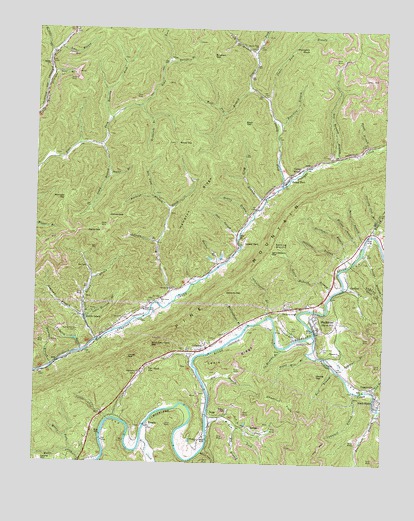
Balkan, KY USGS Topographic Map
Click on map above to begin viewing in our Map Viewer.

This topographic map contains these locations and features:
Feature Name Type Latitude Longitude GNIS ID View Map
Apple Blossom BranchStreamN36.7920°W83.6069°486008View Map
Bailey GapGapN36.8429°W83.5696°486225View Map
BalkanPopulated PlaceN36.7593°W83.5444°507443View Map
Balkan CemeteryCemeteryN36.7651°W83.5555°486284View Map
Balkan Road Station(historical)LocaleN36.7612°W83.5617°2554911View Map
Basin GapGapN36.8481°W83.5510°486456View Map
Bell County Volunteer Fire Department Calloway StationBuildingN36.7830°W83.5640°2637301View Map
Bell County Volunteer Fire Department Right Fork StationBuildingN36.7938°W83.5869°2637299View Map
Ben Howard BranchStreamN36.8376°W83.5171°486840View Map
Betsie BranchStreamN36.7604°W83.5513°487038View Map
Bingham GapGapN36.8673°W83.5627°487324View Map
Black SnakePopulated PlaceN36.7681°W83.5032°487388View Map
BlackmontPopulated PlaceN36.7918°W83.5249°487417View Map
Blackmont Census Designated PlaceCensusN36.7874°W83.5226°2629578View Map
Blackmont SchoolSchoolN36.7931°W83.5319°487418View Map
Blackmount Railroad Station (historical)LocaleN36.7678°W83.5023°2554935View Map
Blacksnake BranchStreamN36.7656°W83.5019°487425View Map
Blacksnake Post Office (historical)Post OfficeN36.7685°W83.5031°2554937View Map
Blanton BranchStreamN36.7781°W83.6185°487468View Map
Blind John Taylor GapGapN36.7843°W83.5827°487482View Map
Board Tree HollowValleyN36.7537°W83.5628°487578View Map
Brownies CreekStreamN36.7570°W83.5857°488020View Map
Buckeye BranchStreamN36.8234°W83.5777°488247View Map
Buffalo CreekStreamN36.8679°W83.6196°511041View Map
Bull BranchStreamN36.7773°W83.5174°488343View Map
Bullins BranchStreamN36.8659°W83.5782°488371View Map
Burst BranchStreamN36.8148°W83.5069°488468View Map
CallawayPopulated PlaceN36.7834°W83.5632°488619View Map
Callaway GapGapN36.7993°W83.5566°488620View Map
Calvary ChurchChurchN36.8004°W83.5763°488634View Map
Camp BranchStreamN36.8415°W83.6024°488666View Map
Camp RitterLocaleN36.8351°W83.5305°488714View Map
Campbell BranchStreamN36.7706°W83.5099°488725View Map
CardinalPopulated PlaceN36.8018°W83.5124°507652View Map
Chestnut FlatsSummitN36.7679°W83.5352°489429View Map
Country Club BranchStreamN36.8165°W83.5032°490153View Map
Crooked BranchStreamN36.7856°W83.5316°490369View Map
Cy Hoskins BranchStreamN36.7834°W83.5366°490517View Map
Deer BranchStreamN36.8620°W83.6199°490768View Map
Dewing GapGapN36.7756°W83.5235°490850View Map
Dry BranchStreamN36.7726°W83.5635°491134View Map
Dry ForkStreamN36.8273°W83.5827°491182View Map
Gabe BranchStreamN36.8151°W83.5524°492639View Map
Green Howard BranchStreamN36.7990°W83.5191°493276View Map
Hall CemeteryCemeteryN36.7890°W83.5305°493571View Map
Hampton RidgeRidgeN36.8265°W83.5666°493660View Map
Hanner GapGapN36.8212°W83.5991°493692View Map
Hata Railroad Station (historical)LocaleN36.7868°W83.5245°2554933View Map
Hulen Post OfficePost OfficeN36.7918°W83.5249°1721335View Map
James York BranchStreamN36.8551°W83.5430°495163View Map
JaybelPopulated PlaceN36.8539°W83.6221°2710812View Map
Jerrys BranchStreamN36.8104°W83.5077°495238View Map
John BranchStreamN36.8695°W83.6169°495318View Map
Johnson BranchStreamN36.8137°W83.5810°495360View Map
Kerrick Railroad Station (historical)LocaleN36.7747°W83.5643°2710720View Map
Kettle GapGapN36.8168°W83.6013°495701View Map
Kettle IslandPopulated PlaceN36.7906°W83.6052°495702View Map
Kettle Island BranchStreamN36.7854°W83.6024°495703View Map
Kettle Island CemeteryCemeteryN36.7884°W83.6099°495704View Map
Kettle Island Coal Camp (historical)Populated PlaceN36.7979°W83.6069°2554924View Map
Kettle Island Railroad Station (historical)LocaleN36.7972°W83.6075°2554932View Map
Knuckles BranchStreamN36.8476°W83.5391°495866View Map
Kotha Railroad Station (historical)LocaleN36.7865°W83.5505°2554909View Map
Lark Howard GapGapN36.8109°W83.5410°495989View Map
Laurel FordPopulated PlaceN36.8134°W83.5505°508429View Map
Lee Andrews BranchStreamN36.7806°W83.5205°496148View Map
Lewis RidgeRidgeN36.7801°W83.5544°496335View Map
Lick BranchStreamN36.7712°W83.5030°496452View Map
Lockes GapGapN36.7812°W83.5910°496929View Map
Luce Railroad Station (historical)LocaleN36.7880°W83.5491°2554907View Map
Mary BranchStreamN36.8265°W83.5432°497638View Map
McFarland BranchStreamN36.7662°W83.5010°497847View Map
Meadow BranchStreamN36.8073°W83.5591°497964View Map
Meetinghouse BranchStreamN36.7887°W83.5499°498032View Map
Middle Fork Watts CreekStreamN36.7534°W83.6107°498141View Map
Mill CreekStreamN36.7968°W83.5757°498233View Map
Mill Creek Baptist ChurchChurchN36.7976°W83.5796°498272View Map
Minton BranchStreamN36.8129°W83.5082°498430View Map
MiraclePopulated PlaceN36.7606°W83.5841°508617View Map
Miracle Railroad Station (historical)LocaleN36.7616°W83.5837°2554919View Map
Missionary ChurchChurchN36.7762°W83.5866°498435View Map
Moccasin GapGapN36.8256°W83.6144°498463View Map
Napier ChurchChurchN36.8645°W83.6210°499167View Map
Newton BranchStreamN36.8209°W83.5471°499450View Map
Newtown BranchStreamN36.7912°W83.6069°499460View Map
Oldhouse BranchStreamN36.8070°W83.5127°499904View Map
Pickerin BranchStreamN36.7823°W83.6080°500559View Map
Pickering Railroad Station (historical)LocaleN36.7858°W83.6031°2554923View Map
Pound Mill BranchStreamN36.7812°W83.5266°501217View Map
Puckett CreekStreamN36.7870°W83.5249°501413View Map
Pumpkin KnobSummitN36.8695°W83.5282°501433View Map
Right Fork School CenterSchoolN36.7940°W83.5855°501924View Map
Roaring ForkStreamN36.8493°W83.5980°502038View Map
Rockhouse BranchStreamN36.8531°W83.5880°502170View Map
Rough BranchStreamN36.8415°W83.5063°502375View Map
Salting GroundAreaN36.8134°W83.5371°502842View Map
Sanborn Railroad Station (historical)LocaleN36.8143°W83.5053°2565803View Map
Saylor BranchStreamN36.8329°W83.5988°503023View Map
Schoolhouse BranchStreamN36.7923°W83.5421°503050View Map
Stillhouse BranchStreamN36.8081°W83.5113°504402View Map
Stoney ForkPopulated PlaceN36.8323°W83.5346°504491View Map
Stoney ForkStreamN36.8301°W83.5371°515733View Map
Stoney Fork Mission ChurchChurchN36.8698°W83.5474°504492View Map
Tacket Hill CemeteryCemeteryN36.7831°W83.5219°504904View Map
Tan Yard HillSummitN36.7765°W83.5838°504934View Map
Tee Jay Railroad Station (historical)LocaleN36.7643°W83.5608°2554913View Map
TejayPopulated PlaceN36.7637°W83.5621°509194View Map
Tom ForkStreamN36.7615°W83.5624°505335View Map
TugglevillePopulated PlaceN36.7723°W83.5044°509242View Map
Upland ChurchChurchN36.7820°W83.5152°505853View Map
Wayne Railroad Station (historical)LocaleN36.7611°W83.5717°2554917View Map
Wessell Railroad Station (historical)LocaleN36.7821°W83.6088°2554921View Map
Whipple ChurchChurchN36.7568°W83.5655°506551View Map
Whipple Railroad Station (historical)LocaleN36.7521°W83.5657°2554915View Map
Wolf Pen BranchStreamN36.8573°W83.5494°507018View Map
Yellow Cliff BranchStreamN36.7626°W83.5980°507209View Map
York BranchStreamN36.8687°W83.5477°516512View Map

Note: Coordinates in the location and feature list above are referenced to NAD83 datum.


Copyright (C) 2008-2024 Ryan Niemi / Sunset Dynamics ... All Rights Reserved