TopoQuest Logo
Do you find TopoQuest useful?
Help keep TopoQuest running and adding new maps/features by donating!
Bitcoin:  19c7KJd3qBynnjoSw5npx9KScwjBe4ifkT
Litecoin:  LXs6TkuXGGXo1vDsWCkWVdjQX94eUKd6ui
Home View Maps Find Maps Find Places Resources & Links


Beverly, Kentucky Topographic Map

USGS Map Title: Beverly, KY
USGS Map MRC: 36083H5
DRG (GeoTIFF) Download: o36083h5.tif


Neighboring USGS Topographic Map Quads:


  Ogle, KY  
37083A6
 

  Creekville, KY  
37083A5
 

  Hoskinston, KY  
37083A4
 

  Scalf, KY  
36083H6
 

  Beverly, KY  
36083H5
 

  Helton, KY  
36083H4
 

  Pineville, KY  
36083G6
 

  Balkan, KY  
36083G5
 

  Wallins Creek, KY  
36083G4


Map MRC Location:

N37°
W84°
N37°
W83°
H8 H7 H6 H5 H4 H3 H2 H1
G8 G7 G6 G5 G4 G3 G2 G1
F8 F7 F6 F5 F4 F3 F2 F1
E8 E7 E6 E5 E4 E3 E2 E1
D8 D7 D6 D5 D4 D3 D2 D1
C8 C7 C6 C5 C4 C3 C2 C1
B8 B7 B6 B5 B4 B3 B2 B1
A8 A7 A6 A5 A4 A3 A2 A1
N36°
W84°
N36°
W83°

Beverly, KY USGS 1:24K Topographic Map Preview:
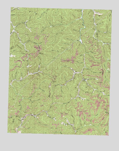
Beverly, KY USGS Topographic Map
Click on map above to begin viewing in our Map Viewer.

This topographic map contains these locations and features:
Feature Name Type Latitude Longitude GNIS ID View Map
Alex CreekStreamN36.9240°W83.6227°510234View Map
Alex SchoolSchoolN36.9098°W83.6066°510235View Map
Asher CemeteryCemeteryN36.9373°W83.5430°510314View Map
Baker BranchStreamN36.8851°W83.5232°510351View Map
Bear Wallow GapGapN36.9176°W83.5310°510473View Map
Bear Wallow HollowValleyN36.9203°W83.5191°510474View Map
Bell BranchStreamN36.8851°W83.5482°510535View Map
Bell LookoutTowerN36.9948°W83.5946°516798View Map
Ben Carrol BranchStreamN36.9179°W83.5121°510550View Map
BeverlyPopulated PlaceN36.9304°W83.5327°510587View Map
Beverly Post Office (historical)Post OfficeN36.9319°W83.5332°2710860View Map
Big BranchStreamN36.9204°W83.5877°510603View Map
Big BranchStreamN36.9251°W83.5266°510606View Map
Birch Lick BranchStreamN36.8784°W83.5410°510735View Map
Bloss BranchStreamN36.9676°W83.5463°510795View Map
Blue Hole CreekStreamN36.9931°W83.5369°510800View Map
Board Tree BranchStreamN36.9109°W83.5988°510817View Map
Bob Slusher GapGapN36.9276°W83.5702°510823View Map
Briar HollowValleyN36.9197°W83.5368°510906View Map
Briar HollowValleyN36.9664°W83.5368°510907View Map
Britts Railroad Station (historical)LocaleN36.8891°W83.6073°2554938View Map
Buck HollowValleyN36.9189°W83.5909°511008View Map
Buffalo BranchStreamN36.9545°W83.5332°511034View Map
Butcher BranchStreamN36.9112°W83.5427°511098View Map
Camp BranchStreamN36.8970°W83.5777°511141View Map
Carter Roark BranchStreamN36.9368°W83.5880°511237View Map
Chestnut Log GapGapN36.9959°W83.6027°511336View Map
Clay Gap ChurchChurchN36.9443°W83.5855°511383View Map
Coon BranchStreamN36.8834°W83.5149°511512View Map
Cove HollowValleyN36.9362°W83.5403°511582View Map
Cow BranchStreamN36.8812°W83.6094°511585View Map
Cow ForkStreamN36.9295°W83.5335°511596View Map
Cow Fork ChurchChurchN36.9320°W83.5455°511597View Map
Cow HollowValleyN36.9897°W83.5442°511598View Map
Crockett ChurchChurchN36.8887°W83.6080°511645View Map
Darbs BranchStreamN36.9634°W83.6074°511713View Map
Darbys Branch SchoolSchoolN36.9640°W83.6071°511715View Map
Dry BranchStreamN36.9173°W83.5082°511900View Map
Dry BranchStreamN36.9826°W83.5741°511905View Map
East Branch Phillips ForkStreamN36.9506°W83.5038°511987View Map
Eros Post Office (historical)Post OfficeN36.9554°W83.6012°2543150View Map
ErosePopulated PlaceN36.9273°W83.6194°512083View Map
Erose SchoolSchoolN36.9345°W83.5991°512084View Map
FieldPopulated PlaceN36.8929°W83.6021°512154View Map
Garden HollowValleyN36.9109°W83.5464°512276View Map
GardnerPopulated PlaceN36.9681°W83.5385°512277View Map
Gardner Post Office (historical)Post OfficeN36.9687°W83.5387°2543076View Map
Gardner Railroad Station (historical)LocaleN36.9692°W83.5371°2543077View Map
Harbon Railroad Station (historical)LocaleN36.8946°W83.5933°2554940View Map
Horse HollowValleyN36.9591°W83.5564°512797View Map
Ice Cliff Post Office (historical)Post OfficeN36.9999°W83.5785°2543099View Map
Indian Grave BranchStreamN36.9801°W83.6205°512912View Map
Indian Grave SchoolSchoolN36.9801°W83.6196°512914View Map
Jackson BranchStreamN36.9356°W83.5913°512964View Map
Jim BranchStreamN36.8843°W83.5294°513008View Map
Kentucky GapGapN36.9012°W83.5032°513128View Map
Kentucky RidgeRidgeN36.9543°W83.6044°513129View Map
Laurel BranchStreamN36.8765°W83.5085°513214View Map
Laurel ForkStreamN36.9554°W83.5632°513246View Map
Lawson BranchStreamN36.9234°W83.5591°513270View Map
Lawson CreekStreamN36.9370°W83.5352°513272View Map
Left Fork Blue Hole CreekStreamN36.9831°W83.5569°513305View Map
Left Fork Indian Grave BranchStreamN36.9848°W83.6071°513313View Map
Left Fork Spruce BranchStreamN36.9559°W83.5269°513325View Map
Lick ForkStreamN36.9690°W83.5382°513404View Map
Little Camp BranchStreamN36.8926°W83.5919°513459View Map
Little Cow ForkStreamN36.9295°W83.5305°513470View Map
Little CreekStreamN36.9359°W83.5430°513471View Map
Little Rocky Point BranchStreamN36.9662°W83.5024°513519View Map
Long BranchStreamN36.9276°W83.5527°513586View Map
Long HollowValleyN36.9685°W83.5155°513625View Map
Low GapGapN36.9409°W83.6138°513661View Map
Low Gap BranchStreamN36.9279°W83.6177°513662View Map
McRoe HollowValleyN36.9468°W83.5326°513883View Map
Middle Fork Spruce BranchStreamN36.9559°W83.5269°513939View Map
Mill HollowValleyN36.9902°W83.5209°513991View Map
Mosley CoveValleyN36.9733°W83.5224°514080View Map
Mosley Cove SchoolSchoolN36.9731°W83.5221°514081View Map
Mud GapGapN36.8784°W83.5013°514129View Map
Mud Hole GapGapN36.9087°W83.6169°514130View Map
Mud Lick BranchStreamN36.9140°W83.5388°514133View Map
Neal HollowValleyN36.9161°W83.5072°514207View Map
Nugym (historical)Populated PlaceN36.8831°W83.6109°2710834View Map
Old Field BranchStreamN36.9770°W83.6199°514319View Map
Old House BranchStreamN36.8843°W83.5441°514321View Map
Orchard HollowValleyN36.9205°W83.5167°514372View Map
Orchard HollowValleyN36.9784°W83.5050°514373View Map
Paint GapGapN36.9540°W83.6016°514420View Map
Paint Gap BranchStreamN36.9337°W83.6007°514421View Map
Paw Paw CoveStreamN36.9809°W83.5821°514458View Map
Peach Orchard BranchStreamN36.8820°W83.5338°514467View Map
Phillips Fork ChurchChurchN36.9804°W83.5194°516799View Map
Pigeon ForkStreamN36.9240°W83.6227°514543View Map
Pups BranchStreamN36.9784°W83.5188°514803View Map
Red Bird Mission HospitalHospitalN36.9373°W83.5357°514861View Map
Red Bird Settlement SchoolSchoolN36.9293°W83.5305°514864View Map
Redbud Railroad Station (historical)LocaleN36.8945°W83.6022°2554939View Map
Rich BranchStreamN36.9431°W83.5313°514909View Map
Richland BranchStreamN36.9781°W83.5385°514913View Map
Right Fork Indian Grave BranchStreamN36.9848°W83.6071°514942View Map
Rock House BranchStreamN36.9287°W83.6088°515028View Map
Rocky HollowValleyN36.9297°W83.5463°515075View Map
Rocky Point BranchStreamN36.9668°W83.5094°515080View Map
Sal North BranchStreamN36.9309°W83.5046°515179View Map
Sand Fork Post Office (historical)Post OfficeN36.9400°W83.5040°2362762View Map
Sandy ForkStreamN36.9401°W83.5041°515241View Map
Sandy Fork Coal Preparation PlantLocaleN36.9681°W83.5369°517556View Map
Sandy Fork School (historical)SchoolN36.9377°W83.5055°2362763View Map
Saw Pit HollowValleyN36.9989°W83.5238°515265View Map
Saylor SchoolSchoolN36.8909°W83.5669°515273View Map
Shep HollowValleyN36.9281°W83.6199°515348View Map
Short HollowValleyN36.9711°W83.5201°515389View Map
Skidmore Post Office (historical)Post OfficeN36.9977°W83.5222°2362773View Map
Slusher SchoolSchoolN36.8931°W83.5921°515497View Map
Snake HollowValleyN36.9644°W83.5488°515522View Map
Spice Lick BranchStreamN36.9848°W83.5188°515587View Map
Spruce BranchStreamN36.9568°W83.5310°515614View Map
Steel Trap BranchStreamN36.9968°W83.5213°515677View Map
Straight Creek BranchStreamN36.9097°W83.6072°515744View Map
Sugar GapGapN36.9570°W83.5869°515790View Map
Sugar Gap BranchStreamN36.9640°W83.5907°515791View Map
Taylor SchoolSchoolN36.9229°W83.6238°515885View Map
The Wetherby TrailTrailN36.9918°W83.5807°515922View Map
Thompson HollowValleyN36.9243°W83.5547°515932View Map
Toms BranchStreamN36.9881°W83.6005°515974View Map
Turkeypen GapGapN36.8915°W83.6149°516059View Map
Upper Blue Hole SchoolSchoolN36.9815°W83.5791°516112View Map
Upper DeZarn HollowValleyN36.9986°W83.5375°516119View Map
Wilson BranchStreamN36.9845°W83.5616°516395View Map
Witch HollowValleyN36.9062°W83.5955°516424View Map

Note: Coordinates in the location and feature list above are referenced to NAD83 datum.


Copyright (C) 2008-2024 Ryan Niemi / Sunset Dynamics ... All Rights Reserved