TopoQuest Logo
Do you find TopoQuest useful?
Help keep TopoQuest running and adding new maps/features by donating!
Bitcoin:  19c7KJd3qBynnjoSw5npx9KScwjBe4ifkT
Litecoin:  LXs6TkuXGGXo1vDsWCkWVdjQX94eUKd6ui
Home View Maps Find Maps Find Places Resources & Links


Johns, Mississippi Topographic Map

USGS Map Title: Johns, MS
USGS Map MRC: 32089B7
DRG (GeoTIFF) Download: o32089b7.tif


Neighboring USGS Topographic Map Quads:


  Brandon, MS  
32089C8
 

  Pelahatchie, MS  
32089C7
 

  Morton, MS  
32089C6
 

  Puckett NW, MS  
32089B8
 

  Johns, MS  
32089B7
 

  Polkville, MS  
32089B6
 

  Braxton, MS  
32089A8
 

  Puckett, MS  
32089A7
 

  White Oak, MS  
32089A6


Map MRC Location:

N33°
W90°
N33°
W89°
H8 H7 H6 H5 H4 H3 H2 H1
G8 G7 G6 G5 G4 G3 G2 G1
F8 F7 F6 F5 F4 F3 F2 F1
E8 E7 E6 E5 E4 E3 E2 E1
D8 D7 D6 D5 D4 D3 D2 D1
C8 C7 C6 C5 C4 C3 C2 C1
B8 B7 B6 B5 B4 B3 B2 B1
A8 A7 A6 A5 A4 A3 A2 A1
N32°
W90°
N32°
W89°

Johns, MS USGS 1:24K Topographic Map Preview:
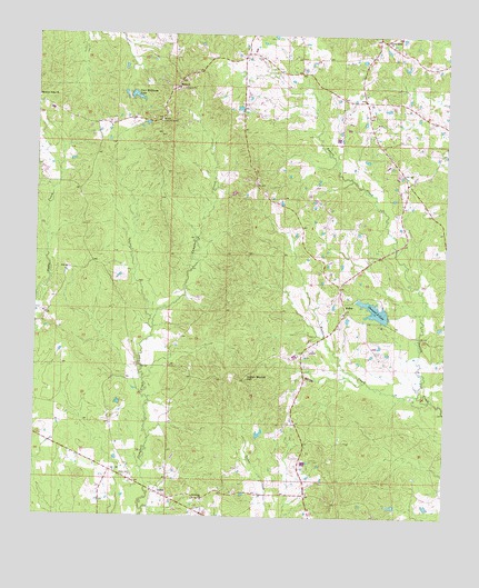
Johns, MS USGS Topographic Map
Click on map above to begin viewing in our Map Viewer.

This topographic map contains these locations and features:
Feature Name Type Latitude Longitude GNIS ID View Map
Antioch CemeteryCemeteryN32.1779°W89.7815°708986View Map
Antioch ChurchChurchN32.1785°W89.7809°687001View Map
Bafrick (historical)Populated PlaceN32.1696°W89.8459°690051View Map
Burnham (historical)Populated PlaceN32.1371°W89.8634°690057View Map
Carr-Williams LakeReservoirN32.2342°W89.8451°668092View Map
Central School (historical)SchoolN32.1843°W89.8506°690058View Map
Cox Lake DamDamN32.1502°W89.8034°681030View Map
Cross RoadsPopulated PlaceN32.2488°W89.7709°711115View Map
Cross Roads ChurchChurchN32.2485°W89.7695°668968View Map
Crossroads CemeteryCemeteryN32.2486°W89.7688°709018View Map
Crossroads School (historical)SchoolN32.2482°W89.7698°690059View Map
Diamond D LakeReservoirN32.1788°W89.7715°669249View Map
Indian Mound HillSummitN32.1610°W89.8104°671696View Map
JohnsPopulated PlaceN32.1310°W89.8381°671904View Map
Johns CemeteryCemeteryN32.1356°W89.8469°671908View Map
Lynwood (historical)Populated PlaceN32.2113°W89.8084°709075View Map
Moseley (historical)Populated PlaceN32.2451°W89.8112°709089View Map
Mountain Ridge CemeteryCemeteryN32.2349°W89.8748°709092View Map
Mountain Ridge ChurchChurchN32.2338°W89.8748°674415View Map
Rocket Lake DamDamN32.2335°W89.8417°681104View Map
RufusPopulated PlaceN32.1782°W89.7806°692193View Map
Shady Grove School (historical)SchoolN32.2196°W89.8106°690079View Map
Shermans Camp (historical)LocaleN32.1988°W89.8598°690080View Map
Shiloh (historical)Populated PlaceN32.2363°W89.8334°709153View Map
Shiloh CemeteryCemeteryN32.2363°W89.8340°709154View Map
Shiloh ChurchChurchN32.2365°W89.8326°677682View Map
Shiloh Lookout TowerTowerN32.2276°W89.8376°711311View Map
Silverena CemeteryCemeteryN32.1296°W89.8231°709155View Map
Swore Lake DamDamN32.1801°W89.7667°681059View Map
Sylvarena ChurchChurchN32.1293°W89.8234°678523View Map
Walters CreekStreamN32.1565°W89.7581°679313View Map
Walters Volunteer Fire Department Station 1 HeadquartersBuildingN32.2326°W89.7775°2667822View Map

Note: Coordinates in the location and feature list above are referenced to NAD83 datum.


Copyright (C) 2008-2024 Ryan Niemi / Sunset Dynamics ... All Rights Reserved