TopoQuest Logo
Do you find TopoQuest useful?
Help keep TopoQuest running and adding new maps/features by donating!
Bitcoin:  19c7KJd3qBynnjoSw5npx9KScwjBe4ifkT
Litecoin:  LXs6TkuXGGXo1vDsWCkWVdjQX94eUKd6ui
Home View Maps Find Maps Find Places Resources & Links


Bakersfield, Vermont Topographic Map

USGS Map Title: Bakersfield, VT
USGS Map MRC: 44072G7
DRG (GeoTIFF) Download: o44072g7.tif


Neighboring USGS Topographic Map Quads:


  Sheldon Springs, VT  
44072H8
 

  Enosburg Falls, VT  
44072H7
 

  Richford, VT  
44072H6
 

  Fairfield, VT  
44072G8
 

  Bakersfield, VT  
44072G7
 

  Cold Hollow Mountains, VT  
44072G6
 

  Gilson Mountain, VT  
44072F8
 

  Jeffersonville, VT  
44072F7
 

  Johnson, VT  
44072F6


Map MRC Location:

N45°
W73°
N45°
W72°
H8 H7 H6 H5 H4 H3 H2 H1
G8 G7 G6 G5 G4 G3 G2 G1
F8 F7 F6 F5 F4 F3 F2 F1
E8 E7 E6 E5 E4 E3 E2 E1
D8 D7 D6 D5 D4 D3 D2 D1
C8 C7 C6 C5 C4 C3 C2 C1
B8 B7 B6 B5 B4 B3 B2 B1
A8 A7 A6 A5 A4 A3 A2 A1
N44°
W73°
N44°
W72°

Bakersfield, VT USGS 1:24K Topographic Map Preview:
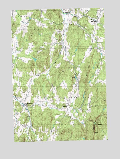
Bakersfield, VT USGS Topographic Map
Click on map above to begin viewing in our Map Viewer.

This topographic map contains these locations and features:
Feature Name Type Latitude Longitude GNIS ID View Map
Advent Christian ChurchChurchN44.8425°W72.8185°1920522View Map
BakersfieldPopulated PlaceN44.7820°W72.8029°1461775View Map
Bakersfield Census Designated PlaceCensusN44.7813°W72.8049°2586616View Map
Bakersfield Elementary SchoolSchoolN44.7844°W72.8028°1920530View Map
Bakersfield Fire DepartmentBuildingN44.7874°W72.7996°2121452View Map
Bakersfield Post OfficePost OfficeN44.7831°W72.8015°1920527View Map
Basswood SchoolSchoolN44.7787°W72.7771°1920532View Map
Beaver Meadow BrookStreamN44.8412°W72.8065°1456354View Map
Bogue BranchStreamN44.8653°W72.7857°1456507View Map
BordovillePopulated PlaceN44.8434°W72.8187°1456526View Map
Bordoville Advent CemeteryCemeteryN44.8436°W72.8198°1920541View Map
Branch SchoolSchoolN44.8256°W72.7990°1456553View Map
Browns PondReservoirN44.8099°W72.7904°1456611View Map
Browns Pond DamDamN44.8103°W72.7907°1766579View Map
Buckley School (historical)SchoolN44.8425°W72.8449°1920546View Map
Burnt MountainSummitN44.7500°W72.7693°1456675View Map
Butternut RidgeRidgeN44.8062°W72.7784°1456700View Map
Checkerberry LedgeBenchN44.7656°W72.7643°1456863View Map
Chester Arthur ChurchChurchN44.8403°W72.8710°1920554View Map
Cooks BrookStreamN44.8278°W72.7562°1457003View Map
Duffy Hill School (historical)SchoolN44.8673°W72.8449°1920567View Map
East FairfieldPopulated PlaceN44.7845°W72.8585°1457276View Map
East Fairfield Covered BridgeBridgeN44.7862°W72.8621°1920574View Map
East Fairfield Fire DepartmentBuildingN44.7852°W72.8586°2121446View Map
East Fairfield Post OfficePost OfficeN44.7842°W72.8583°1920575View Map
Egypt School (historical)SchoolN44.8123°W72.8404°1920585View Map
Enosburg Center CemeteryCemeteryN44.8734°W72.7535°1920588View Map
F H Brigham Memorial Free LibraryBuildingN44.7817°W72.8035°1920607View Map
Giddings HillSummitN44.8162°W72.8107°1457538View Map
Gilberts TanneryPopulated PlaceN44.8625°W72.7601°1457541View Map
Herrick SchoolSchoolN44.8395°W72.8729°1457804View Map
Lapland SchoolSchoolN44.7653°W72.8657°1458166View Map
Leach HillSummitN44.8578°W72.8440°1458183View Map
Maple Grove CemeteryCemeteryN44.7820°W72.7993°1920681View Map
North Fairfield - Herrick CemeteryCemeteryN44.8392°W72.8690°1920707View Map
North School (historical)SchoolN44.7962°W72.7962°1920710View Map
President Arthur Birthplace MuseumBuildingN44.8317°W72.8037°1920721View Map
Ross BrookStreamN44.8148°W72.7643°1459247View Map
Saddle PondLakeN44.7628°W72.7629°1459304View Map
Saint Georges CemeteryCemeteryN44.7855°W72.8038°1920754View Map
School Number 11SchoolN44.8334°W72.7537°1459405View Map
Shattuck MountainSummitN44.7573°W72.7687°1459465View Map
The BranchStreamN44.8700°W72.8043°1459845View Map
Town of BakersfieldCivilN44.7937°W72.7796°1462031View Map
Tri-Church Parish ChurchChurchN44.7814°W72.8004°1920799View Map
West EnosburgPopulated PlaceN44.8720°W72.7979°1460133View Map
West Enosburg CemeteryCemeteryN44.8659°W72.7982°1920805View Map
West Enosburg CemeteryCemeteryN44.8560°W72.8020°1460134View Map
West School (historical)SchoolN44.7878°W72.8287°1920811View Map
Wolf Run Country ClubLocaleN44.8273°W72.7768°1920816View Map
Wolf Run Cross Country Ski CenterLocaleN44.8273°W72.7768°1920817View Map

Note: Coordinates in the location and feature list above are referenced to NAD83 datum.


Copyright (C) 2008-2024 Ryan Niemi / Sunset Dynamics ... All Rights Reserved