TopoQuest Logo
Do you find TopoQuest useful?
Help keep TopoQuest running and adding new maps/features by donating!
Bitcoin:  19c7KJd3qBynnjoSw5npx9KScwjBe4ifkT
Litecoin:  LXs6TkuXGGXo1vDsWCkWVdjQX94eUKd6ui
Home View Maps Find Maps Find Places Resources & Links


Johnson Coulee East, Montana Topographic Map

USGS Map Title: Johnson Coulee East, MT
USGS Map MRC: 47105D8
DRG (GeoTIFF) Download: o47105d8.tif


Neighboring USGS Topographic Map Quads:


  Rodgers Hall, MT  
47106E1
 

  Weldon, MT  
47105E8
 

  North Fork Horse Creek, MT  
47105E7
 

  Johnson Coulee West, MT  
47106D1
 

  Johnson Coulee East, MT  
47105D8
 

  Brockway NE, MT  
47105D7
 

  Cemetery Coulee, MT  
47106C1
 

  Beauty Creek, MT  
47105C8
 

  Brockway, MT  
47105C7


Map MRC Location:

N48°
W106°
N48°
W105°
H8 H7 H6 H5 H4 H3 H2 H1
G8 G7 G6 G5 G4 G3 G2 G1
F8 F7 F6 F5 F4 F3 F2 F1
E8 E7 E6 E5 E4 E3 E2 E1
D8 D7 D6 D5 D4 D3 D2 D1
C8 C7 C6 C5 C4 C3 C2 C1
B8 B7 B6 B5 B4 B3 B2 B1
A8 A7 A6 A5 A4 A3 A2 A1
N47°
W106°
N47°
W105°

Johnson Coulee East, MT USGS 1:24K Topographic Map Preview:
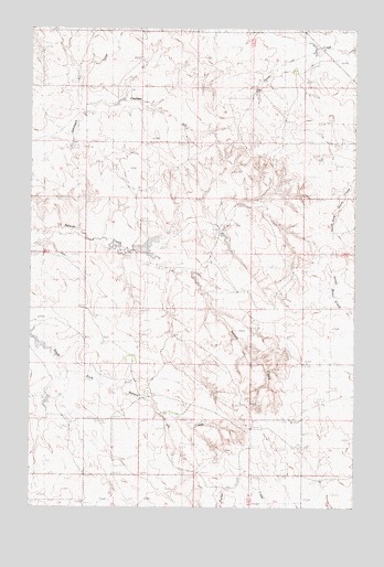
Johnson Coulee East, MT USGS Topographic Map
Click on map above to begin viewing in our Map Viewer.

This topographic map contains these locations and features:
Feature Name Type Latitude Longitude GNIS ID View Map
19N45E04ABBA01 WellWellN47.4394°W105.9892°822934View Map
19N45E09DCCD01 WellWellN47.4131°W105.9878°822750View Map
19N45E10DDCA01 WellWellN47.4122°W105.9620°822747View Map
19N45E11ACCD01 WellWellN47.4194°W105.9458°822792View Map
19N45E16ABAB01 WellWellN47.4119°W105.9867°822742View Map
19N45E22BBAC01 WellWellN47.3956°W105.9761°822639View Map
19N46E08ACDA01 WellWellN47.4208°W105.8786°822801View Map
19N46E08CDAC01 WellWellN47.4147°W105.8847°822769View Map
19N46E08CDDB01 WellWellN47.4133°W105.8847°822756View Map
19N46E17ADBD01 WellWellN47.4075°W105.8761°822716View Map
19N46E29CAAA01 WellWellN47.3758°W105.8839°822537View Map
20N45E10DCCD01 WellWellN47.4997°W105.9672°823421View Map
20N45E22BCCA01 WellWellN47.4778°W105.9781°823280View Map
20N45E22DACC01 WellWellN47.4742°W105.9628°823256View Map
20N45E27ACCC01 WellWellN47.4631°W105.9681°823154View Map
20N45E28BABD01 WellWellN47.4681°W105.9939°823187View Map
20N45E34CAAB01 WellWellN47.4486°W105.9659°822996View Map
20N45E35DAAB01 WellWellN47.4472°W105.9386°822976View Map
20N46E19BBAC01 WellWellN47.4828°W105.9125°823316View Map
20N46E20CADA01 WellWellN47.4742°W105.8853°823255View Map
L Quick DamDamN47.4200°W105.9006°796218View Map
Murphy and Sons Number 2 DamDamN47.4050°W105.9889°797623View Map
Murphy Number 1 DamDamN47.4417°W105.9639°796672View Map
Nelson Creek Post Office (historical)Post OfficeN47.3844°W105.9358°1716184View Map
Waller DamDamN47.4800°W105.9706°797565View Map

Note: Coordinates in the location and feature list above are referenced to NAD83 datum.


Copyright (C) 2008-2025 Ryan Niemi / Sunset Dynamics ... All Rights Reserved