TopoQuest Logo
Do you find TopoQuest useful?
Help keep TopoQuest running and adding new maps/features by donating!
Bitcoin:  19c7KJd3qBynnjoSw5npx9KScwjBe4ifkT
Litecoin:  LXs6TkuXGGXo1vDsWCkWVdjQX94eUKd6ui
Home View Maps Find Maps Find Places Resources & Links


Rodgers Hall, Montana Topographic Map

USGS Map Title: Rodgers Hall, MT
USGS Map MRC: 47106E1
DRG (GeoTIFF) Download: o47106e1.tif


Neighboring USGS Topographic Map Quads:


  Bug Creek, MT  
47106F2
 

  Crow Springs, MT  
47106F1
 

  Figure Eight Creek, MT  
47105F8
 

  Nelson Creek Bay, MT  
47106E2
 

  Rodgers Hall, MT  
47106E1
 

  Weldon, MT  
47105E8
 

  Fortyfour Coulee, MT  
47106D2
 

  Johnson Coulee West, MT  
47106D1
 

  Johnson Coulee East, MT  
47105D8


Map MRC Location:

N48°
W107°
N48°
W106°
H8 H7 H6 H5 H4 H3 H2 H1
G8 G7 G6 G5 G4 G3 G2 G1
F8 F7 F6 F5 F4 F3 F2 F1
E8 E7 E6 E5 E4 E3 E2 E1
D8 D7 D6 D5 D4 D3 D2 D1
C8 C7 C6 C5 C4 C3 C2 C1
B8 B7 B6 B5 B4 B3 B2 B1
A8 A7 A6 A5 A4 A3 A2 A1
N47°
W107°
N47°
W106°

Rodgers Hall, MT USGS 1:24K Topographic Map Preview:
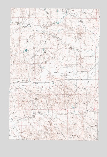
Rodgers Hall, MT USGS Topographic Map
Click on map above to begin viewing in our Map Viewer.

This topographic map contains these locations and features:
Feature Name Type Latitude Longitude GNIS ID View Map
20N45E05DDB_01 WellWellN47.5167°W106.0017°823546View Map
20N45E08DDAC01 WellWellN47.5011°W106.0025°823432View Map
21N44E04DCCB01 WellWellN47.6028°W106.0797°824005View Map
21N44E11CDAC01 WellWellN47.5886°W106.0378°823926View Map
21N44E11DCDA01 WellWellN47.5872°W106.0317°823911View Map
21N44E16DBCD01 WellWellN47.5764°W106.0811°823846View Map
21N44E23BBDC01 WellWellN47.5692°W106.0431°823813View Map
21N44E23CBCD01 WellWellN47.5619°W106.0450°823781View Map
21N44E24BDCC01 WellWellN47.5656°W106.0189°823797View Map
21N44E28DBCC01 WellWellN47.5475°W106.0781°823718View Map
21N44E28DCB_01 WellWellN47.5464°W106.0789°823712View Map
21N45E07BCDD01 WellWellN47.5947°W106.0011°823953View Map
22N44E23DDBC01 WellWellN47.5597°W106.0297°823770View Map
22N44E35BAAA01 WellWellN47.5425°W106.0370°823688View Map
22N44E35BACB01 WellWellN47.5403°W106.0406°823680View Map
22N44E35BACB02 WellWellN47.5403°W106.0406°823681View Map
22N44E36CBBB01 WellWellN47.5353°W106.0245°823656View Map
Anderson CouleeValleyN47.6100°W106.0711°768241View Map
Badgley CouleeValleyN47.5125°W106.1172°768438View Map
Coal CreekStreamN47.5178°W106.1175°769981View Map
Coal Creek (historical)Populated PlaceN47.5250°W106.0422°1716192View Map
Devils Table RockSummitN47.5433°W106.0564°770630View Map
Eagle RockPillarN47.5389°W106.0897°770967View Map
Kurth CouleeValleyN47.5997°W106.0714°773150View Map
Kvam CouleeValleyN47.6033°W106.0906°773151View Map
McDonald ButteSummitN47.5003°W106.0506°773995View Map
North Fork McGuire CreekStreamN47.6033°W106.0770°774782View Map
Paine DamDamN47.5850°W106.1022°797794View Map
Porcupine CouleeValleyN47.6189°W106.0470°775366View Map
Rodgers CouleeValleyN47.5817°W106.0092°775908View Map
Rodgers HallLocaleN47.5653°W106.0197°775909View Map
Romine DivideBasinN47.5639°W106.0475°775918View Map
School Section SpringsSpringN47.5833°W106.0781°776279View Map
Towe Farms Number 3 DamDamN47.6117°W106.0606°798065View Map

Note: Coordinates in the location and feature list above are referenced to NAD83 datum.


Copyright (C) 2008-2025 Ryan Niemi / Sunset Dynamics ... All Rights Reserved