TopoQuest Logo
Do you find TopoQuest useful?
Help keep TopoQuest running and adding new maps/features by donating!
Bitcoin:  19c7KJd3qBynnjoSw5npx9KScwjBe4ifkT
Litecoin:  LXs6TkuXGGXo1vDsWCkWVdjQX94eUKd6ui
Home View Maps Find Maps Find Places Resources & Links


Johnstown, Illinois Topographic Map

USGS Map Title: Johnstown, IL
USGS Map MRC: 39088C3
DRG (GeoTIFF) Download: o39088c3.tif


Neighboring USGS Topographic Map Quads:


  Mattoon West, IL  
39088D4
 

  Mattoon East, IL  
39088D3
 

  Charleston South, IL  
39088D2
 

  Neoga, IL  
39088C4
 

  Johnstown, IL  
39088C3
 

  Toledo, IL  
39088C2
 

  Teutopolis, IL  
39088B4
 

  Woodbury, IL  
39088B3
 

  Greenup, IL  
39088B2


Map MRC Location:

N40°
W89°
N40°
W88°
H8 H7 H6 H5 H4 H3 H2 H1
G8 G7 G6 G5 G4 G3 G2 G1
F8 F7 F6 F5 F4 F3 F2 F1
E8 E7 E6 E5 E4 E3 E2 E1
D8 D7 D6 D5 D4 D3 D2 D1
C8 C7 C6 C5 C4 C3 C2 C1
B8 B7 B6 B5 B4 B3 B2 B1
A8 A7 A6 A5 A4 A3 A2 A1
N39°
W89°
N39°
W88°

Johnstown, IL USGS 1:24K Topographic Map Preview:
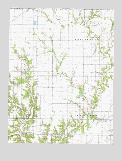
Johnstown, IL USGS Topographic Map
Click on map above to begin viewing in our Map Viewer.

This topographic map contains these locations and features:
Feature Name Type Latitude Longitude GNIS ID View Map
Bean School (historical)SchoolN39.2728°W88.3364°404004View Map
Bear CreekStreamN39.2870°W88.2739°404012View Map
Bear Creek CemeteryCemeteryN39.3034°W88.2995°404027View Map
Berry CemeteryCemeteryN39.2736°W88.2700°404220View Map
Berry School (historical)SchoolN39.2656°W88.2759°404225View Map
Brown School (historical)SchoolN39.3606°W88.3145°404955View Map
Brush CreekStreamN39.2567°W88.3595°405028View Map
Buck BranchStreamN39.3025°W88.3478°405088View Map
Buck Branch School (historical)SchoolN39.3086°W88.3725°405089View Map
Center School (historical)SchoolN39.3017°W88.3050°405804View Map
Clear CreekStreamN39.3584°W88.3106°406205View Map
Cumberland Air Park RLAAirportN39.3138°W88.3428°427598View Map
Darkies CreekStreamN39.3631°W88.2953°406954View Map
Dicks CreekStreamN39.3592°W88.2859°407202View Map
Drummond CemeteryCemeteryN39.3095°W88.3512°407403View Map
Fair Play School (historical)SchoolN39.3303°W88.3048°408154View Map
Folly Grove School (historical)SchoolN39.3303°W88.3428°408483View Map
Fulfer BranchStreamN39.3336°W88.2584°408788View Map
Good Prospect Cumberland Presbyterian ChurchChurchN39.3745°W88.3484°1967353View Map
Haggins CemeteryCemeteryN39.3309°W88.2581°409608View Map
JohnstownPopulated PlaceN39.3634°W88.2870°411190View Map
King School (historical)SchoolN39.3311°W88.2667°411493View Map
Lake LouiseReservoirN39.2967°W88.2832°1691871View Map
Lake Louise DamDamN39.2967°W88.2850°1691870View Map
Long Point CreekStreamN39.2709°W88.3545°412591View Map
Lookout School (historical)SchoolN39.2506°W88.3417°412625View Map
Miller CreekStreamN39.3075°W88.3537°1966068View Map
Mount Zion Baptist ChurchChurchN39.3086°W88.3487°1820737View Map
Mule Creek Post Office (historical)Post OfficeN39.2981°W88.3045°1773396View Map
NealPopulated PlaceN39.3020°W88.3417°423012View Map
Shiloh ChurchChurchN39.3134°W88.3331°418417View Map
Silver Lake School (historical)SchoolN39.3595°W88.3431°418513View Map
Thornton Airport (historical)AirportN39.3411°W88.2914°427870View Map
Township of SumpterCivilN39.2756°W88.2508°429817View Map
Trilla Post OfficePost OfficeN39.3740°W88.3518°2788665View Map
Union School (historical)SchoolN39.3028°W88.2670°420100View Map
Upper Berry CemeteryCemeteryN39.2973°W88.2664°1922857View Map
Whiteoak School (historical)SchoolN39.2725°W88.3042°421096View Map

Note: Coordinates in the location and feature list above are referenced to NAD83 datum.


Copyright (C) 2008-2025 Ryan Niemi / Sunset Dynamics ... All Rights Reserved