TopoQuest Logo
Do you find TopoQuest useful?
Help keep TopoQuest running and adding new maps/features by donating!
Bitcoin:  19c7KJd3qBynnjoSw5npx9KScwjBe4ifkT
Litecoin:  LXs6TkuXGGXo1vDsWCkWVdjQX94eUKd6ui
Home View Maps Find Maps Find Places Resources & Links


Johnsville, California Topographic Map

USGS Map Title: Johnsville, CA
USGS Map MRC: 39120G6
DRG (GeoTIFF) Download: o39120g6.tif


Neighboring USGS Topographic Map Quads:


  Spring Garden, CA  
39120H7
 

  Mount Ingalls, CA  
39120H6
 

  Grizzly Valley, CA  
39120H5
 

  Blue Nose Mountain, CA  
39120G7
 

  Johnsville, CA  
39120G6
 

  Blairsden, CA  
39120G5
 

  Mount Fillmore, CA  
39120F7
 

  Gold Lake, CA  
39120F6
 

  Clio, CA  
39120F5


Map MRC Location:

N40°
W121°
N40°
W120°
H8 H7 H6 H5 H4 H3 H2 H1
G8 G7 G6 G5 G4 G3 G2 G1
F8 F7 F6 F5 F4 F3 F2 F1
E8 E7 E6 E5 E4 E3 E2 E1
D8 D7 D6 D5 D4 D3 D2 D1
C8 C7 C6 C5 C4 C3 C2 C1
B8 B7 B6 B5 B4 B3 B2 B1
A8 A7 A6 A5 A4 A3 A2 A1
N39°
W121°
N39°
W120°

Johnsville, CA USGS 1:24K Topographic Map Preview:
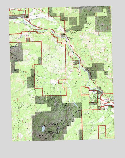
Johnsville, CA USGS Topographic Map
Click on map above to begin viewing in our Map Viewer.

This topographic map contains these locations and features:
Feature Name Type Latitude Longitude GNIS ID View Map
Bear CreekStreamN39.8002°W120.6891°256633View Map
Big HillSummitN39.8324°W120.7213°256942View Map
Bonta CreekStreamN39.7824°W120.6327°266478View Map
Cedar CreekStreamN39.8305°W120.6747°258115View Map
Chris CreekStreamN39.8152°W120.7355°258348View Map
Claim CreekStreamN39.7657°W120.6474°274696View Map
Cogswell CreekStreamN39.8499°W120.6955°1701345View Map
Cogswell RavineValleyN39.8530°W120.6830°258514View Map
Consignee CreekStreamN39.8243°W120.6674°258649View Map
CrombergPopulated PlaceN39.8602°W120.6916°1658353View Map
Cromberg CemeteryCemeteryN39.8534°W120.6947°258926View Map
Cromberg Census Designated PlaceCensusN39.8684°W120.6904°2407684View Map
Cromberg SpringSpringN39.8512°W120.6819°258927View Map
Cub ValleyValleyN39.8360°W120.6915°266612View Map
Deer CreekStreamN39.7766°W120.6980°259209View Map
Eureka CreekStreamN39.8046°W120.6869°259975View Map
Eureka LakeReservoirN39.7610°W120.7127°259978View Map
Eureka Lake 1-042 DamDamN39.7630°W120.7133°1663245View Map
Eureka Peak Loop TrailTrailN39.7541°W120.7238°1701355View Map
Eureka TunnelTunnelN39.7566°W120.7024°259980View Map
Feather River InnPopulated PlaceN39.7905°W120.6297°1666671View Map
Feather River Inn Golf CourseLocaleN39.7868°W120.6361°1701358View Map
Feather River ParkPopulated PlaceN39.7782°W120.6297°1658530View Map
Feather River Prep SchoolSchoolN39.7893°W120.6302°260070View Map
Graeagle Census Designated PlaceCensusN39.7572°W120.6486°2408311View Map
Graeagle DivisionCivilN39.7729°W120.6608°1935118View Map
Jackson CreekStreamN39.8499°W120.6966°261879View Map
Jackson Creek CampgroundLocaleN39.8463°W120.6786°261880View Map
Jackson Creek United States Forest Service Cabin (historical)LocaleN39.8474°W120.6788°1666673View Map
Jamison (historical)Populated PlaceN39.7760°W120.6822°1701371View Map
Jamison CreekStreamN39.8218°W120.6672°261898View Map
JohnsvillePopulated PlaceN39.7607°W120.6955°1658869View Map
Johnsville CemeteryCemeteryN39.7627°W120.6924°1701372View Map
Johnsville Census Designated PlaceCensusN39.7663°W120.7130°2408450View Map
Lava PeakSummitN39.8741°W120.6811°262364View Map
Layman BarBarN39.8360°W120.6780°262377View Map
Layman CampLocaleN39.8360°W120.6777°1666674View Map
Little Long Valley CreekStreamN39.8652°W120.7102°262660View Map
Long ValleyValleyN39.8663°W120.7233°262883View Map
Long Valley CreekStreamN39.8649°W120.7327°262887View Map
Long Valley Volunteer Fire DepartmentBuildingN39.8680°W120.7023°2622118View Map
Madora LakeLakeN39.7830°W120.6725°263109View Map
Madora Lake Loop TrailTrailN39.7827°W120.6736°1701379View Map
Mammoth MillLocaleN39.7580°W120.7069°263143View Map
Mammoth TunnelTunnelN39.7563°W120.7091°263151View Map
MohawkPopulated PlaceN39.7788°W120.6355°1659153View Map
Mohawk Boys CampLocaleN39.7971°W120.6508°1666675View Map
Mohawk Ranger StationLocaleN39.7852°W120.6324°1666676View Map
Mohawk ValleyValleyN39.8063°W120.6552°263727View Map
Mount JacksonSummitN39.8416°W120.6527°261887View Map
Plumas EurekaPopulated PlaceN39.7897°W120.6507°2633140View Map
Plumas Eureka (historical)Populated PlaceN39.7588°W120.7077°1701394View Map
Plumas Eureka Census Designated PlaceCensusN39.7982°W120.6644°2409082View Map
Plumas Eureka Fire and RescueBuildingN39.7897°W120.6504°2621831View Map
Plumas Eureka MillLocaleN39.7568°W120.7005°264866View Map
Plumas Pines Golf CourseLocaleN39.7921°W120.6527°1701395View Map
Plumas-Eureka State ParkParkN39.7610°W120.7066°267135View Map
Poplar ValleyValleyN39.8543°W120.7272°1701396View Map
Rattlesnake CreekStreamN39.8663°W120.7366°265203View Map
Sierra LodgeLocaleN39.7921°W120.6494°1666678View Map
SloatPopulated PlaceN39.8666°W120.7274°1659682View Map
Smith CreekStreamN39.7813°W120.6308°266321View Map
Squirrel CreekStreamN39.8121°W120.6836°267643View Map
Squirrel Creek (historical)Populated PlaceN39.7946°W120.7177°1701413View Map
Squirrel Creek MineMineN39.7927°W120.7272°267647View Map
Twentymile HouseLocaleN39.8513°W120.6961°268513View Map
Two RiversPopulated PlaceN39.8230°W120.6702°1660063View Map

Note: Coordinates in the location and feature list above are referenced to NAD83 datum.


Copyright (C) 2008-2025 Ryan Niemi / Sunset Dynamics ... All Rights Reserved