TopoQuest Logo
Do you find TopoQuest useful?
Help keep TopoQuest running and adding new maps/features by donating!
Bitcoin:  19c7KJd3qBynnjoSw5npx9KScwjBe4ifkT
Litecoin:  LXs6TkuXGGXo1vDsWCkWVdjQX94eUKd6ui
Home View Maps Find Maps Find Places Resources & Links


Mount Fillmore, California Topographic Map

USGS Map Title: Mount Fillmore, CA
USGS Map MRC: 39120F7
DRG (GeoTIFF) Download: o39120f7.tif


Neighboring USGS Topographic Map Quads:


  Onion Valley, CA  
39120G8
 

  Blue Nose Mountain, CA  
39120G7
 

  Johnsville, CA  
39120G6
 

  La Porte, CA  
39120F8
 

  Mount Fillmore, CA  
39120F7
 

  Gold Lake, CA  
39120F6
 

  Goodyears Bar, CA  
39120E8
 

  Downieville, CA  
39120E7
 

  Sierra City, CA  
39120E6


Map MRC Location:

N40°
W121°
N40°
W120°
H8 H7 H6 H5 H4 H3 H2 H1
G8 G7 G6 G5 G4 G3 G2 G1
F8 F7 F6 F5 F4 F3 F2 F1
E8 E7 E6 E5 E4 E3 E2 E1
D8 D7 D6 D5 D4 D3 D2 D1
C8 C7 C6 C5 C4 C3 C2 C1
B8 B7 B6 B5 B4 B3 B2 B1
A8 A7 A6 A5 A4 A3 A2 A1
N39°
W121°
N39°
W120°

Mount Fillmore, CA USGS 1:24K Topographic Map Preview:
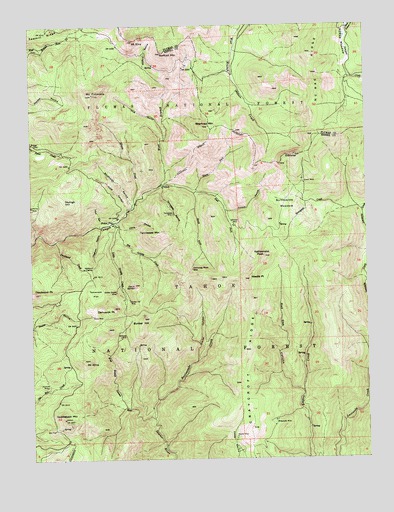
Mount Fillmore, CA USGS Topographic Map
Click on map above to begin viewing in our Map Viewer.

This topographic map contains these locations and features:
Feature Name Type Latitude Longitude GNIS ID View Map
Beartrap MountainSummitN39.7210°W120.8102°256756View Map
Bee TreeLocaleN39.6335°W120.8680°256785View Map
Big Grizzly CreekStreamN39.6932°W120.8447°256936View Map
Bunker HillSummitN39.6657°W120.8347°257688View Map
Bunker Hill MineMineN39.6710°W120.8399°257690View Map
Chimney RockPillarN39.6796°W120.8161°258292View Map
China RavineValleyN39.6916°W120.8430°258316View Map
Clarks CanyonValleyN39.6530°W120.8152°258410View Map
Cleghorn RavineValleyN39.6918°W120.8505°258449View Map
Cloud SplitterSummitN39.6749°W120.8377°258468View Map
Cowell MineMineN39.7043°W120.7744°258816View Map
Craycroft RidgeRidgeN39.6432°W120.7947°258899View Map
Deadwood (historical)Populated PlaceN39.6771°W120.8533°1701298View Map
Deadwood CreekStreamN39.6882°W120.8672°266628View Map
Deadwood DiggingsMineN39.6799°W120.8563°259152View Map
Deadwood PeakSummitN39.6732°W120.8747°259158View Map
Deans RavineValleyN39.6963°W120.8041°259167View Map
Democrat PeakSummitN39.6685°W120.8455°259273View Map
Diamond MineMineN39.6460°W120.8705°259346View Map
East Fork Canyon CreekStreamN39.7018°W120.8155°259716View Map
Empire Creek TrailTrailN39.6746°W120.7752°276086View Map
GibraltarSummitN39.7127°W120.7780°260549View Map
Gibraltar MineMineN39.6921°W120.8013°260550View Map
Gold CanyonValleyN39.6971°W120.8402°260643View Map
Golden Scepter MineMineN39.6732°W120.8449°260684View Map
Hays RavineValleyN39.6924°W120.8508°261185View Map
Herkimer MineMineN39.6599°W120.8430°261279View Map
Hog GulchValleyN39.7174°W120.8269°261396View Map
Illinois CreekStreamN39.6988°W120.8377°261691View Map
Little Grizzly CreekStreamN39.6921°W120.8436°262620View Map
McRae RidgeRidgeN39.7396°W120.7697°263416View Map
Mount AlmaSummitN39.6530°W120.8561°256192View Map
Mount EtnaSummitN39.7457°W120.8386°259972View Map
Mount FillmoreSummitN39.7302°W120.8524°260103View Map
Needle PointSummitN39.6768°W120.7955°264021View Map
Nessler MineMineN39.6307°W120.8005°264051View Map
North Fork Canyon CreekStreamN39.7018°W120.8155°264145View Map
Poker FlatPopulated PlaceN39.6932°W120.8455°1659415View Map
Rattlesnake CreekStreamN39.6366°W120.8313°265199View Map
Rattlesnake PeakSummitN39.6835°W120.7897°265225View Map
Red Oak CanyonValleyN39.6438°W120.7755°265309View Map
Reese MineMineN39.6663°W120.8536°265361View Map
Saddleback MountainSummitN39.6366°W120.8641°265713View Map
SkyhighSummitN39.6993°W120.8633°266254View Map
South Fork Canyon CreekStreamN39.7016°W120.8161°267434View Map
Stafford MountainSummitN39.7421°W120.8274°267654View Map
Stafford RavineValleyN39.7380°W120.8341°267655View Map
Studhorse RavineValleyN39.6980°W120.8388°267821View Map
Sunnyside CreekStreamN39.6971°W120.7541°267964View Map
Sunnyside MeadowFlatN39.6982°W120.7822°267965View Map
Tamarack FlatFlatN39.6732°W120.8527°268077View Map
Tennessee MineMineN39.6957°W120.8238°268150View Map
Tennessee MountainSummitN39.6893°W120.8319°268151View Map
Tennessee RavineValleyN39.7030°W120.8277°268152View Map
West Branch Canyon CreekStreamN39.7038°W120.8283°268862View Map
West Branch Downie RiverStreamN39.6366°W120.8308°268867View Map
Wideawake MineMineN39.6360°W120.7855°269056View Map

Note: Coordinates in the location and feature list above are referenced to NAD83 datum.


Copyright (C) 2008-2025 Ryan Niemi / Sunset Dynamics ... All Rights Reserved