TopoQuest Logo
Do you find TopoQuest useful?
Help keep TopoQuest running and adding new maps/features by donating!
Bitcoin:  19c7KJd3qBynnjoSw5npx9KScwjBe4ifkT
Litecoin:  LXs6TkuXGGXo1vDsWCkWVdjQX94eUKd6ui
Home View Maps Find Maps Find Places Resources & Links


Balls Ferry, California Topographic Map

USGS Map Title: Balls Ferry, CA
USGS Map MRC: 40122D2
DRG (GeoTIFF) Download: o40122d2.tif


Neighboring USGS Topographic Map Quads:


  Enterprise, CA  
40122E3
 

  Palo Cedro, CA  
40122E2
 

  Clough Gulch, CA  
40122E1
 

  Cottonwood, CA  
40122D3
 

  Balls Ferry, CA  
40122D2
 

  Tuscan Buttes NE, CA  
40122D1
 

  Hooker, CA  
40122C3
 

  Bend, CA  
40122C2
 

  Dales, CA  
40122C1


Map MRC Location:

N41°
W123°
N41°
W122°
H8 H7 H6 H5 H4 H3 H2 H1
G8 G7 G6 G5 G4 G3 G2 G1
F8 F7 F6 F5 F4 F3 F2 F1
E8 E7 E6 E5 E4 E3 E2 E1
D8 D7 D6 D5 D4 D3 D2 D1
C8 C7 C6 C5 C4 C3 C2 C1
B8 B7 B6 B5 B4 B3 B2 B1
A8 A7 A6 A5 A4 A3 A2 A1
N40°
W123°
N40°
W122°

Balls Ferry, CA USGS 1:24K Topographic Map Preview:
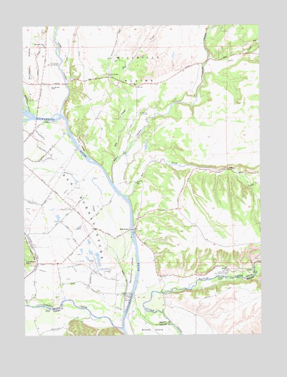
Balls Ferry, CA USGS Topographic Map
Click on map above to begin viewing in our Map Viewer.

This topographic map contains these locations and features:
Feature Name Type Latitude Longitude GNIS ID View Map
Anderson CreekStreamN40.3846°W122.1983°218255View Map
Ash CreekStreamN40.4307°W122.1972°238797View Map
Balls FerryLocaleN40.4174°W122.1950°218634View Map
Balls Ferry BridgeBridgeN40.4174°W122.1942°1661770View Map
Balls Ferry Fishing ResortPopulated PlaceN40.4186°W122.1953°2508639View Map
Bear CreekStreamN40.4357°W122.2036°218828View Map
China GardenFlatN40.4524°W122.2208°221033View Map
Coleman National Fish HatcheryParkN40.3996°W122.1452°221367View Map
Cottonwood CreekStreamN40.3777°W122.1994°233727View Map
Cow CreekStreamN40.4643°W122.2311°221697View Map
Dersch RanchLocaleN40.4865°W122.1517°1682766View Map
Dry CreekStreamN40.4454°W122.2022°222632View Map
Fort Reading RanchLocaleN40.4754°W122.2364°223703View Map
KRDG-AM (Redding)TowerN40.4852°W122.2217°1664914View Map
Lack CreekStreamN40.4804°W122.1547°226734View Map
Lone Tree Community CenterLocaleN40.4277°W122.2267°227523View Map
Lone Tree School (historical)SchoolN40.4257°W122.2250°1661823View Map
Panorama PointCapeN40.4040°W122.2469°230290View Map
Parkville CemeteryCemeteryN40.4646°W122.1889°230368View Map
Parkville SchoolSchoolN40.4760°W122.1914°230369View Map
Patterson CreekStreamN40.3827°W122.2169°230409View Map
Rancherie IslandIslandN40.4027°W122.1942°255018View Map
Rancho Buena VenturaLocaleN40.3915°W122.1997°252308View Map
Rancho BuenaventuraLocaleN40.4132°W122.2017°1661854View Map
Reading AdobeBuildingN40.3921°W122.2000°1661857View Map
Reading Adobe Historical MarkerParkN40.3913°W122.1997°231301View Map
Reading IslandIslandN40.3902°W122.1969°252217View Map
Sacramento River SchoolSchoolN40.4918°W122.2394°232083View Map
Stillwater CreekStreamN40.4654°W122.2486°267749View Map
Twin BridgesBridgeN40.4799°W122.2050°252273View Map

Note: Coordinates in the location and feature list above are referenced to NAD83 datum.


Copyright (C) 2008-2025 Ryan Niemi / Sunset Dynamics ... All Rights Reserved