TopoQuest Logo
Do you find TopoQuest useful?
Help keep TopoQuest running and adding new maps/features by donating!
Bitcoin:  19c7KJd3qBynnjoSw5npx9KScwjBe4ifkT
Litecoin:  LXs6TkuXGGXo1vDsWCkWVdjQX94eUKd6ui
Home View Maps Find Maps Find Places Resources & Links


Bend, California Topographic Map

USGS Map Title: Bend, CA
USGS Map MRC: 40122C2
DRG (GeoTIFF) Download: o40122c2.tif


Neighboring USGS Topographic Map Quads:


  Cottonwood, CA  
40122D3
 

  Balls Ferry, CA  
40122D2
 

  Tuscan Buttes NE, CA  
40122D1
 

  Hooker, CA  
40122C3
 

  Bend, CA  
40122C2
 

  Dales, CA  
40122C1
 

  Red Bluff West, CA  
40122B3
 

  Red Bluff East, CA  
40122B2
 

  Tuscan Springs, CA  
40122B1


Map MRC Location:

N41°
W123°
N41°
W122°
H8 H7 H6 H5 H4 H3 H2 H1
G8 G7 G6 G5 G4 G3 G2 G1
F8 F7 F6 F5 F4 F3 F2 F1
E8 E7 E6 E5 E4 E3 E2 E1
D8 D7 D6 D5 D4 D3 D2 D1
C8 C7 C6 C5 C4 C3 C2 C1
B8 B7 B6 B5 B4 B3 B2 B1
A8 A7 A6 A5 A4 A3 A2 A1
N40°
W123°
N40°
W122°

Bend, CA USGS 1:24K Topographic Map Preview:
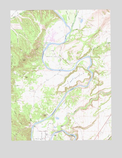
Bend, CA USGS Topographic Map
Click on map above to begin viewing in our Map Viewer.

This topographic map contains these locations and features:
Feature Name Type Latitude Longitude GNIS ID View Map
Bald HillSummitN40.2527°W122.1775°233454View Map
Battle CreekStreamN40.3552°W122.1758°218740View Map
Battle Creek RanchLocaleN40.3660°W122.1658°218741View Map
BendPopulated PlaceN40.2552°W122.2086°1658034View Map
Bend BridgeBridgeN40.2638°W122.2236°252007View Map
Bend Census Designated PlaceCensusN40.2560°W122.2095°2628710View Map
Bend Elementary SchoolSchoolN40.2590°W122.2081°1692737View Map
Bloody IslandIslandN40.3738°W122.1836°219463View Map
Chinese RapidsRapidsN40.2560°W122.1976°221070View Map
Ekelund RanchLocaleN40.3699°W122.2428°1666118View Map
Frazier CreekStreamN40.3210°W122.2081°223847View Map
Inks CreekStreamN40.3302°W122.1525°225938View Map
Inks Creek RanchLocaleN40.3421°W122.1300°225939View Map
Jelly RanchLocaleN40.3288°W122.1892°226187View Map
Jelly School (historical)SchoolN40.3302°W122.1944°1666124View Map
Jellys Ferry (historical)CrossingN40.3171°W122.1889°1666125View Map
Jellys Ferry BridgeBridgeN40.3174°W122.1900°252035View Map
Juniper PointCapeN40.3271°W122.2386°226396View Map
Lake California Air ParkAirportN40.3581°W122.2145°2650944View Map
Lake California Census Designated PlaceCensusN40.3608°W122.2102°2628747View Map
Lookout MountainSummitN40.2743°W122.2106°227639View Map
Paynes CreekStreamN40.2602°W122.1875°264579View Map
Rancho Rio AltoLocaleN40.3529°W122.2031°1666130View Map
Round MountainSummitN40.3099°W122.2325°231966View Map
Spring CreekStreamN40.2629°W122.2256°235243View Map
Table MountainSummitN40.2963°W122.1944°235961View Map
Table Mountain LakeLakeN40.3079°W122.1752°229187View Map
Tehama County Fire Department Station 2 Lake CaliforniaBuildingN40.3543°W122.2133°1692689View Map
Tehama County Fire Department Station 5 BendBuildingN40.2602°W122.2066°2622098View Map
Wildcat PointCapeN40.3399°W122.2164°237804View Map

Note: Coordinates in the location and feature list above are referenced to NAD83 datum.


Copyright (C) 2008-2025 Ryan Niemi / Sunset Dynamics ... All Rights Reserved