TopoQuest Logo
Do you find TopoQuest useful?
Help keep TopoQuest running and adding new maps/features by donating!
Bitcoin:  19c7KJd3qBynnjoSw5npx9KScwjBe4ifkT
Litecoin:  LXs6TkuXGGXo1vDsWCkWVdjQX94eUKd6ui
Home View Maps Find Maps Find Places Resources & Links


Palo Cedro, California Topographic Map

USGS Map Title: Palo Cedro, CA
USGS Map MRC: 40122E2
DRG (GeoTIFF) Download: o40122e2.tif


Neighboring USGS Topographic Map Quads:


  Project City, CA  
40122F3
 

  Bella Vista, CA  
40122F2
 

  Oak Run, CA  
40122F1
 

  Enterprise, CA  
40122E3
 

  Palo Cedro, CA  
40122E2
 

  Clough Gulch, CA  
40122E1
 

  Cottonwood, CA  
40122D3
 

  Balls Ferry, CA  
40122D2
 

  Tuscan Buttes NE, CA  
40122D1


Map MRC Location:

N41°
W123°
N41°
W122°
H8 H7 H6 H5 H4 H3 H2 H1
G8 G7 G6 G5 G4 G3 G2 G1
F8 F7 F6 F5 F4 F3 F2 F1
E8 E7 E6 E5 E4 E3 E2 E1
D8 D7 D6 D5 D4 D3 D2 D1
C8 C7 C6 C5 C4 C3 C2 C1
B8 B7 B6 B5 B4 B3 B2 B1
A8 A7 A6 A5 A4 A3 A2 A1
N40°
W123°
N40°
W122°

Palo Cedro, CA USGS 1:24K Topographic Map Preview:
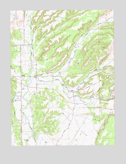
Palo Cedro, CA USGS Topographic Map
Click on map above to begin viewing in our Map Viewer.

This topographic map contains these locations and features:
Feature Name Type Latitude Longitude GNIS ID View Map
Basin Hollow CreekStreamN40.5449°W122.1511°218719View Map
Clover CreekStreamN40.5546°W122.1872°258474View Map
Dry CreekStreamN40.5643°W122.1942°222613View Map
Dry CreekStreamN40.6149°W122.2269°259556View Map
French CreekStreamN40.6015°W122.2236°266726View Map
Henryford (historical)Populated PlaceN40.5727°W122.1358°1682494View Map
Junction Elementary SchoolSchoolN40.5525°W122.2372°226384View Map
Little Cow CreekStreamN40.5557°W122.2314°262570View Map
MillvillePopulated PlaceN40.5493°W122.1753°228775View Map
Millville Census Designated PlaceCensusN40.5576°W122.1696°2408834View Map
Millville Elementary SchoolSchoolN40.5520°W122.1689°228777View Map
Millville Fire Protection DistrictBuildingN40.5490°W122.1739°2622077View Map
Millville Independent Order of Odd Fellows CemeteryCemeteryN40.5538°W122.1675°1661813View Map
Millville PlainsPlainN40.5185°W122.1744°228776View Map
Millville Post OfficePost OfficeN40.5490°W122.1774°2783813View Map
North Cow Creek Elementary SchoolSchoolN40.5934°W122.2295°229623View Map
Oak Run CreekStreamN40.5640°W122.2194°264294View Map
Oak Run School (historical)SchoolN40.5757°W122.1856°1661839View Map
Oat CreekStreamN40.5682°W122.2258°229901View Map
Old Cow CreekStreamN40.5438°W122.1317°264319View Map
Palo CedroPopulated PlaceN40.5638°W122.2389°230275View Map
Palo Cedro Census Designated PlaceCensusN40.5512°W122.2363°2409021View Map
Palo Cedro Post OfficePost OfficeN40.5619°W122.2403°2760043View Map
Palo Cedro Volunteer Fire Company Station 32BuildingN40.5612°W122.2390°2621836View Map
Silver BridgeBridgeN40.5638°W122.2197°252055View Map
South Cow CreekStreamN40.5438°W122.1317°267412View Map
Swede CreekStreamN40.5832°W122.2267°1654973View Map
Tabournel GulchValleyN40.5582°W122.1589°1682524View Map
Tule LakeLakeN40.5030°W122.2082°236737View Map

Note: Coordinates in the location and feature list above are referenced to NAD83 datum.


Copyright (C) 2008-2025 Ryan Niemi / Sunset Dynamics ... All Rights Reserved