TopoQuest Logo
Do you find TopoQuest useful?
Help keep TopoQuest running and adding new maps/features by donating!
Bitcoin:  19c7KJd3qBynnjoSw5npx9KScwjBe4ifkT
Litecoin:  LXs6TkuXGGXo1vDsWCkWVdjQX94eUKd6ui
Home View Maps Find Maps Find Places Resources & Links


Jones Canyon, New Mexico Topographic Map

USGS Map Title: Jones Canyon, NM
USGS Map MRC: 34108A8
DRG (GeoTIFF) Download: o34108a8.tif


Neighboring USGS Topographic Map Quads:


  Nelson Reservoir NE, AZ  
34109B1
 

  Cow Springs, NM  
34108B8
 

  Red Hill, NM  
34108B7
 

  Loco Knoll, AZ  
34109A1
 

  Jones Canyon, NM  
34108A8
 

  Black Peak, NM  
34108A7
 

  Escudilla Mountain, AZ  
33109H1
 

  Underwood Lake, NM  
33108H8
 

  Centerfire Bog, NM  
33108H7


Map MRC Location:

N35°
W109°
N35°
W108°
H8 H7 H6 H5 H4 H3 H2 H1
G8 G7 G6 G5 G4 G3 G2 G1
F8 F7 F6 F5 F4 F3 F2 F1
E8 E7 E6 E5 E4 E3 E2 E1
D8 D7 D6 D5 D4 D3 D2 D1
C8 C7 C6 C5 C4 C3 C2 C1
B8 B7 B6 B5 B4 B3 B2 B1
A8 A7 A6 A5 A4 A3 A2 A1
N34°
W109°
N34°
W108°

Jones Canyon, NM USGS 1:24K Topographic Map Preview:
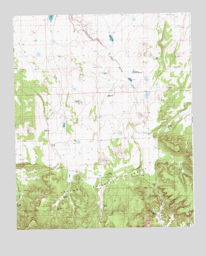
Jones Canyon, NM USGS Topographic Map
Click on map above to begin viewing in our Map Viewer.

This topographic map contains these locations and features:
Feature Name Type Latitude Longitude GNIS ID View Map
B KnightSpringN34.0051°W108.9020°902775View Map
Bear TankReservoirN34.0430°W108.8954°936661View Map
Beard TankReservoirN34.0436°W108.9306°936658View Map
Bevorosa WindmillLocaleN34.0576°W108.9773°2038366View Map
Canovas SpringSpringN34.0144°W108.9999°898503View Map
Corner TankReservoirN34.0353°W108.9473°2038417View Map
Corner TankReservoirN34.0492°W108.9748°1923265View Map
Cout LakeLakeN34.1237°W108.9734°1934802View Map
Cout LakeLakeN34.1235°W108.9732°900147View Map
Dogie TankReservoirN34.0506°W108.9195°2038444View Map
Gasoline LakeLakeN34.0606°W108.9656°1923264View Map
Hay VegaFlatN34.0292°W108.9617°1923247View Map
Hay Vega SpringSpringN34.0189°W108.9673°1923248View Map
Hay Vega TankReservoirN34.0364°W108.9651°2038496View Map
Jones CanyonValleyN34.0370°W108.9095°1923258View Map
Jones LakeLakeN34.0984°W108.9012°1923256View Map
Jones SpringSpringN34.0131°W108.9387°1923249View Map
Jones TankReservoirN34.0037°W108.9423°2038522View Map
Jones TankReservoirN34.0286°W108.9239°936655View Map
Knight GapGapN34.0239°W108.9012°1923259View Map
Knight SpringSpringN34.0078°W108.9019°898867View Map
Laguna AbelLakeN34.1108°W108.9309°1923253View Map
Laguna de la ManzanaLakeN34.0911°W108.9158°1923255View Map
Laguna HondaLakeN34.0743°W108.9536°1923250View Map
Laguna VerdeLakeN34.0904°W108.9377°1923252View Map
Mangitas SpringSpringN34.0587°W108.8926°1923257View Map
Martin ReservoirReservoirN34.0863°W108.9182°1923254View Map
Martin WindmillLocaleN34.0773°W108.9320°1923251View Map
Mesa Storage TankReservoirN34.0426°W108.9973°2038570View Map
Orona TankReservoirN34.0287°W108.9193°936656View Map
Orona TankReservoirN34.0123°W108.9120°2038598View Map
Pine TankReservoirN34.0603°W108.8806°936660View Map
Powerline TankReservoirN34.0309°W108.9409°936659View Map
Tin Cup SpringSpringN34.0120°W108.9715°1923246View Map
Tin Cup TankReservoirN34.0117°W108.9600°936662View Map
Upper Jones WellWellN34.0103°W108.9415°2038739View Map
Vevorosa WindmillLocaleN34.0576°W108.9762°936657View Map

Note: Coordinates in the location and feature list above are referenced to NAD83 datum.


Copyright (C) 2008-2025 Ryan Niemi / Sunset Dynamics ... All Rights Reserved