TopoQuest Logo
Do you find TopoQuest useful?
Help keep TopoQuest running and adding new maps/features by donating!
Bitcoin:  19c7KJd3qBynnjoSw5npx9KScwjBe4ifkT
Litecoin:  LXs6TkuXGGXo1vDsWCkWVdjQX94eUKd6ui
Home View Maps Find Maps Find Places Resources & Links


Mount Guyot, Tennessee Topographic Map

USGS Map Title: Mount Guyot, TN
USGS Map MRC: 35083F3
DRG (GeoTIFF) Download: o35083f3.tif


Neighboring USGS Topographic Map Quads:


  Richardson Cove, TN  
35083G4
 

  Jones Cove, TN  
35083G3
 

  Hartford, TN  
35083G2
 

  Mount Le Conte, TN  
35083F4
 

  Mount Guyot, TN  
35083F3
 

  Luftee Knob, NC  
35083F2
 

  Clingmans Dome, NC  
35083E4
 

  Smokemont, NC  
35083E3
 

  Bunches Bald, NC  
35083E2


Map MRC Location:

N36°
W84°
N36°
W83°
H8 H7 H6 H5 H4 H3 H2 H1
G8 G7 G6 G5 G4 G3 G2 G1
F8 F7 F6 F5 F4 F3 F2 F1
E8 E7 E6 E5 E4 E3 E2 E1
D8 D7 D6 D5 D4 D3 D2 D1
C8 C7 C6 C5 C4 C3 C2 C1
B8 B7 B6 B5 B4 B3 B2 B1
A8 A7 A6 A5 A4 A3 A2 A1
N35°
W84°
N35°
W83°

Mount Guyot, TN USGS 1:24K Topographic Map Preview:
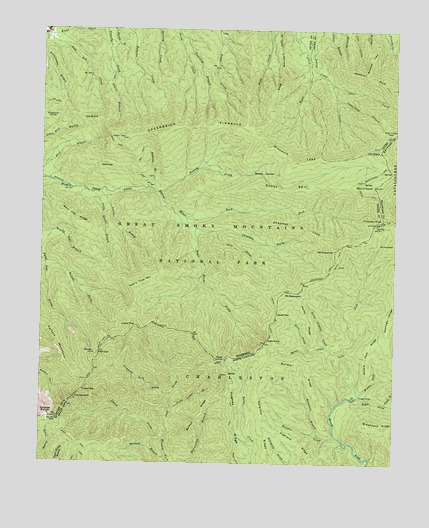
Mount Guyot, TN USGS Topographic Map
Click on map above to begin viewing in our Map Viewer.

This topographic map contains these locations and features:
Feature Name Type Latitude Longitude GNIS ID View Map
Bald Top RidgeRidgeN35.6941°W83.3591°1276218View Map
Balsam RidgeRidgeN35.6450°W83.3114°980507View Map
Barnes Children CemeteryCemeteryN35.7182°W83.3593°2775222View Map
Bills CreekStreamN35.6576°W83.2799°981487View Map
Breakneck RidgeRidgeN35.6360°W83.2524°981846View Map
Breedlove BranchStreamN35.6332°W83.2760°981849View Map
Buck ForkStreamN35.6957°W83.3235°1278814View Map
Buckeye LeadRidgeN35.7387°W83.2598°1278860View Map
Bulldie CreekStreamN35.6329°W83.2702°982220View Map
Bulldie RidgeRidgeN35.6534°W83.2925°982221View Map
Cat StairsCliffN35.7243°W83.3554°1279874View Map
Cat Stairs BranchStreamN35.7423°W83.3510°1279875View Map
Chapman LeadRidgeN35.6881°W83.2723°1280263View Map
Chapman ProngStreamN35.6932°W83.3202°1280264View Map
Charlies BunionSummitN35.6392°W83.3718°1019609View Map
Chasm ProngStreamN35.6251°W83.3615°983055View Map
Copper GapGapN35.6684°W83.2913°1281259View Map
Copperhead BranchStreamN35.7304°W83.2713°1281277View Map
Deer Creek GapGapN35.7197°W83.2517°1652595View Map
Devils DenSummitN35.7113°W83.3535°1282392View Map
Devils Den BranchStreamN35.7034°W83.3435°1312982View Map
Dock Green CemeteryCemeteryN35.7455°W83.3706°2775239View Map
Dry Sluice GapGapN35.6382°W83.3679°1307384View Map
Eagle RocksCliffN35.6601°W83.2957°1004650View Map
Eagle Rocks ProngStreamN35.6932°W83.3202°1306406View Map
Evans CreekStreamN35.7482°W83.3729°1283907View Map
False GapGapN35.6570°W83.3540°1306437View Map
Frowning Rock ProngStreamN35.6443°W83.3304°985470View Map
Greenbrier PinnacleRidgeN35.7211°W83.2988°1286155View Map
Gulf ProngStreamN35.6340°W83.3299°986199View Map
Guyot SpurRidgeN35.7053°W83.2659°1286463View Map
Highland RidgeRidgeN35.6367°W83.2946°986780View Map
Huff CemeteryCemeteryN35.6910°W83.3704°2775253View Map
Hughes RidgeRidgeN35.6536°W83.3096°987235View Map
Kalanu ProngStreamN35.6834°W83.3735°1289902View Map
Katalsta RidgeRidgeN35.6560°W83.2963°987871View Map
Laurel BranchStreamN35.7020°W83.3521°1290694View Map
Laurel TopSummitN35.6645°W83.3410°1000704View Map
Left Fork Raven ForkStreamN35.6448°W83.2621°988323View Map
Little Laurel BranchStreamN35.7032°W83.3568°1291550View Map
Little Niagara CreekStreamN35.6584°W83.2738°988720View Map
Long RidgeRidgeN35.6280°W83.3069°989000View Map
Lost ProngStreamN35.6920°W83.3129°1292090View Map
Maddron BaldRidgeN35.7342°W83.2536°1292473View Map
Middle Fork Raven ForkStreamN35.6448°W83.2621°989777View Map
Middle Fork RidgeRidgeN35.6616°W83.2539°989780View Map
Millfield BranchStreamN35.6987°W83.3296°1313000View Map
Mount ChapmanSummitN35.6868°W83.2710°1306768View Map
Mount GuyotSummitN35.7053°W83.2575°1023660View Map
Mount SequoyahSummitN35.6745°W83.2885°1000705View Map
Old BlackSummitN35.7150°W83.2555°1008011View Map
Otter CreekStreamN35.7351°W83.2727°1296517View Map
Otter Creek CampsiteLocaleN35.7304°W83.2543°1652191View Map
Pecks branchStreamN35.6726°W83.3129°1313003View Map
Pecks CornerSummitN35.6547°W83.3100°1021851View Map
Pecks Corner BranchStreamN35.6412°W83.3279°991999View Map
Pecks Corner ShelterLocaleN35.6508°W83.3085°2776772View Map
Pinnacle LeadRidgeN35.7146°W83.2623°1297679View Map
Porters GapGapN35.6459°W83.3602°1306915View Map
Porters MountainSummitN35.6493°W83.3595°1298280View Map
Ramsey BranchStreamN35.7034°W83.3385°1298878View Map
Ramsey CascadesFallsN35.7085°W83.3000°1298879View Map
Ramsey ProngStreamN35.7029°W83.3335°1298880View Map
Rapid CreekStreamN35.6429°W83.2532°993038View Map
Rapid Creek RidgeRidgeN35.6598°W83.2516°1004655View Map
Raven CreekStreamN35.6570°W83.2718°993062View Map
Raven RidgeRidgeN35.6730°W83.2835°993066View Map
Richland MountainSummitN35.6328°W83.3638°993321View Map
Right Fork Raven ForkStreamN35.6448°W83.2621°993354View Map
Shirt Tail BranchStreamN35.6779°W83.3190°1313009View Map
Snag MountainSummitN35.7219°W83.2986°1270746View Map
Snakefeeder BranchStreamN35.7484°W83.3740°1270759View Map
The SawteethSummitN35.6434°W83.3624°1272437View Map
Three ForksPopulated PlaceN35.6448°W83.2621°1022942View Map
Tricorner KnobSummitN35.6956°W83.2540°1022982View Map
Tricorner ShelterLocaleN35.6938°W83.2566°2776775View Map
Tumbling BranchStreamN35.7482°W83.3260°1272969View Map
Washout BranchStreamN35.6268°W83.3302°996835View Map
Williams - Ramsey CemeteryCemeteryN35.7477°W83.2971°2775321View Map
Woolly Tops MountainSummitN35.6770°W83.3384°1304679View Map

Note: Coordinates in the location and feature list above are referenced to NAD83 datum.


Copyright (C) 2008-2024 Ryan Niemi / Sunset Dynamics ... All Rights Reserved