TopoQuest Logo
Do you find TopoQuest useful?
Help keep TopoQuest running and adding new maps/features by donating!
Bitcoin:  19c7KJd3qBynnjoSw5npx9KScwjBe4ifkT
Litecoin:  LXs6TkuXGGXo1vDsWCkWVdjQX94eUKd6ui
Home View Maps Find Maps Find Places Resources & Links


Jonesboro, Oregon Topographic Map

USGS Map Title: Jonesboro, OR
USGS Map MRC: 43117G8
DRG (GeoTIFF) Download: o43117g8.tif


Neighboring USGS Topographic Map Quads:


  De Armond Mountain, OR  
43118H1
 

  Westfall Butte, OR  
43117H8
 

  Little Black Canyon, OR  
43117H7
 

  Stemler Ridge, OR  
43118G1
 

  Jonesboro, OR  
43117G8
 

  South Mountain, OR  
43117G7
 

  Juntura, OR  
43118F1
 

  Monument Peak, OR  
43117F8
 

  Tims Peak, OR  
43117F7


Map MRC Location:

N44°
W118°
N44°
W117°
H8 H7 H6 H5 H4 H3 H2 H1
G8 G7 G6 G5 G4 G3 G2 G1
F8 F7 F6 F5 F4 F3 F2 F1
E8 E7 E6 E5 E4 E3 E2 E1
D8 D7 D6 D5 D4 D3 D2 D1
C8 C7 C6 C5 C4 C3 C2 C1
B8 B7 B6 B5 B4 B3 B2 B1
A8 A7 A6 A5 A4 A3 A2 A1
N43°
W118°
N43°
W117°

Jonesboro, OR USGS 1:24K Topographic Map Preview:
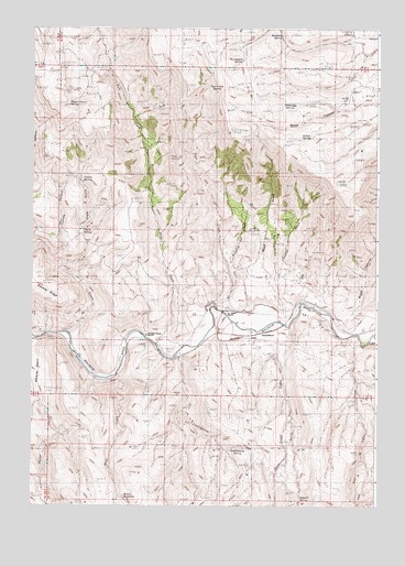
Jonesboro, OR USGS Topographic Map
Click on map above to begin viewing in our Map Viewer.

This topographic map contains these locations and features:
Feature Name Type Latitude Longitude GNIS ID View Map
Antelope SpringSpringN43.8550°W117.9096°1116997View Map
Big Swamp CreekStreamN43.8015°W117.8977°1117685View Map
Black CanyonValleyN43.8171°W117.8760°1138184View Map
Bristol ReservoirReservoirN43.7514°W117.9660°1118085View Map
Buckboard SpringSpringN43.8666°W117.9247°1118222View Map
Butterfly SpringSpringN43.8727°W117.9106°1118400View Map
Calf CreekStreamN43.7949°W117.9863°1118461View Map
Chalk GulchValleyN43.8129°W117.9885°1118801View Map
Chalk SpringSpringN43.8216°W117.9818°1118805View Map
Cherry SpringSpringN43.8349°W117.9819°1118863View Map
Currey CanyonValleyN43.8152°W117.9916°1119631View Map
D Jones RanchLocaleN43.8013°W117.9296°1160570View Map
Deadhorse CreekStreamN43.7724°W117.9063°1119752View Map
Dipping Vat CreekStreamN43.8077°W117.9268°1119951View Map
Indian CreekStreamN43.7938°W117.8824°1122213View Map
Jonesboro (historical)LocaleN43.7957°W117.9146°1158301View Map
Jonesboro CanalCanalN43.7957°W117.9343°1131800View Map
Peach (historical)LocaleN43.7940°W117.9621°1637950View Map
Peavine ReservoirReservoirN43.8621°W117.8863°1131789View Map
Pine CreekStreamN43.7840°W117.9691°1125392View Map
Pole CreekStreamN43.7924°W117.9543°1125530View Map
Road GulchValleyN43.8015°W117.9099°1126087View Map
Saddlehorse CreekStreamN43.7885°W117.9477°1126430View Map
Saddlehorse SpringSpringN43.7608°W117.9256°1126431View Map
Sidehill SpringSpringN43.7510°W117.9013°1126947View Map
South Trail CreekStreamN43.7971°W117.9068°1127353View Map
Trail CreekStreamN43.8010°W117.9310°1128184View Map
Trail Creek SpringSpringN43.8584°W117.9335°1131790View Map
Upper Cherry SpringSpringN43.8547°W117.9880°1133899View Map
Vaughn Peach RanchLocaleN43.7949°W117.9568°1160569View Map
Willow SpringSpringN43.8465°W117.8995°1133898View Map

Note: Coordinates in the location and feature list above are referenced to NAD83 datum.


Copyright (C) 2008-2025 Ryan Niemi / Sunset Dynamics ... All Rights Reserved