TopoQuest Logo
Do you find TopoQuest useful?
Help keep TopoQuest running and adding new maps/features by donating!
Bitcoin:  19c7KJd3qBynnjoSw5npx9KScwjBe4ifkT
Litecoin:  LXs6TkuXGGXo1vDsWCkWVdjQX94eUKd6ui
Home View Maps Find Maps Find Places Resources & Links


Jonesville, Indiana Topographic Map

USGS Map Title: Jonesville, IN
USGS Map MRC: 39085A8
DRG (GeoTIFF) Download: o39085a8.tif


Neighboring USGS Topographic Map Quads:


  New Bellsville, IN  
39086B1
 

  Columbus, IN  
39085B8
 

  Elizabethtown, IN  
39085B7
 

  Waymansville, IN  
39086A1
 

  Jonesville, IN  
39085A8
 

  Azalia, IN  
39085A7
 

  Brownstown, IN  
38086H1
 

  Seymour, IN  
38085H8
 

  Chestnut Ridge, IN  
38085H7


Map MRC Location:

N40°
W86°
N40°
W85°
H8 H7 H6 H5 H4 H3 H2 H1
G8 G7 G6 G5 G4 G3 G2 G1
F8 F7 F6 F5 F4 F3 F2 F1
E8 E7 E6 E5 E4 E3 E2 E1
D8 D7 D6 D5 D4 D3 D2 D1
C8 C7 C6 C5 C4 C3 C2 C1
B8 B7 B6 B5 B4 B3 B2 B1
A8 A7 A6 A5 A4 A3 A2 A1
N39°
W86°
N39°
W85°

Jonesville, IN USGS 1:24K Topographic Map Preview:
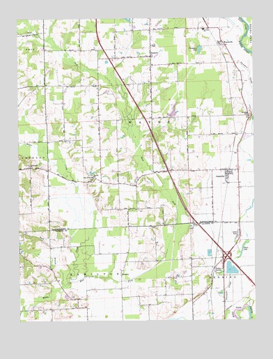
Jonesville, IN USGS Topographic Map
Click on map above to begin viewing in our Map Viewer.

This topographic map contains these locations and features:
Feature Name Type Latitude Longitude GNIS ID View Map
BobtownPopulated PlaceN39.0195°W85.9461°431275View Map
Buck BranchStreamN39.0142°W85.9769°450726View Map
Cooley CreekStreamN39.0034°W86.0000°450798View Map
Corya Pork FarmLocaleN39.0497°W85.9292°2650300View Map
East Fork White CreekStreamN39.0164°W85.9736°450878View Map
John Thompson County DitchCanalN39.0112°W85.8911°449606View Map
JonesvillePopulated PlaceN39.0606°W85.8897°437107View Map
Jonesville Fire Department Station 1BuildingN39.0616°W85.8892°2626208View Map
Lake BarbaraReservoirN39.0865°W85.9177°447811View Map
Little AcrePopulated PlaceN39.0362°W85.8828°452457View Map
Meyer Lake DamDamN39.0851°W85.9200°447812View Map
Peters LakeLakeN39.0292°W85.8814°441055View Map
Peters SwitchPopulated PlaceN39.0217°W85.8966°441057View Map
RosstownPopulated PlaceN39.1092°W85.9294°442328View Map
Saint Johns ChurchChurchN39.0592°W85.9600°442588View Map
Thompsons LakeReservoirN39.1121°W85.9033°444725View Map
Town of JonesvilleCivilN39.0597°W85.8878°2397012View Map
Township of WayneCivilN39.0935°W85.9275°454028View Map
Walker ChapelChurchN39.1134°W85.9292°445375View Map
WaynesvillePopulated PlaceN39.1151°W85.8917°445583View Map
White Creek ChurchChurchN39.0639°W85.9939°445932View Map
White Creek Lutheran SchoolSchoolN39.0595°W85.9608°445933View Map
White Creek Post Office (historical)Post OfficeN39.0189°W85.9753°453006View Map
Wrights HillSummitN39.0842°W85.8778°446343View Map

Note: Coordinates in the location and feature list above are referenced to NAD83 datum.


Copyright (C) 2008-2025 Ryan Niemi / Sunset Dynamics ... All Rights Reserved