TopoQuest Logo
Do you find TopoQuest useful?
Help keep TopoQuest running and adding new maps/features by donating!
Bitcoin:  19c7KJd3qBynnjoSw5npx9KScwjBe4ifkT
Litecoin:  LXs6TkuXGGXo1vDsWCkWVdjQX94eUKd6ui
Home View Maps Find Maps Find Places Resources & Links


Josephine, Texas Topographic Map

USGS Map Title: Josephine, TX
USGS Map MRC: 33096A3
DRG (GeoTIFF) Download: o33096a3.tif


Neighboring USGS Topographic Map Quads:


  Culleoka, TX  
33096B4
 

  Farmersville, TX  
33096B3
 

  Greenville NW, TX  
33096B2
 

  Lavon, TX  
33096A4
 

  Josephine, TX  
33096A3
 

  Greenville SW, TX  
33096A2
 

  Rockwall, TX  
32096H4
 

  Royse City, TX  
32096H3
 

  Quinlan, TX  
32096H2


Map MRC Location:

N34°
W97°
N34°
W96°
H8 H7 H6 H5 H4 H3 H2 H1
G8 G7 G6 G5 G4 G3 G2 G1
F8 F7 F6 F5 F4 F3 F2 F1
E8 E7 E6 E5 E4 E3 E2 E1
D8 D7 D6 D5 D4 D3 D2 D1
C8 C7 C6 C5 C4 C3 C2 C1
B8 B7 B6 B5 B4 B3 B2 B1
A8 A7 A6 A5 A4 A3 A2 A1
N33°
W97°
N33°
W96°

Josephine, TX USGS 1:24K Topographic Map Preview:
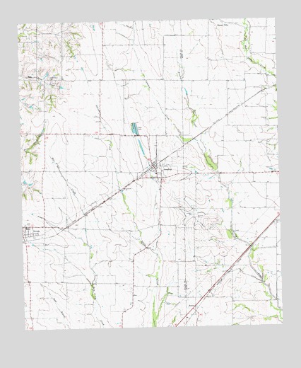
Josephine, TX USGS Topographic Map
Click on map above to begin viewing in our Map Viewer.

This topographic map contains these locations and features:
Feature Name Type Latitude Longitude GNIS ID View Map
BurrowPopulated PlaceN33.0073°W96.2933°2034666View Map
BurrowLocaleN33.0090°W96.2922°1331726View Map
City of JosephineCivilN33.0617°W96.3176°2410151View Map
City of NevadaCivilN33.0386°W96.3694°2411224View Map
Community High SchoolSchoolN33.0696°W96.3636°2004713View Map
Community Middle SchoolSchoolN33.0696°W96.3636°2004714View Map
Cooks LakeReservoirN33.0811°W96.3189°1333274View Map
Cowskin CreekStreamN33.0704°W96.2866°1333570View Map
JosephinePopulated PlaceN33.0612°W96.3072°1338883View Map
Josephine CemeteryCemeteryN33.0448°W96.2911°1338884View Map
Josephine City HallBuildingN33.0659°W96.3121°2753544View Map
Josephine Police DepartmentBuildingN33.0659°W96.3121°2739080View Map
Josephine Post OfficePost OfficeN33.0617°W96.3098°2731403View Map
Josephine Volunteer Fire DepartmentBuildingN33.0651°W96.3124°2551659View Map
McClendon Elementary SchoolSchoolN33.0698°W96.3636°2004748View Map
McMinn CemeteryCemeteryN33.0793°W96.3669°1341264View Map
Needmore CemeteryCemeteryN33.0032°W96.2666°1342401View Map
NevadaPopulated PlaceN33.0423°W96.3739°1375113View Map
Nevada City HallBuildingN33.0416°W96.3674°2753580View Map
Nevada Post OfficePost OfficeN33.0419°W96.3747°2731628View Map
Nevada Volunteer Fire DepartmentBuildingN33.0419°W96.3747°2551585View Map
Payne CreekStreamN33.0179°W96.2597°1343700View Map
Pleasant ValleyPopulated PlaceN33.1237°W96.2730°1378888View Map
Prairie Grove CemeteryCemeteryN33.1026°W96.3603°1344505View Map
Soil Conservation Service Site 85a DamDamN33.1201°W96.3703°1856395View Map
Soil Conservation Service Site 85a ReservoirReservoirN33.1201°W96.3703°1856396View Map
Soil Conservation Service Site 85b DamDamN33.1235°W96.3636°1856393View Map
Soil Conservation Service Site 85b ReservoirReservoirN33.1235°W96.3636°1856394View Map

Note: Coordinates in the location and feature list above are referenced to NAD83 datum.


Copyright (C) 2008-2025 Ryan Niemi / Sunset Dynamics ... All Rights Reserved