TopoQuest Logo
Do you find TopoQuest useful?
Help keep TopoQuest running and adding new maps/features by donating!
Bitcoin:  19c7KJd3qBynnjoSw5npx9KScwjBe4ifkT
Litecoin:  LXs6TkuXGGXo1vDsWCkWVdjQX94eUKd6ui
Home View Maps Find Maps Find Places Resources & Links


Farmersville, Texas Topographic Map

USGS Map Title: Farmersville, TX
USGS Map MRC: 33096B3
DRG (GeoTIFF) Download: o33096b3.tif


Neighboring USGS Topographic Map Quads:


  Blue Ridge, TX  
33096C4
 

  Pike, TX  
33096C3
 

  Celeste, TX  
33096C2
 

  Culleoka, TX  
33096B4
 

  Farmersville, TX  
33096B3
 

  Greenville NW, TX  
33096B2
 

  Lavon, TX  
33096A4
 

  Josephine, TX  
33096A3
 

  Greenville SW, TX  
33096A2


Map MRC Location:

N34°
W97°
N34°
W96°
H8 H7 H6 H5 H4 H3 H2 H1
G8 G7 G6 G5 G4 G3 G2 G1
F8 F7 F6 F5 F4 F3 F2 F1
E8 E7 E6 E5 E4 E3 E2 E1
D8 D7 D6 D5 D4 D3 D2 D1
C8 C7 C6 C5 C4 C3 C2 C1
B8 B7 B6 B5 B4 B3 B2 B1
A8 A7 A6 A5 A4 A3 A2 A1
N33°
W97°
N33°
W96°

Farmersville, TX USGS 1:24K Topographic Map Preview:
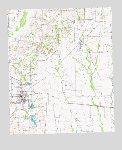
Farmersville, TX USGS Topographic Map
Click on map above to begin viewing in our Map Viewer.

This topographic map contains these locations and features:
Feature Name Type Latitude Longitude GNIS ID View Map
Aston BuildingBuildingN33.1629°W96.3597°2031540View Map
City of FarmersvilleCivilN33.1608°W96.3612°2410486View Map
Clendining CreekStreamN33.1834°W96.2758°1332977View Map
Collin County Constable's Office Precinct 2BuildingN33.1578°W96.3722°2739063View Map
Farmer StadiumParkN33.1740°W96.3616°2027867View Map
FarmersvillePopulated PlaceN33.1634°W96.3600°1335715View Map
Farmersville City HallBuildingN33.1610°W96.3598°2753679View Map
Farmersville High SchoolSchoolN33.1689°W96.3694°2004720View Map
Farmersville Junior High SchoolSchoolN33.1713°W96.3707°2004721View Map
Farmersville Police DepartmentBuildingN33.1650°W96.3607°2739030View Map
Farmersville Post OfficePost OfficeN33.1629°W96.3616°2731913View Map
Farmersville Volunteer Fire DepartmentBuildingN33.1648°W96.3607°2551506View Map
First Baptist ChurchChurchN33.1626°W96.3611°2016603View Map
Fly-N-Ski AirportAirportN33.1855°W96.2710°2675807View Map
Flying M AirportAirportN33.1501°W96.2765°1386642View Map
Hickory CreekStreamN33.2276°W96.3653°1337671View Map
Highmound Park Training TrackLocaleN33.2387°W96.2772°1384741View Map
Hopewell CemeteryCemeteryN33.1785°W96.2523°1338059View Map
J W Spain Athletic ComplexParkN33.1693°W96.3525°2028163View Map
Jones - Yeary CemeteryCemeteryN33.1768°W96.3530°1348277View Map
Liberty CemeteryCemeteryN33.2034°W96.3533°1339875View Map
MeritPopulated PlaceN33.2168°W96.2875°1341384View Map
Merit CemeteryCemeteryN33.2204°W96.2791°1341385View Map
Merit Fire DepartmentBuildingN33.2184°W96.2874°2655215View Map
Merit Post OfficePost OfficeN33.2173°W96.2887°2731619View Map
North LakeReservoirN33.1523°W96.3488°1342768View Map
Short Stop AirportAirportN33.1632°W96.3222°1386629View Map
Soil Conservation Service Site 73 DamDamN33.2401°W96.3203°1856413View Map
Soil Conservation Service Site 73 ReservoirReservoirN33.2401°W96.3203°1856414View Map
Soil Conservation Service Site 75 DamDamN33.2168°W96.3336°1856411View Map
Soil Conservation Service Site 75 ReservoirReservoirN33.2168°W96.3336°1856412View Map
Soil Conservation Service Site 76 DamDamN33.2218°W96.3319°1856409View Map
Soil Conservation Service Site 76 ReservoirReservoirN33.2218°W96.3319°1856410View Map
Soil Conservation Service Site 77 DamDamN33.2301°W96.3469°1856407View Map
Soil Conservation Service Site 77 ReservoirReservoirN33.2301°W96.3469°1856408View Map
Soil Conservation Service Site 79 DamDamN33.1968°W96.3636°1856405View Map
Soil Conservation Service Site 79 ReservoirReservoirN33.1968°W96.3636°1856406View Map
Soil Conservation Service Site 80 DamDamN33.1901°W96.3653°1856403View Map
Soil Conservation Service Site 80 ReservoirReservoirN33.1901°W96.3653°1856404View Map
Soil Conservation Service Site 82 DamDamN33.1434°W96.3503°1856401View Map
Soil Conservation Service Site 82 ReservoirReservoirN33.1434°W96.3503°1856402View Map
Soil Conservation Service Site 83a DamDamN33.1518°W96.3503°1856399View Map
South LakeReservoirN33.1389°W96.3472°1347484View Map
Tatum DamDamN33.1751°W96.3519°1856415View Map
Tatum Elementary SchoolSchoolN33.1668°W96.3611°2004779View Map
Tatum LakeReservoirN33.1751°W96.3519°1856416View Map
Tatum SchoolSchoolN33.1684°W96.3611°1348278View Map
Twin CemeteryCemeteryN33.1907°W96.3453°1348940View Map
Welford SchoolSchoolN33.1568°W96.3675°1349633View Map

Note: Coordinates in the location and feature list above are referenced to NAD83 datum.


Copyright (C) 2008-2024 Ryan Niemi / Sunset Dynamics ... All Rights Reserved