TopoQuest Logo
Do you find TopoQuest useful?
Help keep TopoQuest running and adding new maps/features by donating!
Bitcoin:  19c7KJd3qBynnjoSw5npx9KScwjBe4ifkT
Litecoin:  LXs6TkuXGGXo1vDsWCkWVdjQX94eUKd6ui
Home View Maps Find Maps Find Places Resources & Links


Kalama, Washington Topographic Map

USGS Map Title: Kalama, WA
USGS Map MRC: 46122A7
DRG (GeoTIFF) Download: o46122a7.tif


Neighboring USGS Topographic Map Quads:


  Kelso, WA  
46122B8
 

  Mount Brynion, WA  
46122B7
 

  Hemlock Pass, WA  
46122B6
 

  Rainier, OR  
46122A8
 

  Kalama, WA  
46122A7
 

  Woolford Creek, WA  
46122A6
 

  Trenholm, OR  
45122H8
 

  Deer Island, OR  
45122H7
 

  Woodland, WA  
45122H6


Map MRC Location:

N47°
W123°
N47°
W122°
H8 H7 H6 H5 H4 H3 H2 H1
G8 G7 G6 G5 G4 G3 G2 G1
F8 F7 F6 F5 F4 F3 F2 F1
E8 E7 E6 E5 E4 E3 E2 E1
D8 D7 D6 D5 D4 D3 D2 D1
C8 C7 C6 C5 C4 C3 C2 C1
B8 B7 B6 B5 B4 B3 B2 B1
A8 A7 A6 A5 A4 A3 A2 A1
N46°
W123°
N46°
W122°

Kalama, WA USGS 1:24K Topographic Map Preview:
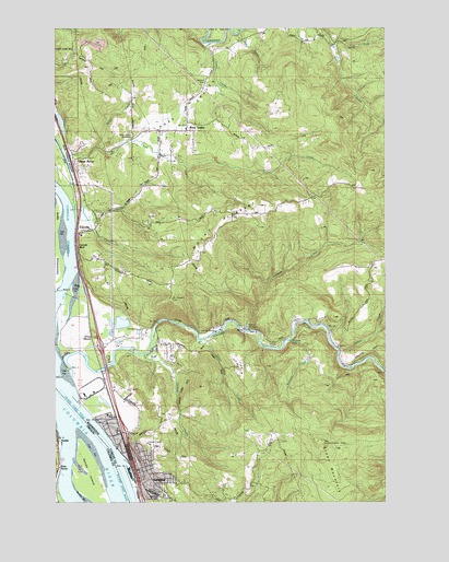
Kalama, WA USGS Topographic Map
Click on map above to begin viewing in our Map Viewer.

This topographic map contains these locations and features:
Feature Name Type Latitude Longitude GNIS ID View Map
Battle MountainSummitN46.0618°W122.7607°1531320View Map
CarrollsPopulated PlaceN46.0715°W122.8623°1512067View Map
Carrolls BluffCliffN46.0671°W122.8673°1503823View Map
Carrolls HillSummitN46.1146°W122.8634°1531321View Map
Carrolls Post OfficePost OfficeN46.0714°W122.8638°2781620View Map
Cedar CreekStreamN46.0426°W122.8196°1503870View Map
City of KalamaCivilN46.0111°W122.8365°2410160View Map
Cowlitz 2 Fire and Rescue Station 24 - Rose ValleyBuildingN46.0980°W122.8280°2619468View Map
Cowlitz County Fire District 5 Station 51BuildingN46.0103°W122.8460°2619466View Map
Cowlitz County Fire District 5 Station 53BuildingN46.0486°W122.7784°2619651View Map
Davis CreekStreamN46.0932°W122.8593°1504337View Map
Drays MoundSummitN46.0437°W122.8607°1512160View Map
Elder RocksPillarN46.0090°W122.8746°1120428View Map
Goble BeachBeachN46.0193°W122.8748°1130258View Map
Hatchery CreekStreamN46.0448°W122.8043°1505415View Map
Hoffman LandingLocaleN46.0165°W122.8346°1848458View Map
Indian CreekStreamN46.0396°W122.7684°1505714View Map
KalamaPopulated PlaceN46.0084°W122.8446°1512340View Map
Kalama DivisionCivilN46.0234°W122.7943°1939528View Map
Kalama Lower RangeChannelN46.0232°W122.8673°1505898View Map
Kalama Lower RangeChannelN46.0232°W122.8676°1122624View Map
Kalama Police DepartmentBuildingN46.0119°W122.8467°2721949View Map
Kalama Post OfficePost OfficeN46.0113°W122.8456°2781716View Map
Kalama RiverStreamN46.0337°W122.8704°1521550View Map
Marietta CreekStreamN46.0426°W122.7871°1506469View Map
Marietta FallsFallsN46.0421°W122.7868°1506470View Map
Mount PleasantSummitN46.0779°W122.7962°1507499View Map
Mount Pleasant CemeteryCemeteryN46.0534°W122.8318°1506823View Map
North Fork Goble CreekStreamN46.1204°W122.7707°1507049View Map
Nye CreekStreamN46.1232°W122.8051°1507119View Map
Owl CreekStreamN46.0768°W122.8687°1507236View Map
Port of Kalama MarinaLocaleN46.0076°W122.8477°2610368View Map
Rose ValleyPopulated PlaceN46.0976°W122.8265°1531319View Map
Rose ValleyValleyN46.1062°W122.8221°1507921View Map
Rose Valley CemeteryCemeteryN46.0967°W122.8472°1507922View Map
Rose Valley Elementary SchoolSchoolN46.0983°W122.8265°1531102View Map
Sandy IslandIslandN46.0076°W122.8626°1126594View Map
Scipio's Goble LandingHarborN46.0161°W122.8736°2668611View Map
Scipio's Goble Landing Boat LaunchLocaleN46.0161°W122.8739°2668342View Map
Spencer CreekStreamN46.0387°W122.8423°1508583View Map
Turner CreekStreamN46.1207°W122.8190°1509130View Map
Vision AcresPopulated PlaceN46.0873°W122.8673°1512765View Map
Walters Arv Ultralight AirportAirportN46.0979°W122.8618°1533801View Map

Note: Coordinates in the location and feature list above are referenced to NAD83 datum.


Copyright (C) 2008-2024 Ryan Niemi / Sunset Dynamics ... All Rights Reserved