TopoQuest Logo
Do you find TopoQuest useful?
Help keep TopoQuest running and adding new maps/features by donating!
Bitcoin:  19c7KJd3qBynnjoSw5npx9KScwjBe4ifkT
Litecoin:  LXs6TkuXGGXo1vDsWCkWVdjQX94eUKd6ui
Home View Maps Find Maps Find Places Resources & Links


Trenholm, Oregon Topographic Map

USGS Map Title: Trenholm, OR
USGS Map MRC: 45122H8
DRG (GeoTIFF) Download: o45122h8.tif


Neighboring USGS Topographic Map Quads:


  Delena, OR  
46123A1
 

  Rainier, OR  
46122A8
 

  Kalama, WA  
46122A7
 

  Baker Point, OR  
45123H1
 

  Trenholm, OR  
45122H8
 

  Deer Island, OR  
45122H7
 

  Bacona, OR  
45123G1
 

  Chapman, OR  
45122G8
 

  Saint Helens, OR  
45122G7


Map MRC Location:

N46°
W123°
N46°
W122°
H8 H7 H6 H5 H4 H3 H2 H1
G8 G7 G6 G5 G4 G3 G2 G1
F8 F7 F6 F5 F4 F3 F2 F1
E8 E7 E6 E5 E4 E3 E2 E1
D8 D7 D6 D5 D4 D3 D2 D1
C8 C7 C6 C5 C4 C3 C2 C1
B8 B7 B6 B5 B4 B3 B2 B1
A8 A7 A6 A5 A4 A3 A2 A1
N45°
W123°
N45°
W122°

Trenholm, OR USGS 1:24K Topographic Map Preview:
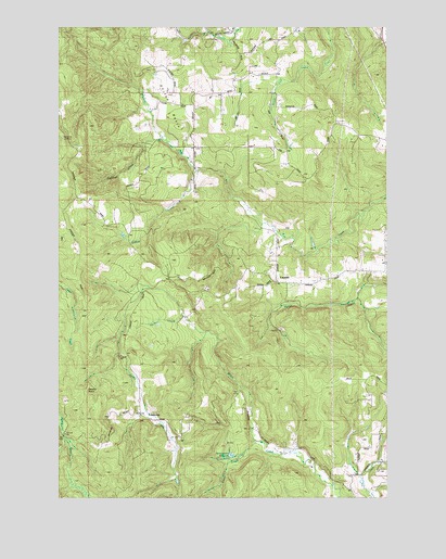
Trenholm, OR USGS Topographic Map
Click on map above to begin viewing in our Map Viewer.

This topographic map contains these locations and features:
Feature Name Type Latitude Longitude GNIS ID View Map
Apilton CreekStreamN45.9226°W122.9534°1117017View Map
Bishop CreekStreamN45.9618°W122.9482°1117735View Map
CanaanPopulated PlaceN45.9321°W122.9179°1118553View Map
Canaan Community ChurchChurchN45.9322°W122.9178°2508069View Map
Carico Post Office (historical)Post OfficeN45.9326°W122.9657°1164252View Map
Endicott CreekStreamN45.9698°W122.9593°1120505View Map
Goble CemeteryCemeteryN45.9827°W122.9575°1130095View Map
Goble DivisionCivilN45.9837°W122.9216°1938018View Map
Meissner LookoutLocaleN45.9703°W122.9994°1124046View Map
Royal Oaks City ParkParkN45.9459°W122.9648°1966232View Map
Salmonberry CreekStreamN45.8898°W122.9257°1126517View Map
Salmonberry ReservoirReservoirN45.8862°W122.9356°1126519View Map
Serafin PointSummitN45.9033°W122.9908°1136737View Map
Shiloh BasinBasinN45.9787°W122.9576°1126882View Map
Shiloh Basin CemeteryCemeteryN45.9676°W122.9492°1130094View Map
Shiloh Basin School (historical)SchoolN45.9682°W122.9484°1126883View Map
Smith CreekStreamN45.8876°W122.9296°1127115View Map
Tidecreek Post Office (historical)Post OfficeN45.9865°W122.9176°1164728View Map
TrenholmPopulated PlaceN45.8954°W122.9654°1128217View Map
Trenholm Post Office (historical)Post OfficeN45.8954°W122.9654°1166063View Map
Valley Post Office (historical)Post OfficeN45.8915°W122.9990°1164753View Map
Wilark Guard Station (historical)LocaleN45.8921°W122.9915°1638901View Map

Note: Coordinates in the location and feature list above are referenced to NAD83 datum.


Copyright (C) 2008-2025 Ryan Niemi / Sunset Dynamics ... All Rights Reserved