TopoQuest Logo
Do you find TopoQuest useful?
Help keep TopoQuest running and adding new maps/features by donating!
Bitcoin:  19c7KJd3qBynnjoSw5npx9KScwjBe4ifkT
Litecoin:  LXs6TkuXGGXo1vDsWCkWVdjQX94eUKd6ui
Home View Maps Find Maps Find Places Resources & Links


Kamiah, Idaho Topographic Map

USGS Map Title: Kamiah, ID
USGS Map MRC: 46116B1
DRG (GeoTIFF) Download: o46116b1.tif


Neighboring USGS Topographic Map Quads:


  Sixmile Creek, ID  
46116C2
 

  Woodland, ID  
46116C1
 

  Weippe South, ID  
46115C8
 

  Nezperce, ID  
46116B2
 

  Kamiah, ID  
46116B1
 

  Kooskia, ID  
46115B8
 

  Nezperce SW, ID  
46116A2
 

  Nezperce SE, ID  
46116A1
 

  Stites, ID  
46115A8


Map MRC Location:

N47°
W117°
N47°
W116°
H8 H7 H6 H5 H4 H3 H2 H1
G8 G7 G6 G5 G4 G3 G2 G1
F8 F7 F6 F5 F4 F3 F2 F1
E8 E7 E6 E5 E4 E3 E2 E1
D8 D7 D6 D5 D4 D3 D2 D1
C8 C7 C6 C5 C4 C3 C2 C1
B8 B7 B6 B5 B4 B3 B2 B1
A8 A7 A6 A5 A4 A3 A2 A1
N46°
W117°
N46°
W116°

Kamiah, ID USGS 1:24K Topographic Map Preview:
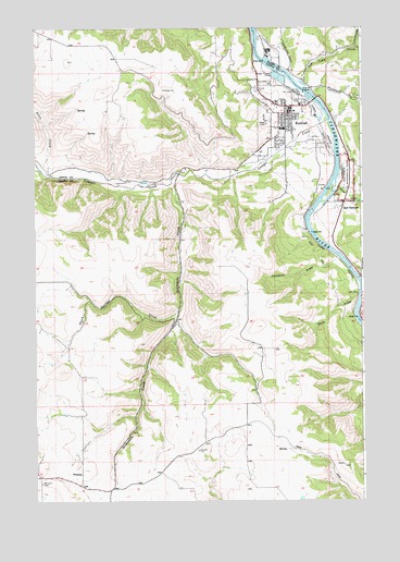
Kamiah, ID USGS Topographic Map
Click on map above to begin viewing in our Map Viewer.

This topographic map contains these locations and features:
Feature Name Type Latitude Longitude GNIS ID View Map
Church CanyonValleyN46.2050°W116.0038°379334View Map
City of KamiahCivilN46.2268°W116.0282°2410163View Map
Doty DrawValleyN46.1804°W116.0023°380730View Map
East KamiahPopulated PlaceN46.2027°W116.0079°396436View Map
Heart of the Monster Point of InterestLocaleN46.2168°W116.0057°394026View Map
Jameson DrawValleyN46.1894°W116.0099°383855View Map
KamiahPopulated PlaceN46.2271°W116.0293°396726View Map
Kamiah DivisionCivilN46.2479°W116.1025°1936743View Map
Kamiah Elementary SchoolSchoolN46.2233°W116.0306°401526View Map
Kamiah High SchoolSchoolN46.2233°W116.0310°401527View Map
Kamiah Holding PondsLocaleN46.2088°W116.0926°401534View Map
Kamiah Municipal AirportAirportN46.2206°W116.0143°400847View Map
Kamiah Police DepartmentBuildingN46.2269°W116.0277°2722410View Map
Kamiah Post OfficePost OfficeN46.2277°W116.0282°2766886View Map
Kamiah Volunteer Fire DepartmentBuildingN46.2266°W116.0276°2619114View Map
Lawyer CreekStreamN46.2255°W116.0132°384492View Map
Long Camp and ASA Smith MissionLocaleN46.2463°W116.0418°394019View Map
Nikesa CemeteryCemeteryN46.2041°W116.0060°387566View Map
Nikesa CreekStreamN46.2074°W116.0099°387567View Map
Pierce Ranger StationLocaleN46.2285°W116.0324°394027View Map
Riverfront ParkParkN46.2291°W116.0168°394025View Map
Sevenmile CreekStreamN46.2091°W116.0726°390121View Map
Suzie CreekStreamN46.2129°W116.1229°391696View Map
Teh LaPa Low CemeteryCemeteryN46.2353°W116.0334°391886View Map
Thorn Springs CreekStreamN46.1752°W116.0707°392060View Map
Tom Taha CreekStreamN46.2360°W116.0260°392224View Map
WinonaPopulated PlaceN46.1321°W116.1079°400176View Map
Winona CemeteryCemeteryN46.1301°W116.1232°393600View Map

Note: Coordinates in the location and feature list above are referenced to NAD83 datum.


Copyright (C) 2008-2025 Ryan Niemi / Sunset Dynamics ... All Rights Reserved