TopoQuest Logo
Do you find TopoQuest useful?
Help keep TopoQuest running and adding new maps/features by donating!
Bitcoin:  19c7KJd3qBynnjoSw5npx9KScwjBe4ifkT
Litecoin:  LXs6TkuXGGXo1vDsWCkWVdjQX94eUKd6ui
Home View Maps Find Maps Find Places Resources & Links


Kooskia, Idaho Topographic Map

USGS Map Title: Kooskia, ID
USGS Map MRC: 46115B8
DRG (GeoTIFF) Download: o46115b8.tif


Neighboring USGS Topographic Map Quads:


  Woodland, ID  
46116C1
 

  Weippe South, ID  
46115C8
 

  Brown Creek Ridge, ID  
46115C7
 

  Kamiah, ID  
46116B1
 

  Kooskia, ID  
46115B8
 

  Glenwood, ID  
46115B7
 

  Nezperce SE, ID  
46116A1
 

  Stites, ID  
46115A8
 

  Big Cedar, ID  
46115A7


Map MRC Location:

N47°
W116°
N47°
W115°
H8 H7 H6 H5 H4 H3 H2 H1
G8 G7 G6 G5 G4 G3 G2 G1
F8 F7 F6 F5 F4 F3 F2 F1
E8 E7 E6 E5 E4 E3 E2 E1
D8 D7 D6 D5 D4 D3 D2 D1
C8 C7 C6 C5 C4 C3 C2 C1
B8 B7 B6 B5 B4 B3 B2 B1
A8 A7 A6 A5 A4 A3 A2 A1
N46°
W116°
N46°
W115°

Kooskia, ID USGS 1:24K Topographic Map Preview:
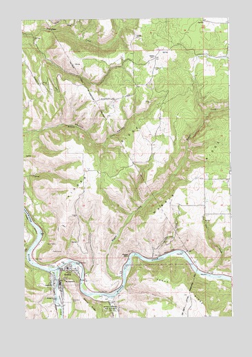
Kooskia, ID USGS Topographic Map
Click on map above to begin viewing in our Map Viewer.

This topographic map contains these locations and features:
Feature Name Type Latitude Longitude GNIS ID View Map
Button Beach Access AreaLocaleN46.1632°W115.9885°401221View Map
City of KooskiaCivilN46.1413°W115.9765°2411556View Map
Clear CreekStreamN46.1341°W115.9521°379399View Map
Clearwater Valley ElementarySchoolN46.1462°W115.9744°401271View Map
Coyote CreekStreamN46.1507°W115.9176°379993View Map
Grandview CemeteryCemeteryN46.2294°W115.9201°382510View Map
Harris RidgeRidgeN46.1943°W115.8807°382930View Map
KidderLocaleN46.2332°W115.9199°384212View Map
Kidder RidgeRidgeN46.1866°W115.9454°384213View Map
KooskiaPopulated PlaceN46.1449°W115.9779°399948View Map
Kooskia AmbulanceBuildingN46.1358°W115.9794°2642817View Map
Kooskia Fire DepartmentBuildingN46.1351°W115.9792°2619205View Map
Kooskia Municipal AirportAirportN46.1334°W115.9792°400852View Map
Kooskia National Fish HatcheryParkN46.1313°W115.9485°400281View Map
Kooskia Police DepartmentBuildingN46.1393°W115.9792°2722445View Map
Kooskia Post OfficePost OfficeN46.1387°W115.9790°2766884View Map
Maggie BendBendN46.1513°W115.9340°386352View Map
Maggie CreekStreamN46.1418°W115.9407°386354View Map
Middle Fork Clearwater RiverStreamN46.1454°W115.9824°386806View Map
Miller CemeteryCemeteryN46.1499°W115.9937°386963View Map
Mount StewartSummitN46.1396°W115.9707°397213View Map
Nicodemus CemeteryCemeteryN46.1469°W115.9816°387564View Map
Penny CliffsCliffN46.1524°W115.9121°388335View Map
Pine Grove CemeteryCemeteryN46.1324°W115.9724°388515View Map
Red Pine CreekStreamN46.1421°W115.8840°389220View Map
South Fork Clearwater RiverStreamN46.1457°W115.9824°390908View Map
Too Kush CreekStreamN46.1380°W115.9413°399316View Map

Note: Coordinates in the location and feature list above are referenced to NAD83 datum.


Copyright (C) 2008-2025 Ryan Niemi / Sunset Dynamics ... All Rights Reserved