TopoQuest Logo
Do you find TopoQuest useful?
Help keep TopoQuest running and adding new maps/features by donating!
Bitcoin:  19c7KJd3qBynnjoSw5npx9KScwjBe4ifkT
Litecoin:  LXs6TkuXGGXo1vDsWCkWVdjQX94eUKd6ui
Home View Maps Find Maps Find Places Resources & Links


Stites, Idaho Topographic Map

USGS Map Title: Stites, ID
USGS Map MRC: 46115A8
DRG (GeoTIFF) Download: o46115a8.tif


Neighboring USGS Topographic Map Quads:


  Kamiah, ID  
46116B1
 

  Kooskia, ID  
46115B8
 

  Glenwood, ID  
46115B7
 

  Nezperce SE, ID  
46116A1
 

  Stites, ID  
46115A8
 

  Big Cedar, ID  
46115A7
 

  Grangeville East, ID  
45116H1
 

  Harpster, ID  
45115H8
 

  Corral Hill, ID  
45115H7


Map MRC Location:

N47°
W116°
N47°
W115°
H8 H7 H6 H5 H4 H3 H2 H1
G8 G7 G6 G5 G4 G3 G2 G1
F8 F7 F6 F5 F4 F3 F2 F1
E8 E7 E6 E5 E4 E3 E2 E1
D8 D7 D6 D5 D4 D3 D2 D1
C8 C7 C6 C5 C4 C3 C2 C1
B8 B7 B6 B5 B4 B3 B2 B1
A8 A7 A6 A5 A4 A3 A2 A1
N46°
W116°
N46°
W115°

Stites, ID USGS 1:24K Topographic Map Preview:
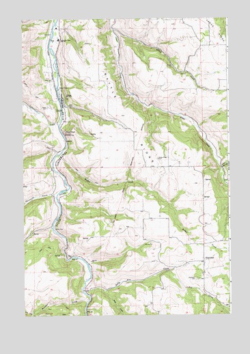
Stites, ID USGS Topographic Map
Click on map above to begin viewing in our Map Viewer.

This topographic map contains these locations and features:
Feature Name Type Latitude Longitude GNIS ID View Map
Battle RidgeRidgeN46.0904°W115.9415°377043View Map
Battle Ridge - Pleasant Valley - Clearwater Volunteer Rural Fire DepartmentBuildingN46.0222°W115.8916°2619321View Map
Battle Ridge CemeteryCemeteryN46.0660°W115.9182°371389View Map
Big Cedar CreekStreamN46.0563°W115.8782°397435View Map
Butcher CreekStreamN46.0054°W115.9618°378594View Map
City of StitesCivilN46.0921°W115.9762°2411985View Map
Clear CreekStreamN46.0541°W115.8757°379389View Map
Clear CreekStreamN46.1249°W115.9465°372047View Map
ClearwaterPopulated PlaceN46.0224°W115.8910°372052View Map
Clearwater Battlefield SiteLocaleN46.0766°W115.9751°372053View Map
Clearwater CemeteryCemeteryN46.0152°W115.8954°372054View Map
Clearwater Valley Junior - Senior High SchoolSchoolN46.1161°W115.9780°372056View Map
Clearwater Valley Primary SchoolSchoolN46.1171°W115.9782°401272View Map
Cottonwood CreekStreamN46.0810°W115.9776°372169View Map
Dizzy HeadCliffN46.0774°W115.9749°372429View Map
Leitch CreekStreamN46.1204°W115.9446°384562View Map
Little Cedar CreekStreamN46.0618°W115.8799°384772View Map
Rabbit CreekStreamN46.0263°W115.8754°389000View Map
Rabbit CreekStreamN46.0677°W115.9779°389005View Map
Sally Ann CreekStreamN46.0093°W115.9632°389847View Map
Sill CreekStreamN46.0182°W115.9121°390411View Map
StitesPopulated PlaceN46.0916°W115.9763°398187View Map
Stites Fire DepartmentBuildingN46.0912°W115.9764°2619275View Map
Stites Indian Church CemeteryCemeteryN46.0999°W115.9825°2766762View Map
Stites IOOF CemeteryCemeteryN46.0878°W115.9853°375287View Map
Stites Post OfficePost OfficeN46.0910°W115.9760°2766885View Map
Threemile CreekStreamN46.0496°W115.9804°392103View Map
Wall CreekStreamN46.0104°W115.9521°392792View Map

Note: Coordinates in the location and feature list above are referenced to NAD83 datum.


Copyright (C) 2008-2025 Ryan Niemi / Sunset Dynamics ... All Rights Reserved