TopoQuest Logo
Do you find TopoQuest useful?
Help keep TopoQuest running and adding new maps/features by donating!
Bitcoin:  19c7KJd3qBynnjoSw5npx9KScwjBe4ifkT
Litecoin:  LXs6TkuXGGXo1vDsWCkWVdjQX94eUKd6ui
Home View Maps Find Maps Find Places Resources & Links


Keating, Pennsylvania Topographic Map

USGS Map Title: Keating, PA
USGS Map MRC: 41077C8
DRG (GeoTIFF) Download: o41077c8.tif


Neighboring USGS Topographic Map Quads:


  First Fork, PA  
41078D1
 

  Hammersley Fork, PA  
41077D8
 

  Tamarack, PA  
41077D7
 

  Sinnemahoning, PA  
41078C1
 

  Keating, PA  
41077C8
 

  Renovo West, PA  
41077C7
 

  Pottersdale, PA  
41078B1
 

  Snow Shoe NW, PA  
41077B8
 

  Snow Shoe NE, PA  
41077B7


Map MRC Location:

N42°
W78°
N42°
W77°
H8 H7 H6 H5 H4 H3 H2 H1
G8 G7 G6 G5 G4 G3 G2 G1
F8 F7 F6 F5 F4 F3 F2 F1
E8 E7 E6 E5 E4 E3 E2 E1
D8 D7 D6 D5 D4 D3 D2 D1
C8 C7 C6 C5 C4 C3 C2 C1
B8 B7 B6 B5 B4 B3 B2 B1
A8 A7 A6 A5 A4 A3 A2 A1
N41°
W78°
N41°
W77°

Keating, PA USGS 1:24K Topographic Map Preview:
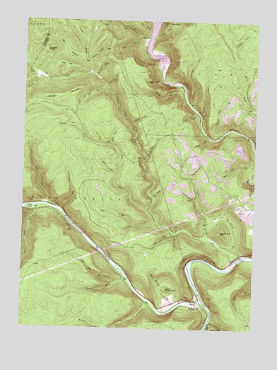
Keating, PA USGS Topographic Map
Click on map above to begin viewing in our Map Viewer.

This topographic map contains these locations and features:
Feature Name Type Latitude Longitude GNIS ID View Map
Bear HollowValleyN41.3034°W77.9289°1168881View Map
Bearfield HollowValleyN41.3515°W77.9914°1168968View Map
Bechtel TrailTrailN41.2831°W77.9147°1206371View Map
Bee Tree DraftValleyN41.3530°W77.9613°1169091View Map
Beer Hollow TrailTrailN41.3084°W77.9247°1206369View Map
BitumenPopulated PlaceN41.2998°W77.8786°1169680View Map
Brink Hollow TrailTrailN41.2984°W77.9194°1206370View Map
Buckhorn HollowValleyN41.3327°W77.9721°1170565View Map
Buckhorn TrailTrailN41.3328°W77.9658°1206361View Map
Bucktail State Park Natural AreaParkN41.2756°W77.9464°2351303View Map
Bushley RidgeRidgeN41.3631°W77.9881°1170776View Map
Butler HollowValleyN41.3690°W77.9383°1170798View Map
Butler TrailTrailN41.3659°W77.9450°1206364View Map
Camp RunStreamN41.2923°W77.9258°1171080View Map
Cole RunStreamN41.2892°W77.9186°1172179View Map
Commissioner Run TrailTrailN41.3140°W77.9714°1206358View Map
Commissioners RunStreamN41.2984°W77.9797°1172266View Map
Cook RunStreamN41.3581°W77.9994°1202936View Map
Cooks RunStreamN41.2776°W77.8847°1192297View Map
Cooks RunPopulated PlaceN41.2809°W77.8758°1213065View Map
Cooks Run TrailTrailN41.3601°W77.9567°1206365View Map
Cow HoleValleyN41.2922°W77.9401°1172544View Map
Crabapple HollowValleyN41.3648°W77.8872°1172580View Map
Crawford BranchStreamN41.3545°W77.9636°1172647View Map
Crawford HollowValleyN41.3591°W77.9669°1172650View Map
Crowley HollowValleyN41.2956°W77.8997°1172775View Map
Crowley TrailTrailN41.3173°W77.9236°1206368View Map
Dark HollowValleyN41.3537°W77.9952°1172939View Map
Daugherty TrailTrailN41.3192°W77.8975°1206373View Map
Dry HollowValleyN41.3714°W77.9323°1173511View Map
Duck HollowValleyN41.3099°W77.8757°1173568View Map
Eightmile Dam HollowValleyN41.3490°W77.9550°1174061View Map
Fisher HollowValleyN41.3516°W77.9261°1174818View Map
Fivemile HollowValleyN41.3289°W77.8937°1174874View Map
Fork HillSummitN41.3573°W77.9778°1174990View Map
Grass Flats RunStreamN41.2684°W77.9500°1175979View Map
Hicks HollowValleyN41.3375°W77.9069°1176983View Map
Honey RunStreamN41.3490°W77.9161°1177349View Map
Huling Ridge TrailTrailN41.3515°W77.8958°1206390View Map
Jacob HollowValleyN41.2854°W77.9982°1177951View Map
Jews RunStreamN41.2531°W77.8972°1178076View Map
KeatingPopulated PlaceN41.2590°W77.9042°1178270View Map
Kettle Creek LakeReservoirN41.3608°W77.9289°1195498View Map
Kettle Creek Lake DamDamN41.3593°W77.9243°1168245View Map
Lebo BranchStreamN41.3581°W77.9669°1179105View Map
Lick RunStreamN41.3476°W77.9544°1179301View Map
Lick Run TrailTrailN41.3467°W77.9664°1206357View Map
Little Round TopSummitN41.2665°W77.9211°1179662View Map
Log Slide HollowValleyN41.3265°W77.9397°1179809View Map
Lookout TrailTrailN41.2551°W77.8844°1206326View Map
Mill RunStreamN41.2998°W77.9861°1181182View Map
Milligan RunStreamN41.2792°W77.8819°1181269View Map
Mitchell TrailTrailN41.3451°W77.9469°1206367View Map
Moccasin RunStreamN41.2615°W77.9308°1168011View Map
Nefure HollowValleyN41.3026°W77.9061°1182218View Map
Onion RunStreamN41.3206°W77.9328°1182993View Map
Owl HollowValleyN41.3373°W77.9041°1183159View Map
Owl Hollow TrailTrailN41.3551°W77.9006°1206374View Map
Pitch Pine HollowValleyN41.3121°W77.9085°1183972View Map
Pitch Pine TrailTrailN41.3140°W77.9069°1206372View Map
Rock RunStreamN41.2981°W77.9311°1185283View Map
Round IslandIslandN41.2987°W77.9961°1185526View Map
Round Island RunStreamN41.2984°W77.9936°1185527View Map
Round Top MountainSummitN41.2895°W77.8925°1185553View Map
RoundtopSummitN41.3748°W77.9211°1185563View Map
Roundtop HollowValleyN41.3691°W77.9296°1185567View Map
Savage HollowValleyN41.3253°W77.9535°1187011View Map
Savage MountainSummitN41.3440°W77.9881°1187012View Map
Savage TrailTrailN41.3301°W77.9519°1206360View Map
Sinnemahoning CreekStreamN41.2617°W77.9022°1187724View Map
Slide HollowValleyN41.3279°W77.9005°1187808View Map
Smiths Run TrailTrailN41.2648°W77.8830°1206687View Map
Sugar Camp RunStreamN41.3690°W77.9319°1188926View Map
Summerson RunStreamN41.3409°W77.9100°1189029View Map
Tank HollowValleyN41.2905°W77.9723°1189260View Map
Threepoint HollowValleyN41.3329°W77.9417°1189556View Map
Threepoint Hollow TrailTrailN41.3359°W77.9364°1206366View Map
Township of East KeatingCivilN41.3016°W77.9702°1216260View Map
Twin HollowValleyN41.3255°W77.9583°1190007View Map
Upper Stimpson RunStreamN41.2598°W77.9153°1190255View Map
Wildcat HollowValleyN41.3127°W77.9490°1191408View Map
Wildcat TrailTrailN41.3187°W77.9558°1206359View Map
Wistar RunStreamN41.2712°W77.9428°1191633View Map

Note: Coordinates in the location and feature list above are referenced to NAD83 datum.


Copyright (C) 2008-2024 Ryan Niemi / Sunset Dynamics ... All Rights Reserved