TopoQuest Logo
Do you find TopoQuest useful?
Help keep TopoQuest running and adding new maps/features by donating!
Bitcoin:  19c7KJd3qBynnjoSw5npx9KScwjBe4ifkT
Litecoin:  LXs6TkuXGGXo1vDsWCkWVdjQX94eUKd6ui
Home View Maps Find Maps Find Places Resources & Links


Kellys Pond, Georgia Topographic Map

USGS Map Title: Kellys Pond, GA
USGS Map MRC: 33082A3
DRG (GeoTIFF) Download: o33082a3.tif


Neighboring USGS Topographic Map Quads:


  Wrens, GA  
33082B4
 

  Matthews, GA  
33082B3
 

  Keysville, GA  
33082B2
 

  Louisville, GA  
33082A4
 

  Kellys Pond, GA  
33082A3
 

  Gough, GA  
33082A2
 

  Louisville South, GA  
32082H4
 

  Old Town, GA  
32082H3
 

  Scotts Corner, GA  
32082H2


Map MRC Location:

N34°
W83°
N34°
W82°
H8 H7 H6 H5 H4 H3 H2 H1
G8 G7 G6 G5 G4 G3 G2 G1
F8 F7 F6 F5 F4 F3 F2 F1
E8 E7 E6 E5 E4 E3 E2 E1
D8 D7 D6 D5 D4 D3 D2 D1
C8 C7 C6 C5 C4 C3 C2 C1
B8 B7 B6 B5 B4 B3 B2 B1
A8 A7 A6 A5 A4 A3 A2 A1
N33°
W83°
N33°
W82°

Kellys Pond, GA USGS 1:24K Topographic Map Preview:
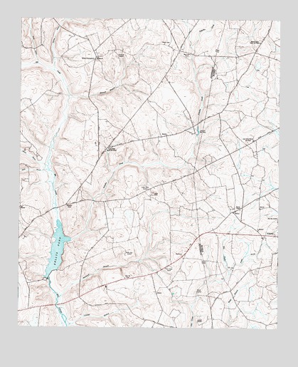
Kellys Pond, GA USGS Topographic Map
Click on map above to begin viewing in our Map Viewer.

This topographic map contains these locations and features:
Feature Name Type Latitude Longitude GNIS ID View Map
Allen Temple ChurchChurchN33.0246°W82.3040°310461View Map
Blackjack BranchStreamN33.0121°W82.3554°311498View Map
Blounts ChapelChurchN33.0482°W82.2685°354774View Map
Boatwright CemeteryCemeteryN33.1096°W82.3287°311593View Map
Dry Creek School (historical)SchoolN33.0035°W82.3104°345701View Map
Ellis PlantationPopulated PlaceN33.1096°W82.3385°313925View Map
Fleming BranchStreamN33.1040°W82.3585°314214View Map
Green Grove ChurchChurchN33.0763°W82.2623°314842View Map
Green Grove SchoolSchoolN33.0757°W82.2637°314844View Map
Greener Mill PondLakeN33.0800°W82.2890°356101View Map
Hannah BranchStreamN33.0943°W82.3510°315091View Map
Hickory School (historical)SchoolN33.0563°W82.2532°348000View Map
Kellys PondReservoirN33.0313°W82.3563°316366View Map
Kellys Pond DamDamN33.0204°W82.3604°336149View Map
Lawson BranchStreamN33.0004°W82.3507°316701View Map
Lockhart SchoolSchoolN33.0551°W82.3107°317273View Map
Mays Grove CemeteryCemeteryN33.1113°W82.2932°345733View Map
Mays Grove ChurchChurchN33.1110°W82.2932°317826View Map
McBride CemeteryCemeteryN33.0024°W82.2885°317841View Map
Melton Place CemeteryCemeteryN33.0307°W82.3240°318011View Map
Munjin SchoolSchoolN33.1151°W82.3060°319150View Map
Nesbitt BranchStreamN33.0229°W82.2737°319254View Map
Nesbitt CemeteryCemeteryN33.0146°W82.2896°319255View Map
Newberrys PondReservoirN33.0235°W82.3248°340985View Map
Newberrys Pond DamDamN33.0235°W82.3248°340984View Map
Ponder Family CemeteryCemeteryN33.0563°W82.3126°320999View Map
Rabun LakeReservoirN33.0634°W82.3701°340983View Map
Rabun Lake DamDamN33.0635°W82.3682°340982View Map
Rocky BranchStreamN33.1068°W82.3660°321793View Map
Rose Dhu CemeteryCemeteryN33.0449°W82.2501°321907View Map
Schaffer CreekStreamN33.0360°W82.3496°322624View Map
Smith BranchStreamN33.0635°W82.3604°323096View Map
Spies Hill SchoolSchoolN33.0204°W82.3235°323344View Map
Spring Bethel ChurchChurchN33.0729°W82.3318°323354View Map
Spring Bethel SchoolSchoolN33.0735°W82.3312°323355View Map
Stinson BranchStreamN33.0651°W82.3610°323629View Map
Williams Grove ChurchChurchN33.1149°W82.2601°325359View Map
Williams Grove SchoolSchoolN33.1160°W82.2596°325361View Map
Woodlawn ChapelChurchN33.0499°W82.3518°325536View Map

Note: Coordinates in the location and feature list above are referenced to NAD83 datum.


Copyright (C) 2008-2025 Ryan Niemi / Sunset Dynamics ... All Rights Reserved