TopoQuest Logo
Do you find TopoQuest useful?
Help keep TopoQuest running and adding new maps/features by donating!
Bitcoin:  19c7KJd3qBynnjoSw5npx9KScwjBe4ifkT
Litecoin:  LXs6TkuXGGXo1vDsWCkWVdjQX94eUKd6ui
Home View Maps Find Maps Find Places Resources & Links


Matthews, Georgia Topographic Map

USGS Map Title: Matthews, GA
USGS Map MRC: 33082B3
DRG (GeoTIFF) Download: o33082b3.tif


Neighboring USGS Topographic Map Quads:


  Bowdens Pond, GA  
33082C4
 

  Avondale, GA  
33082C3
 

  Blythe, GA  
33082C2
 

  Wrens, GA  
33082B4
 

  Matthews, GA  
33082B3
 

  Keysville, GA  
33082B2
 

  Louisville, GA  
33082A4
 

  Kellys Pond, GA  
33082A3
 

  Gough, GA  
33082A2


Map MRC Location:

N34°
W83°
N34°
W82°
H8 H7 H6 H5 H4 H3 H2 H1
G8 G7 G6 G5 G4 G3 G2 G1
F8 F7 F6 F5 F4 F3 F2 F1
E8 E7 E6 E5 E4 E3 E2 E1
D8 D7 D6 D5 D4 D3 D2 D1
C8 C7 C6 C5 C4 C3 C2 C1
B8 B7 B6 B5 B4 B3 B2 B1
A8 A7 A6 A5 A4 A3 A2 A1
N33°
W83°
N33°
W82°

Matthews, GA USGS 1:24K Topographic Map Preview:
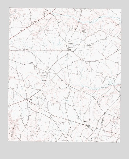
Matthews, GA USGS Topographic Map
Click on map above to begin viewing in our Map Viewer.

This topographic map contains these locations and features:
Feature Name Type Latitude Longitude GNIS ID View Map
AtwellPopulated PlaceN33.1407°W82.2862°331065View Map
Atwell SchoolSchoolN33.1446°W82.2910°310664View Map
Beasley CemeteryCemeteryN33.2374°W82.3451°310961View Map
Brinson CrossingPopulated PlaceN33.2104°W82.3598°331236View Map
Bull Nose BranchStreamN33.1788°W82.2557°312021View Map
Burke CemeteryCemeteryN33.1299°W82.3498°312044View Map
Carson CemeteryCemeteryN33.1351°W82.3421°312359View Map
Eliott Barrow Airport (historical)AirportN33.2001°W82.2665°351843View Map
Flat Rock BranchStreamN33.2446°W82.3246°314193View Map
Flat Rock CemeteryCemeteryN33.2310°W82.3012°345706View Map
Flat Rock ChurchChurchN33.2304°W82.3010°355828View Map
Goodins Pond (historical)ReservoirN33.2432°W82.3257°345710View Map
Gun PondSwampN33.1475°W82.3392°345712View Map
Hadden BranchStreamN33.1832°W82.3618°315002View Map
Harmony ChurchChurchN33.2313°W82.3557°315146View Map
Johnson BranchStreamN33.1754°W82.3198°316148View Map
Jordan BranchStreamN33.1868°W82.3421°316264View Map
Littles BridgeBridgeN33.2465°W82.3279°345722View Map
MatthewsPopulated PlaceN33.2110°W82.3076°332331View Map
Matthews Census Designated PlaceCensusN33.2175°W82.3079°2587038View Map
Matthews Community Fire DepartmentBuildingN33.2097°W82.3055°2604494View Map
Matthews Junior High SchoolSchoolN33.2096°W82.3026°345732View Map
Moses Chapel ChurchChurchN33.1271°W82.3090°318513View Map
Mosley Chapel CemeteryCemeteryN33.1268°W82.3090°345734View Map
Mount Horeb CemeteryCemeteryN33.2032°W82.2937°345736View Map
Mount Horeb ChurchChurchN33.2032°W82.2932°318675View Map
Mount Moriah CampgroundsLocaleN33.2285°W82.2923°345737View Map
Mount Moriah CemeteryCemeteryN33.2296°W82.2921°345738View Map
Mount Moriah ChurchChurchN33.2288°W82.2935°318699View Map
NoahPopulated PlaceN33.2154°W82.2860°332507View Map
Nortons MillraceStreamN33.2471°W82.3287°319710View Map
Ocala School (historical)SchoolN33.1399°W82.3554°345743View Map
Oliphant Pond (historical)ReservoirN33.2345°W82.3150°345745View Map
Padgett Crossing (historical)Populated PlaceN33.2215°W82.2612°345747View Map
Pennington LakeReservoirN33.1851°W82.3115°340997View Map
Pennington Lake DamDamN33.1851°W82.3115°340996View Map
Pilcher LakeReservoirN33.1913°W82.3428°336156View Map
Pilcher Lake DamDamN33.1885°W82.3415°336155View Map
Smiths Grove CemeteryCemeteryN33.1726°W82.2782°345763View Map
Smiths Grove ChurchChurchN33.1724°W82.2779°323160View Map
StellavillePopulated PlaceN33.1901°W82.3312°356559View Map
Stellaville Junior High SchoolSchoolN33.1838°W82.3332°345767View Map
Thomas Spring Hill SchoolSchoolN33.2174°W82.3085°324090View Map
Thomason Spring Hill ChurchChurchN33.2160°W82.3082°324091View Map
Ways BridgeBridgeN33.1810°W82.3343°345772View Map
Ways CemeteryCemeteryN33.1824°W82.3329°345773View Map
Ways ChurchChurchN33.1824°W82.3340°324941View Map
Ways Grove CemeteryCemeteryN33.1863°W82.3382°345774View Map
Ways Grove ChurchChurchN33.1868°W82.3385°324942View Map
Wrens DivisionCivilN33.2103°W82.3446°1936659View Map
ZebinaPopulated PlaceN33.1646°W82.3537°333491View Map

Note: Coordinates in the location and feature list above are referenced to NAD83 datum.


Copyright (C) 2008-2024 Ryan Niemi / Sunset Dynamics ... All Rights Reserved