TopoQuest Logo
Do you find TopoQuest useful?
Help keep TopoQuest running and adding new maps/features by donating!
Bitcoin:  19c7KJd3qBynnjoSw5npx9KScwjBe4ifkT
Litecoin:  LXs6TkuXGGXo1vDsWCkWVdjQX94eUKd6ui
Home View Maps Find Maps Find Places Resources & Links


Kellyton, Alabama Topographic Map

USGS Map Title: Kellyton, AL
USGS Map MRC: 32086H1
DRG (GeoTIFF) Download: o32086h1.tif


Neighboring USGS Topographic Map Quads:


  Hollins, AL  
33086A2
 

  Goodwater, AL  
33086A1
 

  Hackneyville, AL  
33085A8
 

  Rockford, AL  
32086H2
 

  Kellyton, AL  
32086H1
 

  Alexander City, AL  
32085H8
 

  Rockford SW, AL  
32086G2
 

  Equality, AL  
32086G1
 

  Our Town, AL  
32085G8


Map MRC Location:

N33°
W87°
N33°
W86°
H8 H7 H6 H5 H4 H3 H2 H1
G8 G7 G6 G5 G4 G3 G2 G1
F8 F7 F6 F5 F4 F3 F2 F1
E8 E7 E6 E5 E4 E3 E2 E1
D8 D7 D6 D5 D4 D3 D2 D1
C8 C7 C6 C5 C4 C3 C2 C1
B8 B7 B6 B5 B4 B3 B2 B1
A8 A7 A6 A5 A4 A3 A2 A1
N32°
W87°
N32°
W86°

Kellyton, AL USGS 1:24K Topographic Map Preview:
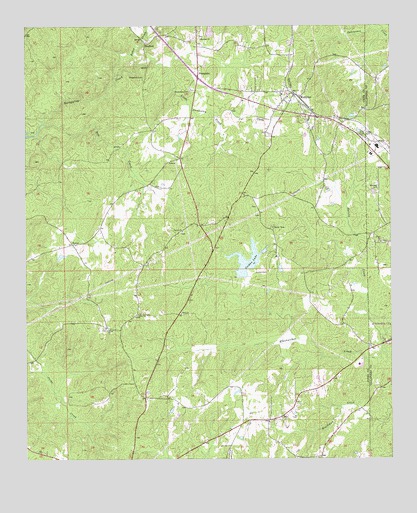
Kellyton, AL USGS Topographic Map
Click on map above to begin viewing in our Map Viewer.

This topographic map contains these locations and features:
Feature Name Type Latitude Longitude GNIS ID View Map
Alexander City Work Release CenterBuildingN32.9021°W86.0111°163394View Map
Ann Jordan Lake DamDamN32.9268°W86.0500°131103View Map
Ann Jordan Resort AreaParkN32.9371°W86.0416°135652View Map
Baker CreekStreamN32.9848°W86.0952°159103View Map
Bow CreekStreamN32.9721°W86.1186°114767View Map
BradfordPopulated PlaceN32.9948°W86.0850°156105View Map
Bradford CemeteryCemeteryN32.9968°W86.0647°135665View Map
Bradford Methodist ChurchChurchN32.9965°W86.0666°114807View Map
Brooks Farm PondReservoirN32.9618°W86.0700°131111View Map
Brooks Farm Pond DamDamN32.9618°W86.0700°131112View Map
Cat CreekStreamN32.9743°W86.0614°155012View Map
Chapman CemeteryCemeteryN32.9857°W86.0858°115962View Map
Corinth ChurchChurchN32.9407°W86.0722°116634View Map
Doctor Kellys Private CemeteryCemeteryN32.9534°W86.0791°135675View Map
Dunnings PondReservoirN32.8870°W86.0360°135677View Map
Edward (historical)LocaleN32.9512°W86.0500°163175View Map
Elem ChurchChurchN32.9171°W86.0727°117915View Map
Elem ChurchChurchN32.9168°W86.0869°164049View Map
Goodwater-Kellyton DivisionCivilN32.9944°W86.0754°165720View Map
Hallmans LakeReservoirN32.9465°W86.1139°135685View Map
Harold CreekStreamN32.9057°W86.0016°119765View Map
Holdridge PondReservoirN32.9525°W86.0212°135690View Map
JonPopulated PlaceN32.8940°W86.0311°135709View Map
Jones PondReservoirN32.8885°W86.0758°135695View Map
Jordan CemeteryCemeteryN32.9287°W86.0430°151923View Map
Jordan LakeReservoirN32.9320°W86.0493°121052View Map
KellytonPopulated PlaceN32.9798°W86.0336°121129View Map
Kellyton Baptist ChurchChurchN32.9793°W86.0350°135696View Map
Kellyton CemeteryCemeteryN32.9723°W86.0289°135697View Map
Kellyton ChurchChurchN32.9976°W86.0769°163402View Map
Kellyton Emmanuel Holiness ChurchChurchN32.9704°W86.0277°135698View Map
Kellyton Junior High SchoolSchoolN32.9801°W86.0369°135699View Map
Kellyton Methodist ChurchChurchN32.9771°W86.0308°164173View Map
Kellyton Post OfficePost OfficeN32.9795°W86.0332°168297View Map
Kellyton United Methodist ChurchChurchN32.9826°W86.0358°135700View Map
Kellyton Volunteer Fire and RescueBuildingN32.9802°W86.0332°2691270View Map
KeynoPopulated PlaceN32.9371°W86.1091°121177View Map
Little Socapatoy CreekStreamN32.9893°W86.0791°121893View Map
Marja School (historical)SchoolN32.9335°W86.0391°135706View Map
Maxwell CemeteryCemeteryN32.9537°W86.0044°122405View Map
Memorial Gardens CemeteryCemeteryN32.9704°W86.0291°135707View Map
New Elam Number 1 Baptist ChurchChurchN32.9376°W86.0036°149956View Map
New Shiloh CemeteryCemeteryN32.9123°W86.0977°135714View Map
Nibletts PondReservoirN32.9739°W86.0133°135715View Map
RayPopulated PlaceN32.8873°W86.0377°125452View Map
Ray Baptist ChurchChurchN32.8857°W86.0422°135728View Map
Ray Census Designated PlaceCensusN32.8790°W86.0350°2582695View Map
Ray Community CenterBuildingN32.8840°W86.0419°135729View Map
Ray Community Volunteer Fire DepartmentBuildingN32.8852°W86.0420°2691453View Map
Shiloh Baptist ChurchChurchN32.9123°W86.0975°153421View Map
SocapatoyPopulated PlaceN32.9865°W86.0672°158087View Map
Socapatoy CemeteryCemeteryN32.9815°W86.0700°127089View Map
Socapatoy ChurchChurchN32.9848°W86.0664°135736View Map
Swan LakeReservoirN32.9697°W86.0108°135739View Map
Town of KellytonCivilN32.9791°W86.0358°2405933View Map
Walls LakeReservoirN32.9985°W86.0615°131135View Map
Walls Lake DamDamN32.9968°W86.0616°131134View Map

Note: Coordinates in the location and feature list above are referenced to NAD83 datum.


Copyright (C) 2008-2025 Ryan Niemi / Sunset Dynamics ... All Rights Reserved