TopoQuest Logo
Do you find TopoQuest useful?
Help keep TopoQuest running and adding new maps/features by donating!
Bitcoin:  19c7KJd3qBynnjoSw5npx9KScwjBe4ifkT
Litecoin:  LXs6TkuXGGXo1vDsWCkWVdjQX94eUKd6ui
Home View Maps Find Maps Find Places Resources & Links


Rockford SW, Alabama Topographic Map

USGS Map Title: Rockford SW, AL
USGS Map MRC: 32086G2
DRG (GeoTIFF) Download: o32086g2.tif


Neighboring USGS Topographic Map Quads:


  Flag Mountain, AL  
32086H3
 

  Rockford, AL  
32086H2
 

  Kellyton, AL  
32086H1
 

  Richville, AL  
32086G3
 

  Rockford SW, AL  
32086G2
 

  Equality, AL  
32086G1
 

  Holtville, AL  
32086F3
 

  Dexter, AL  
32086F2
 

  Eclectic, AL  
32086F1


Map MRC Location:

N33°
W87°
N33°
W86°
H8 H7 H6 H5 H4 H3 H2 H1
G8 G7 G6 G5 G4 G3 G2 G1
F8 F7 F6 F5 F4 F3 F2 F1
E8 E7 E6 E5 E4 E3 E2 E1
D8 D7 D6 D5 D4 D3 D2 D1
C8 C7 C6 C5 C4 C3 C2 C1
B8 B7 B6 B5 B4 B3 B2 B1
A8 A7 A6 A5 A4 A3 A2 A1
N32°
W87°
N32°
W86°

Rockford SW, AL USGS 1:24K Topographic Map Preview:
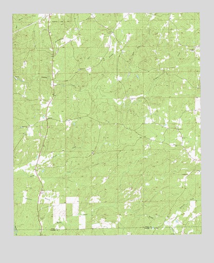
Rockford SW, AL USGS Topographic Map
Click on map above to begin viewing in our Map Viewer.

This topographic map contains these locations and features:
Feature Name Type Latitude Longitude GNIS ID View Map
Bethesda CreekStreamN32.7571°W86.1469°114106View Map
Concord Baptist ChurchChurchN32.7962°W86.1969°116493View Map
Concord CemeteryCemeteryN32.7965°W86.1991°135671View Map
Flat BranchStreamN32.8382°W86.2250°118366View Map
Hachemedega CreekStreamN32.8398°W86.2261°157978View Map
Lindsey CemeteryCemeteryN32.7837°W86.1330°152073View Map
Little Sam Jack CreekStreamN32.8332°W86.1930°121875View Map
Lybrand CreekStreamN32.7857°W86.2425°122112View Map
Mount Nebo ChurchChurchN32.7598°W86.2322°123271View Map
New Life ChurchChurchN32.7915°W86.1266°163405View Map
PentonvillePopulated PlaceN32.8157°W86.2277°156870View Map
Pinthlocco (historical)Populated PlaceN32.8390°W86.2111°157804View Map
Pleasant Hill Methodist ChurchChurchN32.8432°W86.2058°152996View Map
Rehobeth CemeteryCemeteryN32.8087°W86.1402°135730View Map
Rehobeth Methodist ChurchChurchN32.8096°W86.1397°153132View Map
Rockford DivisionCivilN32.8339°W86.2060°165721View Map
Shady Grove Baptist ChurchChurchN32.8112°W86.2402°153384View Map
Shady Grove CemeteryCemeteryN32.8118°W86.2400°135734View Map
SpeedPopulated PlaceN32.7748°W86.2319°157090View Map
Swift Creek Hunting ClubLocaleN32.8096°W86.1750°135740View Map
The Baptist Temple ChurchChurchN32.7918°W86.1294°135742View Map
Thomas MineMineN32.8146°W86.1350°157679View Map
Union Academy (historical)SchoolN32.8021°W86.1519°135743View Map
Union CemeteryCemeteryN32.8643°W86.1841°135744View Map
Union Presbyterian ChurchChurchN32.8643°W86.1836°153764View Map

Note: Coordinates in the location and feature list above are referenced to NAD83 datum.


Copyright (C) 2008-2025 Ryan Niemi / Sunset Dynamics ... All Rights Reserved