TopoQuest Logo
Do you find TopoQuest useful?
Help keep TopoQuest running and adding new maps/features by donating!
Bitcoin:  19c7KJd3qBynnjoSw5npx9KScwjBe4ifkT
Litecoin:  LXs6TkuXGGXo1vDsWCkWVdjQX94eUKd6ui
Home View Maps Find Maps Find Places Resources & Links


Our Town, Alabama Topographic Map

USGS Map Title: Our Town, AL
USGS Map MRC: 32085G8
DRG (GeoTIFF) Download: o32085g8.tif


Neighboring USGS Topographic Map Quads:


  Kellyton, AL  
32086H1
 

  Alexander City, AL  
32085H8
 

  Jacksons Gap, AL  
32085H7
 

  Equality, AL  
32086G1
 

  Our Town, AL  
32085G8
 

  Dadeville, AL  
32085G7
 

  Eclectic, AL  
32086F1
 

  Red Hill, AL  
32085F8
 

  Ponders, AL  
32085F7


Map MRC Location:

N33°
W86°
N33°
W85°
H8 H7 H6 H5 H4 H3 H2 H1
G8 G7 G6 G5 G4 G3 G2 G1
F8 F7 F6 F5 F4 F3 F2 F1
E8 E7 E6 E5 E4 E3 E2 E1
D8 D7 D6 D5 D4 D3 D2 D1
C8 C7 C6 C5 C4 C3 C2 C1
B8 B7 B6 B5 B4 B3 B2 B1
A8 A7 A6 A5 A4 A3 A2 A1
N32°
W86°
N32°
W85°

Our Town, AL USGS 1:24K Topographic Map Preview:
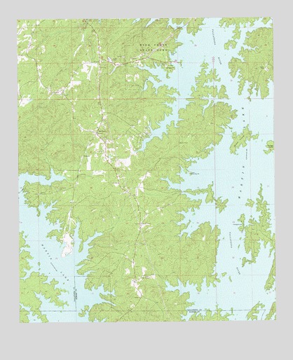
Our Town, AL USGS Topographic Map
Click on map above to begin viewing in our Map Viewer.

This topographic map contains these locations and features:
Feature Name Type Latitude Longitude GNIS ID View Map
Alkehatchee (historical)Populated PlaceN32.8668°W85.9097°158380View Map
Benson (historical)Populated PlaceN32.7643°W85.8772°163199View Map
Benson ChurchChurchN32.7601°W85.9402°113932View Map
Benson School (historical)SchoolN32.7687°W85.9408°158679View Map
BulgersPopulated PlaceN32.8187°W85.9680°158802View Map
Camp AlamiscoLocaleN32.7632°W85.9436°137378View Map
Dyke (historical)Populated PlaceN32.8007°W85.9722°137408View Map
Elkahatchee CreekStreamN32.8662°W85.9164°158823View Map
Friendship Baptist Church (historical)ChurchN32.8046°W85.9802°158693View Map
Friendship CemeteryCemeteryN32.8046°W85.9808°118655View Map
Island Home (historical)Populated PlaceN32.8496°W85.9080°137461View Map
Liberty Baptist ChurchChurchN32.8035°W85.9894°152040View Map
Liberty CemeteryCemeteryN32.8032°W85.9900°137468View Map
Mask CemeteryCemeteryN32.8076°W85.9505°122356View Map
Mount Pleasant ChurchChurchN32.7601°W85.9402°152495View Map
Mount ZionPopulated PlaceN32.8590°W85.9597°158700View Map
Mount Zion Baptist ChurchChurchN32.8576°W85.9594°152527View Map
Mount Zion CemeteryCemeteryN32.8579°W85.9583°137480View Map
Mount Zion CemeteryCemeteryN32.8240°W85.9213°123425View Map
Mount Zion ChurchChurchN32.8257°W85.9577°137481View Map
New Hope Baptist ChurchChurchN32.8112°W85.9155°158885View Map
New Hope CemeteryCemeteryN32.8112°W85.9158°158701View Map
Our TownPopulated PlaceN32.8282°W85.9619°158894View Map
Our Town - Willow Point Volunteer Fire DepartmentBuildingN32.8280°W85.9621°2691422View Map
Our Town Census Designated PlaceCensusN32.8305°W85.9686°2582692View Map
Ourtown School (historical)SchoolN32.8287°W85.9630°158705View Map
Pine Point MarinaLocaleN32.8051°W85.9983°137500View Map
Piney Woods MarinaLocaleN32.8679°W85.9136°137502View Map
Pleasant Point MarinaLocaleN32.7912°W85.9772°137503View Map
Robert Alston Russell BridgeBridgeN32.8715°W85.9191°137516View Map
Robinson Ferry (historical)CrossingN32.7535°W85.8913°158988View Map
Rover (historical)Populated PlaceN32.7954°W85.9383°137514View Map
Russell Farm ChurchChurchN32.7907°W85.9402°153229View Map
Russell Ferry EstatesPopulated PlaceN32.8737°W85.8786°137515View Map
Walker Ferry (historical)CrossingN32.8607°W85.9055°158996View Map
Willow Point AirportAirportN32.8020°W85.9839°2676326View Map
Willow Point Country ClubLocaleN32.7873°W85.8914°137555View Map
Willow Point Volunteer Fire DepartmentBuildingN32.7970°W85.9758°2691281View Map
Wind CreekStreamN32.8640°W85.9052°137556View Map
Wind Creek FarmsPopulated PlaceN32.8262°W85.9414°137557View Map
Wind Creek State ParkParkN32.8632°W85.9339°129108View Map
Windermere Volunteer Fire DepartmentBuildingN32.7515°W85.9043°2691169View Map
Woods IslandIslandN32.8248°W85.8908°129214View Map
Youngs IslandIslandN32.8221°W85.8766°129318View Map

Note: Coordinates in the location and feature list above are referenced to NAD83 datum.


Copyright (C) 2008-2025 Ryan Niemi / Sunset Dynamics ... All Rights Reserved