TopoQuest Logo
Do you find TopoQuest useful?
Help keep TopoQuest running and adding new maps/features by donating!
Bitcoin:  19c7KJd3qBynnjoSw5npx9KScwjBe4ifkT
Litecoin:  LXs6TkuXGGXo1vDsWCkWVdjQX94eUKd6ui
Home View Maps Find Maps Find Places Resources & Links


Keltner, Missouri Topographic Map

USGS Map Title: Keltner, MO
USGS Map MRC: 36092H8
DRG (GeoTIFF) Download: o36092h8.tif


Neighboring USGS Topographic Map Quads:


  Rogersville, MO  
37093A1
 

  Bruner, MO  
37092A8
 

  Dogwood, MO  
37092A7
 

  Chadwick, MO  
36093H1
 

  Keltner, MO  
36092H8
 

  Goodhope, MO  
36092H7
 

  Garrison, MO  
36093G1
 

  Bradleyville, MO  
36092G8
 

  Brownbranch, MO  
36092G7


Map MRC Location:

N37°
W93°
N37°
W92°
H8 H7 H6 H5 H4 H3 H2 H1
G8 G7 G6 G5 G4 G3 G2 G1
F8 F7 F6 F5 F4 F3 F2 F1
E8 E7 E6 E5 E4 E3 E2 E1
D8 D7 D6 D5 D4 D3 D2 D1
C8 C7 C6 C5 C4 C3 C2 C1
B8 B7 B6 B5 B4 B3 B2 B1
A8 A7 A6 A5 A4 A3 A2 A1
N36°
W93°
N36°
W92°

Keltner, MO USGS 1:24K Topographic Map Preview:
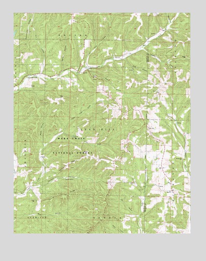
Keltner, MO USGS Topographic Map
Click on map above to begin viewing in our Map Viewer.

This topographic map contains these locations and features:
Feature Name Type Latitude Longitude GNIS ID View Map
Bill HollowValleyN36.8842°W92.9118°753513View Map
Board HollowValleyN36.9245°W92.9799°748945View Map
Boulder Fork CemeteryCemeteryN36.9173°W92.8807°753509View Map
Buck BranchStreamN36.9745°W92.9216°749080View Map
Gray CemeteryCemeteryN36.9217°W92.9507°753512View Map
Hall CemeteryCemeteryN36.9884°W92.8999°753504View Map
Hall CemeteryCemeteryN36.9123°W92.8954°753510View Map
Hall SchoolSchoolN36.9914°W92.8913°750198View Map
Harmon HollowValleyN36.9009°W92.9882°750232View Map
Harmon RidgeRidgeN36.9156°W92.9596°750233View Map
Harmon SpringSpringN36.9056°W92.9631°750234View Map
Harvill CemeteryCemeteryN36.9750°W92.9288°753507View Map
High Lonesome SchoolSchoolN36.9564°W92.8963°750315View Map
Honey BranchStreamN36.9942°W92.8896°738449View Map
KeltnerPopulated PlaceN36.9689°W92.9482°750583View Map
Lead Hill School (historical)SchoolN36.9167°W92.9321°750669View Map
Little Cedar CreekStreamN36.9323°W92.9649°750746View Map
Lost CreekStreamN36.9637°W92.9832°750862View Map
Loving RidgeRidgeN36.8976°W92.9624°750871View Map
Maggard CemeteryCemeteryN36.9750°W92.8782°753505View Map
Marshfield RidgeRidgeN36.9895°W92.9888°750945View Map
Mound ChurchChurchN36.9034°W92.8891°753511View Map
Mound SchoolSchoolN36.9031°W92.8882°751168View Map
Mount Olive ChurchChurchN36.9556°W92.8982°753506View Map
Nance HollowValleyN36.9673°W92.9652°751257View Map
Old MerrittPopulated PlaceN36.8998°W92.8874°751422View Map
OngoPopulated PlaceN36.9906°W92.8941°751435View Map
Peters BranchStreamN36.9695°W92.9482°751568View Map
Punching CreekStreamN36.9789°W92.9105°751775View Map
Sugar Camp CreekStreamN36.9695°W92.9491°752410View Map
Tater HillSummitN36.8939°W92.9852°752494View Map
Township of Lead HillCivilN36.9338°W92.9426°766477View Map
Turnip KnobSummitN36.9578°W92.9805°752629View Map
Union Hill ChurchChurchN36.9662°W92.9510°753508View Map
Union Hill SchoolSchoolN36.9670°W92.9549°752663View Map
Walnut Grove SchoolSchoolN36.9203°W92.9932°752744View Map

Note: Coordinates in the location and feature list above are referenced to NAD83 datum.


Copyright (C) 2008-2024 Ryan Niemi / Sunset Dynamics ... All Rights Reserved