TopoQuest Logo
Do you find TopoQuest useful?
Help keep TopoQuest running and adding new maps/features by donating!
Bitcoin:  19c7KJd3qBynnjoSw5npx9KScwjBe4ifkT
Litecoin:  LXs6TkuXGGXo1vDsWCkWVdjQX94eUKd6ui
Home View Maps Find Maps Find Places Resources & Links


Goodhope, Missouri Topographic Map

USGS Map Title: Goodhope, MO
USGS Map MRC: 36092H7
DRG (GeoTIFF) Download: o36092h7.tif


Neighboring USGS Topographic Map Quads:


  Bruner, MO  
37092A8
 

  Dogwood, MO  
37092A7
 

  Cedar Gap, MO  
37092A6
 

  Keltner, MO  
36092H8
 

  Goodhope, MO  
36092H7
 

  Ava, MO  
36092H6
 

  Bradleyville, MO  
36092G8
 

  Brownbranch, MO  
36092G7
 

  Smallett, MO  
36092G6


Map MRC Location:

N37°
W93°
N37°
W92°
H8 H7 H6 H5 H4 H3 H2 H1
G8 G7 G6 G5 G4 G3 G2 G1
F8 F7 F6 F5 F4 F3 F2 F1
E8 E7 E6 E5 E4 E3 E2 E1
D8 D7 D6 D5 D4 D3 D2 D1
C8 C7 C6 C5 C4 C3 C2 C1
B8 B7 B6 B5 B4 B3 B2 B1
A8 A7 A6 A5 A4 A3 A2 A1
N36°
W93°
N36°
W92°

Goodhope, MO USGS 1:24K Topographic Map Preview:
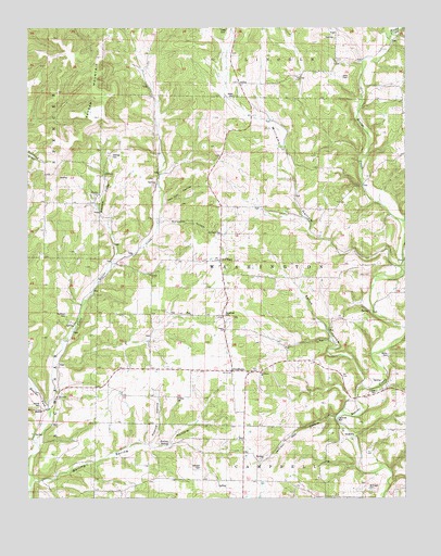
Goodhope, MO USGS Topographic Map
Click on map above to begin viewing in our Map Viewer.

This topographic map contains these locations and features:
Feature Name Type Latitude Longitude GNIS ID View Map
ArdenPopulated PlaceN36.9853°W92.8046°740632View Map
Arden CemeteryCemeteryN36.9820°W92.8066°743023View Map
Arden School (historical)SchoolN36.9870°W92.8038°733869View Map
Boiling Spring HollowValleyN36.8795°W92.8732°714490View Map
Boiling Spring SchoolSchoolN36.8898°W92.8274°714491View Map
Boulder ForkStreamN36.8995°W92.8680°748971View Map
Breeden ChurchChurchN36.9559°W92.8516°743030View Map
Breeden CreekStreamN36.9398°W92.8449°714665View Map
Breeden SchoolSchoolN36.9534°W92.8521°714666View Map
Butler CemeteryCemeteryN36.9131°W92.7557°743020View Map
Capp CemeteryCemeteryN36.9334°W92.8641°1890884View Map
Cox CemeteryCemeteryN36.9034°W92.7616°743019View Map
Daily CemeteryCemeteryN36.9870°W92.7713°743021View Map
Eslick HollowValleyN36.9053°W92.7635°717627View Map
Flatrock School (historical)SchoolN36.9612°W92.7868°718003View Map
Fox Den HollowValleyN36.9537°W92.8296°718146View Map
Freeport SchoolSchoolN36.8759°W92.7743°735623View Map
GoodhopePopulated PlaceN36.9089°W92.8077°718562View Map
Goodhope CemeteryCemeteryN36.9237°W92.8102°743025View Map
Goodhope ChurchChurchN36.9084°W92.7982°743027View Map
Goodhope Fire DepartmentBuildingN36.9084°W92.8033°2621371View Map
Goodhope School (historical)SchoolN36.9198°W92.8085°718563View Map
Hedrick HollowValleyN36.8889°W92.8329°719339View Map
Herrell CemeteryCemeteryN36.8995°W92.8713°743029View Map
Honey CreekStreamN36.9984°W92.7552°719755View Map
Huffman CemeteryCemeteryN36.9239°W92.8624°719961View Map
Jackson MillPopulated PlaceN36.8973°W92.7735°740960View Map
Jackson Mill HollowValleyN36.8962°W92.7716°720218View Map
Jacksons Mill (historical)LocaleN36.8970°W92.7749°733870View Map
Jenkins CemeteryCemeteryN36.9020°W92.8254°720290View Map
Johnson CemeteryCemeteryN36.8834°W92.8179°743028View Map
Keyger MountainSummitN36.9923°W92.8507°738448View Map
Lakey CemeteryCemeteryN36.9995°W92.8116°743022View Map
Liberty School (historical)SchoolN36.8803°W92.8716°735691View Map
McKnight CemeteryCemeteryN36.8773°W92.7618°743018View Map
MerrittPopulated PlaceN36.8987°W92.8693°722242View Map
Pleasant Green SchoolSchoolN36.9989°W92.7716°724476View Map
Red BankPopulated PlaceN36.9384°W92.8107°735818View Map
Red Bank ChurchChurchN36.9456°W92.8116°743024View Map
RoyPopulated PlaceN36.8903°W92.8038°725641View Map
Sixteenth HollowValleyN36.9478°W92.8313°726501View Map
Stillings CemeteryCemeteryN36.9659°W92.8471°743031View Map
Township of WashingtonCivilN36.9379°W92.7974°766633View Map
Union ChurchChurchN36.9198°W92.8104°743026View Map
Whiteoak School (historical)SchoolN36.9184°W92.8607°735911View Map
Williams HollowValleyN36.9376°W92.7541°728898View Map

Note: Coordinates in the location and feature list above are referenced to NAD83 datum.


Copyright (C) 2008-2025 Ryan Niemi / Sunset Dynamics ... All Rights Reserved