TopoQuest Logo
Do you find TopoQuest useful?
Help keep TopoQuest running and adding new maps/features by donating!
Bitcoin:  19c7KJd3qBynnjoSw5npx9KScwjBe4ifkT
Litecoin:  LXs6TkuXGGXo1vDsWCkWVdjQX94eUKd6ui
Home View Maps Find Maps Find Places Resources & Links


Kennedy, New York Topographic Map

USGS Map Title: Kennedy, NY
USGS Map MRC: 42079B1
DRG (GeoTIFF) Download: o42079b1.tif


Neighboring USGS Topographic Map Quads:


  Hamlet, NY  
42079C2
 

  Cherry Creek, NY  
42079C1
 

  New Albion, NY  
42078C8
 

  Gerry, NY  
42079B2
 

  Kennedy, NY  
42079B1
 

  Randolph, NY  
42078B8
 

  Jamestown, NY  
42079A2
 

  Ivory, NY  
42079A1
 

  Steamburg, NY  
42078A8


Map MRC Location:

N43°
W80°
N43°
W79°
H8 H7 H6 H5 H4 H3 H2 H1
G8 G7 G6 G5 G4 G3 G2 G1
F8 F7 F6 F5 F4 F3 F2 F1
E8 E7 E6 E5 E4 E3 E2 E1
D8 D7 D6 D5 D4 D3 D2 D1
C8 C7 C6 C5 C4 C3 C2 C1
B8 B7 B6 B5 B4 B3 B2 B1
A8 A7 A6 A5 A4 A3 A2 A1
N42°
W80°
N42°
W79°

Kennedy, NY USGS 1:24K Topographic Map Preview:
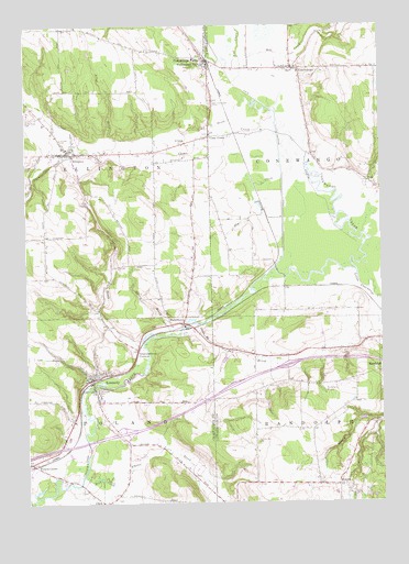
Kennedy, NY USGS Topographic Map
Click on map above to begin viewing in our Map Viewer.

This topographic map contains these locations and features:
Feature Name Type Latitude Longitude GNIS ID View Map
Abers AcresLocaleN42.1456°W79.1117°2516305View Map
Allen BrookStreamN42.2317°W79.0462°942347View Map
Beavers Dairy FarmLocaleN42.1653°W79.0464°2516359View Map
BowenPopulated PlaceN42.1295°W79.0153°944505View Map
Campbell FieldAirportN42.1554°W79.0147°978251View Map
Clear CreekStreamN42.2276°W79.0378°970009View Map
Clear CreekPopulated PlaceN42.2209°W79.0603°946812View Map
ConewangoPopulated PlaceN42.2387°W79.0312°947267View Map
Conewango Fire DepartmentBuildingN42.2397°W79.0287°2735034View Map
Conewango ValleyPopulated PlaceN42.2409°W79.0609°947269View Map
Conewango Valley Post OfficePost OfficeN42.2384°W79.0598°2598447View Map
Davis BrookStreamN42.1720°W79.0653°948054View Map
Dry BrookStreamN42.1653°W79.0548°948673View Map
Elkins BrookStreamN42.1309°W79.0962°949501View Map
EllingtonPopulated PlaceN42.2167°W79.1078°949516View Map
Ellington Congregational ChurchChurchN42.2174°W79.1100°2615872View Map
Ellington Fire DepartmentBuildingN42.2164°W79.1096°2700796View Map
Ellington United Methodist ChurchChurchN42.2168°W79.1104°2615873View Map
Farman Free LibraryBuildingN42.2176°W79.1093°2617272View Map
Fly CreekStreamN42.2098°W79.0345°950330View Map
Harris BrookStreamN42.1689°W79.0739°952259View Map
Indian BrookStreamN42.1653°W79.0831°953625View Map
KennedyPopulated PlaceN42.1573°W79.1020°954501View Map
Kennedy Baptist ChurchChurchN42.1582°W79.1002°2616553View Map
Kennedy Census Designated PlaceCensusN42.1589°W79.0983°2628170View Map
Kennedy Fire DepartmentBuildingN42.1579°W79.1022°2701082View Map
Kennedy First United Methodist ChurchChurchN42.1584°W79.1008°2616554View Map
Kennedy Free LibraryBuildingN42.1584°W79.1009°2617324View Map
Kennedy Post OfficePost OfficeN42.1587°W79.1010°2617987View Map
Little Clear Creek CemeteryCemeteryN42.2290°W79.0583°955492View Map
Little Conewango CreekStreamN42.1853°W79.0087°955499View Map
Mill CreekStreamN42.2401°W79.0487°957223View Map
Mud CreekStreamN42.1295°W79.1087°958003View Map
Mud CreekStreamN42.2351°W79.0517°958004View Map
Myrtle CemeteryCemeteryN42.1264°W79.0937°2554270View Map
Ormond FarmLocaleN42.1344°W79.0733°2516358View Map
Paul B D Temple Elementary SchoolSchoolN42.1523°W79.0980°2668889View Map
Pioneer CemeteryCemeteryN42.2203°W79.1125°960612View Map
Poland CenterPopulated PlaceN42.1353°W79.1239°960851View Map
PopePopulated PlaceN42.2092°W79.0048°960923View Map
Pope Haven CampgroundLocaleN42.2106°W79.0005°2598246View Map
Riverside CemeteryCemeteryN42.1550°W79.0992°962578View Map
Rutledge Rural CemeteryCemeteryN42.2390°W79.0265°2554916View Map
Sample Hill CemeteryCemeteryN42.1408°W79.0443°964346View Map
Schermerhorn CornersLocaleN42.1651°W79.0862°964578View Map
Town of ConewangoCivilN42.2167°W79.0014°978860View Map
Town of EllingtonCivilN42.2170°W79.1194°978935View Map
Town of PolandCivilN42.1300°W79.1191°979381View Map
Town of RandolphCivilN42.1293°W79.0009°979407View Map
Twentyeighth CreekStreamN42.2148°W79.0989°968025View Map
WaterboroPopulated PlaceN42.1720°W79.0698°973204View Map

Note: Coordinates in the location and feature list above are referenced to NAD83 datum.


Copyright (C) 2008-2025 Ryan Niemi / Sunset Dynamics ... All Rights Reserved