TopoQuest Logo
Do you find TopoQuest useful?
Help keep TopoQuest running and adding new maps/features by donating!
Bitcoin:  19c7KJd3qBynnjoSw5npx9KScwjBe4ifkT
Litecoin:  LXs6TkuXGGXo1vDsWCkWVdjQX94eUKd6ui
Home View Maps Find Maps Find Places Resources & Links


Ketchum, Oklahoma Topographic Map

USGS Map Title: Ketchum, OK
USGS Map MRC: 36095E1
DRG (GeoTIFF) Download: o36095e1.tif


Neighboring USGS Topographic Map Quads:


  Vinita, OK  
36095F2
 

  Vinita NE, OK  
36095F1
 

  Afton, OK  
36094F8
 

  Big Cabin, OK  
36095E2
 

  Ketchum, OK  
36095E1
 

  Bernice, OK  
36094E8
 

  Strang, OK  
36095D2
 

  Spavinaw, OK  
36095D1
 

  Chloeta, OK  
36094D8


Map MRC Location:

N37°
W96°
N37°
W95°
H8 H7 H6 H5 H4 H3 H2 H1
G8 G7 G6 G5 G4 G3 G2 G1
F8 F7 F6 F5 F4 F3 F2 F1
E8 E7 E6 E5 E4 E3 E2 E1
D8 D7 D6 D5 D4 D3 D2 D1
C8 C7 C6 C5 C4 C3 C2 C1
B8 B7 B6 B5 B4 B3 B2 B1
A8 A7 A6 A5 A4 A3 A2 A1
N36°
W96°
N36°
W95°

Ketchum, OK USGS 1:24K Topographic Map Preview:
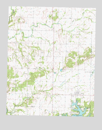
Ketchum, OK USGS Topographic Map
Click on map above to begin viewing in our Map Viewer.

This topographic map contains these locations and features:
Feature Name Type Latitude Longitude GNIS ID View Map
Carselowey CemeteryCemeteryN36.5292°W95.1144°1090997View Map
Carselowey Community Fire DepartmentBuildingN36.5309°W95.1128°2656821View Map
Foursquare Gospel ChurchChurchN36.5320°W95.1130°1093000View Map
Grand Lake TownePopulated PlaceN36.5042°W95.0225°1100458View Map
KetchumPopulated PlaceN36.5245°W95.0239°1094351View Map
Ketchum CemeteryCemeteryN36.5242°W95.0172°2710131View Map
Ketchum CommunityCivilN36.5041°W95.0526°2631119View Map
Ketchum Elementary SchoolSchoolN36.5270°W95.0233°1803537View Map
Ketchum Emergency Medical ServicesBuildingN36.5242°W95.0185°2695960View Map
Ketchum Fire DepartmentBuildingN36.5249°W95.0243°2657108View Map
Ketchum High SchoolSchoolN36.5260°W95.0177°1790381View Map
Ketchum Middle SchoolSchoolN36.5248°W95.0229°1790496View Map
KITO-FM (Vinita)TowerN36.5823°W95.0266°1102829View Map
OkoeePopulated PlaceN36.5187°W95.0947°1100690View Map
Old Ketchum CemeteryCemeteryN36.5481°W95.0966°1096241View Map
South Grand Lake Regional AirportAirportN36.5428°W95.0153°1102522View Map
SuccessPopulated PlaceN36.6129°W95.0350°1100861View Map
Town of Grand Lake TowneCivilN36.5048°W95.0255°2412702View Map
Town of KetchumCivilN36.5106°W95.0418°2412829View Map
Vinita WaterworksLocaleN36.5479°W95.0927°1102099View Map

Note: Coordinates in the location and feature list above are referenced to NAD83 datum.


Copyright (C) 2008-2025 Ryan Niemi / Sunset Dynamics ... All Rights Reserved