TopoQuest Logo
Do you find TopoQuest useful?
Help keep TopoQuest running and adding new maps/features by donating!
Bitcoin:  19c7KJd3qBynnjoSw5npx9KScwjBe4ifkT
Litecoin:  LXs6TkuXGGXo1vDsWCkWVdjQX94eUKd6ui
Home View Maps Find Maps Find Places Resources & Links


Vinita NE, Oklahoma Topographic Map

USGS Map Title: Vinita NE, OK
USGS Map MRC: 36095F1
DRG (GeoTIFF) Download: o36095f1.tif


Neighboring USGS Topographic Map Quads:


  Pyramid Corners, OK  
36095G2
 

  Welch South, OK  
36095G1
 

  Miami SW, OK  
36094G8
 

  Vinita, OK  
36095F2
 

  Vinita NE, OK  
36095F1
 

  Afton, OK  
36094F8
 

  Big Cabin, OK  
36095E2
 

  Ketchum, OK  
36095E1
 

  Bernice, OK  
36094E8


Map MRC Location:

N37°
W96°
N37°
W95°
H8 H7 H6 H5 H4 H3 H2 H1
G8 G7 G6 G5 G4 G3 G2 G1
F8 F7 F6 F5 F4 F3 F2 F1
E8 E7 E6 E5 E4 E3 E2 E1
D8 D7 D6 D5 D4 D3 D2 D1
C8 C7 C6 C5 C4 C3 C2 C1
B8 B7 B6 B5 B4 B3 B2 B1
A8 A7 A6 A5 A4 A3 A2 A1
N36°
W96°
N36°
W95°

Vinita NE, OK USGS 1:24K Topographic Map Preview:
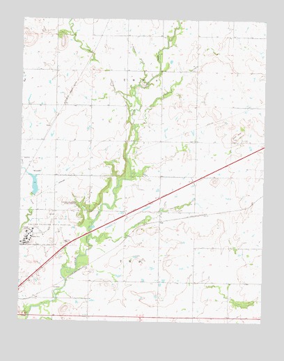
Vinita NE, OK USGS Topographic Map
Click on map above to begin viewing in our Map Viewer.

This topographic map contains these locations and features:
Feature Name Type Latitude Longitude GNIS ID View Map
Bull LakeReservoirN36.6813°W95.1182°1758781View Map
Carter ChurchChurchN36.7001°W95.0355°1091004View Map
Coal CreekStreamN36.7051°W95.0666°1091508View Map
CornatzarPopulated PlaceN36.6390°W95.1077°1100323View Map
Craig HeliportAirportN36.6501°W95.1169°1102721View Map
Eastern Oklahoma Hospital DamDamN36.6774°W95.1193°1758780View Map
Eastern State Hospital CemeteryCemeteryN36.6567°W95.1083°2710130View Map
Goat HillSummitN36.7012°W95.0158°1093218View Map
Jones CreekStreamN36.7126°W95.0666°1094263View Map
KelsoPopulated PlaceN36.7056°W95.1100°1100548View Map
Oklahoma Forensic CenterBuildingN36.6562°W95.1245°2657532View Map
Possum BranchStreamN36.7229°W95.0650°1096848View Map
Shawnee CreekStreamN36.6604°W95.0886°1097968View Map
ToddPopulated PlaceN36.6667°W95.0533°1100890View Map
Township 7CivilN36.6501°W95.0683°1824545View Map
Township 9CivilN36.7251°W95.0683°1824547View Map
Vinita East DivisionCivilN36.6347°W95.0927°1937897View Map

Note: Coordinates in the location and feature list above are referenced to NAD83 datum.


Copyright (C) 2008-2025 Ryan Niemi / Sunset Dynamics ... All Rights Reserved