TopoQuest Logo
Do you find TopoQuest useful?
Help keep TopoQuest running and adding new maps/features by donating!
Bitcoin:  19c7KJd3qBynnjoSw5npx9KScwjBe4ifkT
Litecoin:  LXs6TkuXGGXo1vDsWCkWVdjQX94eUKd6ui
Home View Maps Find Maps Find Places Resources & Links


Keys Creek, Oregon Topographic Map

USGS Map Title: Keys Creek, OR
USGS Map MRC: 44120C1
DRG (GeoTIFF) Download: o44120c1.tif


Neighboring USGS Topographic Map Quads:


  Mount Pisgah, OR  
44120D2
 

  Peterson Point, OR  
44120D1
 

  Derr Meadows, OR  
44119D8
 

  Williams Prairie, OR  
44120C2
 

  Keys Creek, OR  
44120C1
 

  Little Summit Prairie, OR  
44119C8
 

  Committee Creek, OR  
44120B2
 

  Rabbit Valley, OR  
44120B1
 

  Paulina, OR  
44119B8


Map MRC Location:

N45°
W121°
N45°
W120°
H8 H7 H6 H5 H4 H3 H2 H1
G8 G7 G6 G5 G4 G3 G2 G1
F8 F7 F6 F5 F4 F3 F2 F1
E8 E7 E6 E5 E4 E3 E2 E1
D8 D7 D6 D5 D4 D3 D2 D1
C8 C7 C6 C5 C4 C3 C2 C1
B8 B7 B6 B5 B4 B3 B2 B1
A8 A7 A6 A5 A4 A3 A2 A1
N44°
W121°
N44°
W120°

Keys Creek, OR USGS 1:24K Topographic Map Preview:
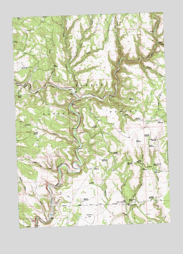
Keys Creek, OR USGS Topographic Map
Click on map above to begin viewing in our Map Viewer.

This topographic map contains these locations and features:
Feature Name Type Latitude Longitude GNIS ID View Map
Amber ReservoirReservoirN44.2958°W120.0166°1137183View Map
Bentonite ReservoirReservoirN44.3022°W120.0159°1137938View Map
Big Spring CreekStreamN44.3471°W120.0217°1138077View Map
Buck Hollow CreekStreamN44.3262°W120.0478°1138794View Map
Burnt Corral CreekStreamN44.2549°W120.0364°1138986View Map
Burnt Corral SpringSpringN44.2634°W120.0343°1138988View Map
Butler SpringSpringN44.3282°W120.1237°1139051View Map
Cary ReservoirReservoirN44.3743°W120.1220°1139412View Map
Charity ReservoirReservoirN44.2904°W120.1164°1160755View Map
Cinch ReservoirReservoirN44.3096°W120.1222°1160756View Map
Connell ReservoirReservoirN44.3532°W120.1239°1160757View Map
Crazy CreekStreamN44.3482°W120.0361°1140420View Map
Cross ReservoirReservoirN44.2987°W120.0275°1140480View Map
Crossroads ReservoirReservoirN44.2884°W120.0515°1140482View Map
Deep CreekStreamN44.3246°W120.0753°1140800View Map
Deep Creek Recreation SiteLocaleN44.3279°W120.0772°1140807View Map
Doe ReservoirReservoirN44.2823°W120.0231°1141119View Map
Donnelly CreekStreamN44.2996°W120.0744°1141183View Map
Donnelly SpringSpringN44.3066°W120.1116°1141184View Map
Dry ReservoirReservoirN44.3097°W120.0088°1141352View Map
East Burnt Log SpringSpringN44.2627°W120.0357°1141510View Map
Fawn ReservoirReservoirN44.2870°W120.0231°1142048View Map
Fir Tree SpringSpringN44.2749°W120.1233°1161184View Map
Flat ReservoirReservoirN44.2837°W120.0627°1142239View Map
Horseshoe ReservoirReservoirN44.2861°W120.0352°1143813View Map
Indian Creek ReservoirReservoirN44.2994°W120.0103°1144051View Map
Indian Spring ReservoirReservoirN44.2845°W120.0138°1144079View Map
Indian Trail CreekStreamN44.2532°W120.1022°1144083View Map
Jade ReservoirReservoirN44.2805°W120.0130°1144212View Map
Keys CreekStreamN44.3346°W120.0983°1144589View Map
Keys TroughsSpringN44.3451°W120.0931°1144590View Map
Lame Dog CreekStreamN44.2826°W120.0922°1144802View Map
Little Summit CreekStreamN44.3562°W120.0061°1145273View Map
Looney CreekStreamN44.3449°W120.0825°1145487View Map
Marble ReservoirReservoirN44.2922°W120.0424°1145801View Map
Market SpringSpringN44.3143°W120.0622°1160758View Map
Paulina ReservoirReservoirN44.2651°W120.0726°1147508View Map
Pine ReservoirReservoirN44.3137°W120.0594°1160759View Map
Porter CreekStreamN44.3293°W120.0786°1147907View Map
Roadside ReservoirReservoirN44.2648°W120.0139°1148513View Map
Sand SpringSpringN44.2613°W120.0005°1149047View Map
Shale ReservoirReservoirN44.3146°W120.0108°1160760View Map
Shown TroughsSpringN44.3240°W120.0315°1149449View Map
Stupid CreekStreamN44.3415°W120.0811°1150510View Map
Tansy ReservoirReservoirN44.2752°W120.0630°1150898View Map
Twin SpringsSpringN44.3083°W120.0592°1151590View Map
Twin Springs CampgroundLocaleN44.3082°W120.0594°1167635View Map
Twin Springs ReservoirReservoirN44.3082°W120.0580°1156718View Map
Upper FallsFallsN44.2550°W120.1005°1151675View Map
West Burnt Log SpringSpringN44.2631°W120.0370°1152035View Map

Note: Coordinates in the location and feature list above are referenced to NAD83 datum.


Copyright (C) 2008-2025 Ryan Niemi / Sunset Dynamics ... All Rights Reserved