TopoQuest Logo
Do you find TopoQuest useful?
Help keep TopoQuest running and adding new maps/features by donating!
Bitcoin:  19c7KJd3qBynnjoSw5npx9KScwjBe4ifkT
Litecoin:  LXs6TkuXGGXo1vDsWCkWVdjQX94eUKd6ui
Home View Maps Find Maps Find Places Resources & Links


Mount Pisgah, Oregon Topographic Map

USGS Map Title: Mount Pisgah, OR
USGS Map MRC: 44120D2
DRG (GeoTIFF) Download: o44120d2.tif


Neighboring USGS Topographic Map Quads:


  Lawson Mountain, OR  
44120E3
 

  Mitchell, OR  
44120E2
 

  Keyes Mountain, OR  
44120E1
 

  Ochoco Butte, OR  
44120D3
 

  Mount Pisgah, OR  
44120D2
 

  Peterson Point, OR  
44120D1
 

  Lookout Mountain, OR  
44120C3
 

  Williams Prairie, OR  
44120C2
 

  Keys Creek, OR  
44120C1


Map MRC Location:

N45°
W121°
N45°
W120°
H8 H7 H6 H5 H4 H3 H2 H1
G8 G7 G6 G5 G4 G3 G2 G1
F8 F7 F6 F5 F4 F3 F2 F1
E8 E7 E6 E5 E4 E3 E2 E1
D8 D7 D6 D5 D4 D3 D2 D1
C8 C7 C6 C5 C4 C3 C2 C1
B8 B7 B6 B5 B4 B3 B2 B1
A8 A7 A6 A5 A4 A3 A2 A1
N44°
W121°
N44°
W120°

Mount Pisgah, OR USGS 1:24K Topographic Map Preview:
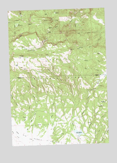
Mount Pisgah, OR USGS Topographic Map
Click on map above to begin viewing in our Map Viewer.

This topographic map contains these locations and features:
Feature Name Type Latitude Longitude GNIS ID View Map
Allen Creek DamDamN44.3819°W120.1655°1155511View Map
Allen Creek Horse CampLocaleN44.3943°W120.1733°1156753View Map
Allen Creek ReservoirReservoirN44.3853°W120.1645°1137147View Map
Badger CabinLocaleN44.4304°W120.1389°1137391View Map
Beetle CreekStreamN44.3893°W120.1608°1137891View Map
Bridge Creek WildernessReserveN44.4766°W120.2039°1167443View Map
Bridge SpringSpringN44.4790°W120.1995°1138623View Map
Bug CreekStreamN44.4399°W120.1253°1138886View Map
Carrol CampgroundLocaleN44.4624°W120.2250°1139391View Map
Crosswhite CreekStreamN44.4007°W120.2464°1140483View Map
Dent SpringSpringN44.4280°W120.1378°1140901View Map
East Fork Elliot CreekStreamN44.4012°W120.2003°1141561View Map
East PointSummitN44.4624°W120.1728°1141636View Map
Fox CreekStreamN44.3810°W120.2367°1142387View Map
Hemp SpringSpringN44.4376°W120.1254°1143484View Map
Hoffman SpringSpringN44.4578°W120.1336°1143631View Map
Masterson SpringSpringN44.4869°W120.2250°1145867View Map
Maxwell CreekStreamN44.4862°W120.1775°1145888View Map
Maxwell ReservoirReservoirN44.4966°W120.1902°1145891View Map
Maxwell SpringSpringN44.4832°W120.1989°1145892View Map
Milk SpringSpringN44.4638°W120.1608°1146215View Map
Mount PisgahSummitN44.4571°W120.2364°1147773View Map
Mud SpringSpringN44.4970°W120.2363°1146599View Map
Nelson SpringSpringN44.4964°W120.2034°1146775View Map
North Pisgah SpringSpringN44.4865°W120.2388°1147048View Map
North PointCliffN44.4762°W120.2358°1160754View Map
Pisgah SpringSpringN44.4625°W120.2248°1147772View Map
Ross ReservoirReservoirN44.4093°W120.1328°1148741View Map
Scotts Recreation SiteLocaleN44.4246°W120.1447°1149179View Map
Shady CreekStreamN44.3815°W120.2381°1149273View Map
Slow SpringSpringN44.3992°W120.1259°1160521View Map
Stump CreekStreamN44.3840°W120.2408°1150504View Map
West Fork Fox CreekStreamN44.4129°W120.2183°1152076View Map
Wineburger CampLocaleN44.4651°W120.2353°1152522View Map
Wolf SpringSpringN44.4495°W120.2401°1152604View Map
Yellowjacket CreekStreamN44.3837°W120.1569°1152716View Map
Yellowjacket ReservoirReservoirN44.4132°W120.1289°1152719View Map

Note: Coordinates in the location and feature list above are referenced to NAD83 datum.


Copyright (C) 2008-2025 Ryan Niemi / Sunset Dynamics ... All Rights Reserved