TopoQuest Logo
Do you find TopoQuest useful?
Help keep TopoQuest running and adding new maps/features by donating!
Bitcoin:  19c7KJd3qBynnjoSw5npx9KScwjBe4ifkT
Litecoin:  LXs6TkuXGGXo1vDsWCkWVdjQX94eUKd6ui
Home View Maps Find Maps Find Places Resources & Links


Kidney Lake, Utah Topographic Map

USGS Map Title: Kidney Lake, UT
USGS Map MRC: 40110E5
DRG (GeoTIFF) Download: o40110e5.tif


Neighboring USGS Topographic Map Quads:


  Explorer Peak, UT  
40110F6
 

  Oweep Creek, UT  
40110F5
 

  Garfield Basin, UT  
40110F4
 

  Tworoose Pass, UT  
40110E6
 

  Kidney Lake, UT  
40110E5
 

  Lake Fork Mountain, UT  
40110E4
 

  Farm Creek Peak, UT  
40110D6
 

  Dry Mountain, UT  
40110D5
 

  Mountain Home, UT  
40110D4


Map MRC Location:

N41°
W111°
N41°
W110°
H8 H7 H6 H5 H4 H3 H2 H1
G8 G7 G6 G5 G4 G3 G2 G1
F8 F7 F6 F5 F4 F3 F2 F1
E8 E7 E6 E5 E4 E3 E2 E1
D8 D7 D6 D5 D4 D3 D2 D1
C8 C7 C6 C5 C4 C3 C2 C1
B8 B7 B6 B5 B4 B3 B2 B1
A8 A7 A6 A5 A4 A3 A2 A1
N40°
W111°
N40°
W110°

Kidney Lake, UT USGS 1:24K Topographic Map Preview:
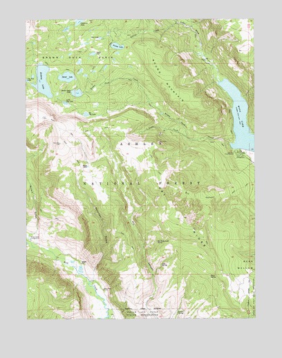
Kidney Lake, UT USGS Topographic Map
Click on map above to begin viewing in our Map Viewer.

This topographic map contains these locations and features:
Feature Name Type Latitude Longitude GNIS ID View Map
Aspen LakeLakeN40.6106°W110.5889°1438292View Map
Atwine CreekStreamN40.6236°W110.5427°1438300View Map
Atwine LakeLakeN40.6138°W110.5756°1438301View Map
Baum LakeLakeN40.5637°W110.5920°1438424View Map
Big Dog LakeLakeN40.5853°W110.5927°1438659View Map
Brown Duck BasinBasinN40.6091°W110.6052°1439163View Map
Brown Duck CreekStreamN40.5730°W110.5146°1439164View Map
Brown Duck DamDamN40.5933°W110.5957°1447874View Map
Brown Duck LakeReservoirN40.5942°W110.5979°1439165View Map
Cold SpringSpringN40.5228°W110.5520°1439872View Map
Corner SpringSpringN40.5033°W110.5416°1439958View Map
Dry CanyonValleyN40.5524°W110.5127°1440572View Map
Dry RidgeRidgeN40.5419°W110.5404°1440682View Map
Fence SpringSpringN40.5180°W110.5252°1441023View Map
Island LakeReservoirN40.6009°W110.6032°1442066View Map
Island Lake DamDamN40.5999°W110.6007°1447881View Map
Kidney LakeReservoirN40.5995°W110.6165°1442308View Map
Kidney Lake DamDamN40.6033°W110.6107°1447883View Map
Lake Fork Guard StationLocaleN40.5691°W110.5121°1442410View Map
Little Dog LakeLakeN40.5903°W110.6043°1442704View Map
Miners GulchValleyN40.5336°W110.6246°1443513View Map
Miners Gulch BridgeBridgeN40.5336°W110.6238°1450106View Map
Miners Gulch CampgroundLocaleN40.5336°W110.6243°1443514View Map
Miners Gulch Campground BridgeBridgeN40.5347°W110.6243°1450105View Map
Moon LakeReservoirN40.5796°W110.5048°1443576View Map
Moon Lake CampgroundLocaleN40.5691°W110.5102°1443577View Map
Moon Lake LodgePopulated PlaceN40.5694°W110.5074°1454823View Map
Mud LakeLakeN40.6173°W110.5848°1443675View Map
Paint MineMineN40.5741°W110.5532°1444161View Map
Peterson GulchValleyN40.5152°W110.5891°1444308View Map
Red Bedground SpringSpringN40.5325°W110.5543°1444760View Map
Robbins RanchLocaleN40.5230°W110.5952°1445017View Map
Rock Creek CorralLocaleN40.5124°W110.5835°1445065View Map
Round MountainSummitN40.6074°W110.5532°1445172View Map
Slate CreekStreamN40.5761°W110.5382°1445662View Map

Note: Coordinates in the location and feature list above are referenced to NAD83 datum.


Copyright (C) 2008-2025 Ryan Niemi / Sunset Dynamics ... All Rights Reserved