TopoQuest Logo
Do you find TopoQuest useful?
Help keep TopoQuest running and adding new maps/features by donating!
Bitcoin:  19c7KJd3qBynnjoSw5npx9KScwjBe4ifkT
Litecoin:  LXs6TkuXGGXo1vDsWCkWVdjQX94eUKd6ui
Home View Maps Find Maps Find Places Resources & Links


Lake Fork Mountain, Utah Topographic Map

USGS Map Title: Lake Fork Mountain, UT
USGS Map MRC: 40110E4
DRG (GeoTIFF) Download: o40110e4.tif


Neighboring USGS Topographic Map Quads:


  Oweep Creek, UT  
40110F5
 

  Garfield Basin, UT  
40110F4
 

  Mount Emmons, UT  
40110F3
 

  Kidney Lake, UT  
40110E5
 

  Lake Fork Mountain, UT  
40110E4
 

  Burnt Mill Spring, UT  
40110E3
 

  Dry Mountain, UT  
40110D5
 

  Mountain Home, UT  
40110D4
 

  Altonah, UT  
40110D3


Map MRC Location:

N41°
W111°
N41°
W110°
H8 H7 H6 H5 H4 H3 H2 H1
G8 G7 G6 G5 G4 G3 G2 G1
F8 F7 F6 F5 F4 F3 F2 F1
E8 E7 E6 E5 E4 E3 E2 E1
D8 D7 D6 D5 D4 D3 D2 D1
C8 C7 C6 C5 C4 C3 C2 C1
B8 B7 B6 B5 B4 B3 B2 B1
A8 A7 A6 A5 A4 A3 A2 A1
N40°
W111°
N40°
W110°

Lake Fork Mountain, UT USGS 1:24K Topographic Map Preview:
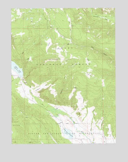
Lake Fork Mountain, UT USGS Topographic Map
Click on map above to begin viewing in our Map Viewer.

This topographic map contains these locations and features:
Feature Name Type Latitude Longitude GNIS ID View Map
Bear ParkFlatN40.5761°W110.4099°1438483View Map
Bear WallowBasinN40.5186°W110.4960°1438503View Map
Beaver Dam CampgroundLocaleN40.5219°W110.4438°1454660View Map
Center ParkFlatN40.5986°W110.4390°1439619View Map
Cow ParkFlatN40.5919°W110.4557°1440093View Map
Fish CreekStreamN40.5699°W110.4885°1441076View Map
Fish Creek National Recreation TrailTrailN40.5844°W110.4602°1450111View Map
Fisher RanchLocaleN40.5336°W110.4471°1441093View Map
Flea FlatFlatN40.5630°W110.4049°1441143View Map
Lake Fork CorralLocaleN40.5269°W110.4432°1442408View Map
Lake Fork MountainSummitN40.5769°W110.4560°1442411View Map
Little MeadowSwampN40.5786°W110.4779°1442740View Map
Long ParkFlatN40.6091°W110.4304°1442926View Map
Mackentire DrawValleyN40.5352°W110.4352°1443060View Map
McKune SpringSpringN40.5049°W110.3871°1450095View Map
Mill ParkFlatN40.5866°W110.4446°1443467View Map
Mill SpringSpringN40.5923°W110.4311°1443475View Map
Moon Lake DamDamN40.5616°W110.4907°1447868View Map
Moon Lake ResortPopulated PlaceN40.5613°W110.4924°1454824View Map
Mule CreekStreamN40.5216°W110.4274°1443727View Map
Raspberry DrawValleyN40.5452°W110.4729°1444728View Map
Transfer SpringSpringN40.5513°W110.4221°1446702View Map
Twin Pats BridgeBridgeN40.5213°W110.4415°1450113View Map
Twin Pots DamDamN40.5044°W110.4288°1447867View Map
Twin Pots ReservoirReservoirN40.5130°W110.4367°1446804View Map
Upper Moon Lake Canal BridgeBridgeN40.5349°W110.4677°1450112View Map

Note: Coordinates in the location and feature list above are referenced to NAD83 datum.


Copyright (C) 2008-2025 Ryan Niemi / Sunset Dynamics ... All Rights Reserved