TopoQuest Logo
Do you find TopoQuest useful?
Help keep TopoQuest running and adding new maps/features by donating!
Bitcoin:  19c7KJd3qBynnjoSw5npx9KScwjBe4ifkT
Litecoin:  LXs6TkuXGGXo1vDsWCkWVdjQX94eUKd6ui
Home View Maps Find Maps Find Places Resources & Links


Kigalia Point, Utah Topographic Map

USGS Map Title: Kigalia Point, UT
USGS Map MRC: 37109F7
DRG (GeoTIFF) Download: o37109f7.tif


Neighboring USGS Topographic Map Quads:


  Warren Canyon, UT  
37109G8
 

  Poison Canyon, UT  
37109G7
 

  Chippean Rocks, UT  
37109G6
 

  Woodenshoe Buttes, UT  
37109F8
 

  Kigalia Point, UT  
37109F7
 

  Cream Pots, UT  
37109F6
 

  Kane Gulch, UT  
37109E8
 

  South Long Point, UT  
37109E7
 

  Hotel Rock, UT  
37109E6


Map MRC Location:

N38°
W110°
N38°
W109°
H8 H7 H6 H5 H4 H3 H2 H1
G8 G7 G6 G5 G4 G3 G2 G1
F8 F7 F6 F5 F4 F3 F2 F1
E8 E7 E6 E5 E4 E3 E2 E1
D8 D7 D6 D5 D4 D3 D2 D1
C8 C7 C6 C5 C4 C3 C2 C1
B8 B7 B6 B5 B4 B3 B2 B1
A8 A7 A6 A5 A4 A3 A2 A1
N37°
W110°
N37°
W109°

Kigalia Point, UT USGS 1:24K Topographic Map Preview:
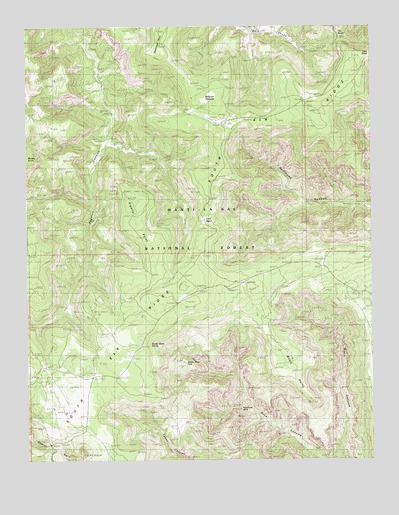
Kigalia Point, UT USGS Topographic Map
Click on map above to begin viewing in our Map Viewer.

This topographic map contains these locations and features:
Feature Name Type Latitude Longitude GNIS ID View Map
Arch Canyon OverlookLocaleN37.6686°W109.8232°1450004View Map
Babylon PastureFlatN37.7286°W109.8096°1438319View Map
Bears EarsSummitN37.6300°W109.8676°1438507View Map
Bears Ears Point of InterestLocaleN37.6292°W109.8679°1453022View Map
Brushy KnollSummitN37.7119°W109.8665°1439202View Map
Butts CanyonCapeN37.6525°W109.7868°1439398View Map
Butts PointRidgeN37.6519°W109.7801°1448217View Map
Hammond Canyon Point of InterestLocaleN37.6936°W109.8112°1453021View Map
Keystone ArchArchN37.6397°W109.7987°1448545View Map
Kigalia CanyonValleyN37.7180°W109.8446°1442310View Map
Kigalia PointCliffN37.7025°W109.8393°1442311View Map
Kigalia Ranger StationLocaleN37.6750°W109.8262°1442312View Map
Little NotchGapN37.6944°W109.8115°1442753View Map
Peavine TrailTrailN37.6817°W109.8554°1450044View Map
San Juan CountyCivilN37.6259°W109.8046°1448032View Map
South Elk RidgeRidgeN37.6830°W109.8115°1454326View Map
Squaw Water HoleLakeN37.6530°W109.8184°1449056View Map
Squaw Water SpringSpringN37.6586°W109.8312°1449057View Map
The NotchGapN37.7480°W109.7565°1446484View Map
Ute CabinLocaleN37.6767°W109.8243°1450003View Map
Wabin MineMineN37.6930°W109.8724°1450002View Map

Note: Coordinates in the location and feature list above are referenced to NAD83 datum.


Copyright (C) 2008-2024 Ryan Niemi / Sunset Dynamics ... All Rights Reserved