TopoQuest Logo
Do you find TopoQuest useful?
Help keep TopoQuest running and adding new maps/features by donating!
Bitcoin:  19c7KJd3qBynnjoSw5npx9KScwjBe4ifkT
Litecoin:  LXs6TkuXGGXo1vDsWCkWVdjQX94eUKd6ui
Home View Maps Find Maps Find Places Resources & Links


Kane Gulch, Utah Topographic Map

USGS Map Title: Kane Gulch, UT
USGS Map MRC: 37109E8
DRG (GeoTIFF) Download: o37109e8.tif


Neighboring USGS Topographic Map Quads:


  The Cheesebox, UT  
37110F1
 

  Woodenshoe Buttes, UT  
37109F8
 

  Kigalia Point, UT  
37109F7
 

  Moss Back Butte, UT  
37110E1
 

  Kane Gulch, UT  
37109E8
 

  South Long Point, UT  
37109E7
 

  Pollys Pasture, UT  
37110D1
 

  Cedar Mesa North, UT  
37109D8
 

  Snow Flat Spring Cave, UT  
37109D7


Map MRC Location:

N38°
W110°
N38°
W109°
H8 H7 H6 H5 H4 H3 H2 H1
G8 G7 G6 G5 G4 G3 G2 G1
F8 F7 F6 F5 F4 F3 F2 F1
E8 E7 E6 E5 E4 E3 E2 E1
D8 D7 D6 D5 D4 D3 D2 D1
C8 C7 C6 C5 C4 C3 C2 C1
B8 B7 B6 B5 B4 B3 B2 B1
A8 A7 A6 A5 A4 A3 A2 A1
N37°
W110°
N37°
W109°

Kane Gulch, UT USGS 1:24K Topographic Map Preview:
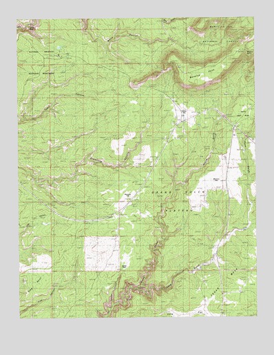
Kane Gulch, UT USGS Topographic Map
Click on map above to begin viewing in our Map Viewer.

This topographic map contains these locations and features:
Feature Name Type Latitude Longitude GNIS ID View Map
Blanding DivisionCivilN37.6074°W109.9843°1939350View Map
Fortress CanyonValleyN37.5052°W109.9517°1448418View Map
Grand FlatFlatN37.5858°W109.9126°1441402View Map
Grand Gulch Ranger StationLocaleN37.5247°W109.8990°1450010View Map
Harmony FlatFlatN37.5483°W109.9462°1441602View Map
Hells Half AcreFlatN37.5869°W109.8782°1441689View Map
Hole in the Rock TrailTrailN37.5431°W109.8910°1450066View Map
Indian ParkFlatN37.5258°W109.9454°1442016View Map
Junction RuinLocaleN37.5117°W109.9371°1448529View Map
Junction SpringSpringN37.5122°W109.9407°1448530View Map
Kane GulchValleyN37.5120°W109.9382°1442270View Map
Kane Gulch Ranger StationLocaleN37.5244°W109.8990°1448537View Map
Kane Gulch TrailheadLocaleN37.5244°W109.8990°1448538View Map
Maverick PointCapeN37.6111°W109.8804°1443231View Map
Maverick SpringSpringN37.6109°W109.8792°1443233View Map
Monument Valley OverlookLocaleN37.5958°W109.9407°1448685View Map
Mormon FlatFlatN37.5583°W109.8929°1443587View Map
Natural Bridges National Monument CampgroundLocaleN37.6092°W109.9846°1448726View Map
Natural Bridges National Monument Visitor CenterLocaleN37.6097°W109.8787°1448727View Map
Natural Bridges Recreation SiteLocaleN37.6094°W109.9799°1453026View Map
Photovoltaic ArrayLocaleN37.6075°W109.9774°1454574View Map
Sphinx RockPillarN37.6208°W109.9946°1445960View Map
Stimper ArchArchN37.5078°W109.9446°1449071View Map
Turkey Pen RuinLocaleN37.5094°W109.9474°1449117View Map
Turkey Pen RuinLocaleN37.5069°W109.9474°1450011View Map

Note: Coordinates in the location and feature list above are referenced to NAD83 datum.


Copyright (C) 2008-2025 Ryan Niemi / Sunset Dynamics ... All Rights Reserved