TopoQuest Logo
Do you find TopoQuest useful?
Help keep TopoQuest running and adding new maps/features by donating!
Bitcoin:  19c7KJd3qBynnjoSw5npx9KScwjBe4ifkT
Litecoin:  LXs6TkuXGGXo1vDsWCkWVdjQX94eUKd6ui
Home View Maps Find Maps Find Places Resources & Links


Kimshew Point, California Topographic Map

USGS Map Title: Kimshew Point, CA
USGS Map MRC: 39121H4
DRG (GeoTIFF) Download: o39121h4.tif


Neighboring USGS Topographic Map Quads:


  Butte Meadows, CA  
40121A5
 

  Jonesville, CA  
40121A4
 

  Belden, CA  
40121A3
 

  Stirling City, CA  
39121H5
 

  Kimshew Point, CA  
39121H4
 

  Storrie, CA  
39121H3
 

  Paradise East, CA  
39121G5
 

  Pulga, CA  
39121G4
 

  Soapstone Hill, CA  
39121G3


Map MRC Location:

N40°
W122°
N40°
W121°
H8 H7 H6 H5 H4 H3 H2 H1
G8 G7 G6 G5 G4 G3 G2 G1
F8 F7 F6 F5 F4 F3 F2 F1
E8 E7 E6 E5 E4 E3 E2 E1
D8 D7 D6 D5 D4 D3 D2 D1
C8 C7 C6 C5 C4 C3 C2 C1
B8 B7 B6 B5 B4 B3 B2 B1
A8 A7 A6 A5 A4 A3 A2 A1
N39°
W122°
N39°
W121°

Kimshew Point, CA USGS 1:24K Topographic Map Preview:
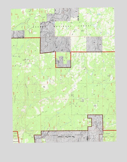
Kimshew Point, CA USGS Topographic Map
Click on map above to begin viewing in our Map Viewer.

This topographic map contains these locations and features:
Feature Name Type Latitude Longitude GNIS ID View Map
Bald MountainSummitN39.9527°W121.4825°1666431View Map
Bear LakeLakeN39.9936°W121.3948°256676View Map
Breakneck CanyonValleyN39.9088°W121.4825°257442View Map
Brown RavineValleyN39.9915°W121.4777°257497View Map
Campbell Cow CampLocaleN39.9368°W121.3816°257909View Map
Chipmunk CreekStreamN39.9277°W121.4033°258331View Map
Crane ValleyBasinN39.9596°W121.4491°258877View Map
East Fork Last Chance CreekStreamN39.9918°W121.4780°259740View Map
Frying Pan CreekStreamN39.9813°W121.3866°253258View Map
Granite RidgeRidgeN39.8879°W121.4583°260762View Map
Granite SpringSpringN39.9018°W121.4458°1666448View Map
Jones MeadowFlatN39.9882°W121.4500°262003View Map
Keyser CreekStreamN39.9238°W121.4452°262157View Map
Kimshew PointCapeN39.9032°W121.4577°262177View Map
Little Kimshew CreekStreamN39.9182°W121.4472°262649View Map
Little North Valley CreekStreamN39.9296°W121.3844°262681View Map
Little Rock CreekStreamN39.8874°W121.4955°262703View Map
Logue MeadowsFlatN39.8924°W121.4086°1666510View Map
Long RavineValleyN39.8874°W121.3950°1666511View Map
Lynch MeadowsFlatN39.9082°W121.4011°263082View Map
Millers MeadowFlatN39.9599°W121.4494°1723823View Map
North ValleyAreaN39.9332°W121.3808°264244View Map
Oak PointSummitN39.9268°W121.4633°1659273View Map
Ramsey BarLocaleN39.9166°W121.4277°265166View Map
Snow MeadowFlatN39.9793°W121.4127°267321View Map
Snow MineMineN39.9593°W121.4308°1723898View Map
Table MountainSummitN39.9771°W121.4233°1659942View Map
The Big HillSummitN39.9118°W121.4166°1659977View Map
Transfer RidgeRidgeN39.9215°W121.4947°268383View Map

Note: Coordinates in the location and feature list above are referenced to NAD83 datum.


Copyright (C) 2008-2025 Ryan Niemi / Sunset Dynamics ... All Rights Reserved